List of Docklands Light Railway stations
The Docklands Light Railway (DLR) is an automated light metro system in the United Kingdom that serves the London Docklands area of east and south-east London, owned by Transport for London (TfL) and currently operated under contract by Keolis Amey Docklands Ltd.
Construction of the DLR was a key component in the regeneration of large parts of the London Docklands from disused industrial land into valuable commercial and residential districts. The first part opened in 1987 serving 15 stations, using redundant railway infrastructure and new construction. The network has been extended and the capacity of its trains expanded so that now nearly 70 million journeys are made every year.[1] Stations are in the City of London and the boroughs of Newham, Tower Hamlets, Greenwich and Lewisham with the majority of the network north of the River Thames.
Of the 45 stations, five are underground: Woolwich Arsenal, Island Gardens, Bank, Stratford International and Cutty Sark (for maritime Greenwich).
History
Background

For over 200 years London's docks and wharves thrived on imperial commerce. From the Pool of London and St Katharine Docks close to the Tower of London they grew eastwards along both sides of the River Thames to include the London Docks, Surrey Docks, Limehouse Dock, West India Docks, Millwall Dock, East India Docks and the three Royal Docks, extending to Barking and becoming the world's largest port. The docks stimulated and supported an extensive network of industrial enterprise such as ship repair, heavy engineering, food processing, warehousing and distribution plus industries based on imported raw materials, particularly tobacco, timber and skins. The expansion of the docks culminated with the King George V Dock, opened by the King in 1921. In the 1930s the docks were at their peak, employing hundreds of thousands of people, but technological and managerial changes and changing patterns of trade led to a gradual decline after World War II. The government started to look at the implications and consequences of possible closures and alternative uses.[2]
In 1962, the Rochdale Report was published, concerned with the London Docks and St Katherine Dock. It recognised that whilst activities at the docks were useful, the traffic could be developed elsewhere in the port or at the Port of Tilbury. The docks could be filled in and used for storage, and warehouses could be used by private enterprise.[2] After extensive review, the Port of London Authority (PLA) decided that the smaller up-stream docks were not commercially viable, and closures began in 1967 with East India Dock and 1968 with St Katherine Dock, London Docks and Surrey Docks. Other docks were under serious threat: between 1966 and 1976 the PLA workforce in the boroughs of Tower Hamlets, Newham, Southwark, Lewisham and Greenwich reduced by 20 percent. The objective of the closures was to concentrate resources at Tilbury downstream for containerisation and the accommodation of larger ships with profitable bulk cargoes in the Lower Thames Estuary.[2][3] A five-year phased project was set up in 1970 by the PLA to close more upper docks and berths. Competition from air traffic and European ports also contributed to the decline of trade within the London Docklands until only the Royal Docks remained in operation. The Royal Docks closed in 1981.[2][3]
A report published in 1973 by the London Docklands Study Team saw future demand for better transport in the Isle of Dogs. An early suggestion was an underground line, but it was thought that there was insufficient demand. The idea was revived in 1976, but put on hold by Norman Fowler in 1979 in favour of lower-cost alternatives. In 1974, the Docklands Joint Committee was formed from the dockland boroughs and the Greater London Council (GLC), with a plan to redevelop the London Docklands with new industry and housing as quickly as possible. Throughout the 1970s light rail options were proposed. A later recommendation was an automatic light rail option from Aldgate East to the Isle of Dogs and Beckton. As an alternative to the east-west route, a cheaper north-south route from the Isle of Dogs was considered, but later forecasts of population and employment growth, coupled with the absence of any connection to the south of the river, showed that both routes were needed.[3][4] The London Docklands Development Corporation (LDDC), formed in 1981 with responsibility to regenerate the whole area, helped to speed up the process.[4]
In June 1982, a report published by the GLC, LDDC and other authorities recommended the construction of two light rail routes from the City of London and Mile End to the Isle of Dogs. Funding for the Docklands Light Railway was promised within three months. Later, £77 million was approved to be spent by 1987.[3][4] In the mid-1980s it was found that the original plan to run at street level along the A11 to Mile End could not be achieved, so an alternative route was found along a railway cutting north to Stratford. This provided better transport connections and the line could use a disused platform at Stratford station.[4]
Opening and extensions
The routes from Tower Gateway and Stratford to Island Gardens opened on 31 August 1987, with 15 stations. The tracks used a combination of redundant and new viaducts and underused routes.[4] The station at Canary Wharf did not open until 1991, as the first sections of the Canary Wharf development were still under construction.[5] Sites for stations at Carmen Street (later Langdon Park) and Pudding Mill Lane were safeguarded, the latter to be on a passing loop on the Stratford branch.[5] The extension to Beckton opened on 28 March 1994.[4]
In 1997 the DLR commissioned a study into expansion of the network, as there were still significant transport gaps. One of the planned extensions was from Canning Town to North Woolwich – options considered included North Woolwich station and a site near King George V Dock. The development of Silvertown and North Woolwich and the projected expansion of London City Airport led to this line being planned with a possible extension to Woolwich Arsenal.[4] The branch opened to King George V station on 2 December 2005,[6] with Woolwich Arsenal opening on 10 January 2009.[7] On this branch a station site has been safeguarded at Thames Wharf whilst the area awaits redevelopment.[4]
With plans being developed for regeneration around Stratford International station and the expansion of London City Airport, connecting the two along the North London Line route via Canning Town was investigated. Whilst it was acknowledged that the Jubilee line already ran over part of the route between Canning Town and Stratford, it was seen that the DLR link would be valuable and that it could connect with Stratford International at a low cost and with less difficulty if the North London Line was closed and converted for DLR use between Stratford and Canning Town.[4] The North London Line closed between Stratford and North Woolwich in 2006,[8] and the extension opened in 2012 with the former North London line platforms at West Ham and Stratford rebuilt for DLR trains and new stations at Star Lane, Abbey Road, Stratford High Street and Stratford International.[9] A station between Stratford and Stratford International was proposed at Carpenters Road.[4]
Tower Gateway station was seen as an interim solution to serve the City within the original £77 million budget. Almost immediately it became apparent that two-car trains stopping at short platforms would not be able to cope with the projected 50,000 people working in the Canary Wharf development. £276 million was spent on upgrading the signalling, lengthening the platforms and providing an extension to Bank, which was built in 1991.[3][4] When the system opened, the section south of Crossharbour station followed a disused viaduct of the Millwall Extension Railway. It ran beside East Ferry Road to where it diverged east onto a new bridge to accommodate Mudchute station before returning to the railway's 1872 single-track viaduct through Millwall Park to a terminus at Island Gardens.[4] For the £200 million extension under the River Thames to Lewisham, the route south of Crossharbour was replaced with a new alignment to the tunnel under the river. Mudchute and Island Gardens stations were resited onto the new route, with Island Gardens being constructed underground.[3][4] Canning Town station was resited to accommodate the Jubilee line extension.[10] South Quay was resited in 2009 to accommodate three-car trains across the network. The original site had sharp curves at each end, making extension impossible.[11]
Future developments
An extension to Dagenham Dock has been proposed, but is currently unfunded.[12] Another previous proposal was an extension to Thamesmead.[4] These were to both start from just east of Gallions Reach on the Beckton branch.[4][12] Consideration has been given to an extension west from Bank to the disused Jubilee line platforms at Charing Cross.[13]
There have been numerous other proposals for stations along the line. These have included, or still do include the following:
- Thames Wharf, between Canning Town and West Silvertown,[14]
- Woolwich Reach, between King George V and Woolwich Arsenal,[14]
- Connaught between Prince Regent and Royal Albert,[5]
- Silvertown, between Pontoon Dock and London City Airport[15]
- Tower Hill, on the Bank branch.[5]
Stations and routes
Listed for each station is the branch or branches it is on, the local authority, the London Travelcard zone in which it is located, interchanges with other modes of transport, the opening date and any resiting.
Four stations have direct interchanges with London Underground lines: Bank (Central, Circle, District, Northern and Waterloo & City), Canning Town (Jubilee), West Ham (Hammersmith & City, Jubilee and District lines) and Stratford (Central and Jubilee). There are indirect interchanges at Canary Wharf and Heron Quays (for Jubilee line from Canary Wharf), Bow Church (for District and Hammersmith & City lines from Bow Road) and Tower Gateway (for Circle and District lines from Tower Hill). There are interchanges with London Overground at Stratford (direct) and Shadwell (indirect). There are interchanges with National Rail at Greenwich, Lewisham, Limehouse, Woolwich Arsenal, Stratford, West Ham and Stratford International.[16]
List
| Station | Image | Local Authority | Zone(s) | Opened[note 1] | Other names[note 2] | Usage (millions)[17][note 3] | Coordinates | Notes |
|---|---|---|---|---|---|---|---|---|
| Abbey Road |  |
Newham | 3 |
– |
1.204 |
51°31′55.20″N 0°0′14.4″E | – | |
| All Saints |  |
Tower Hamlets | 2 |
31 August 1987[20] |
– |
2.160 |
51°30′39″N 0°00′47″W | On the site of Poplar (East India Road) station (1866–1944)[8][21] |
| Bank |  |
City of London | 1 |
– |
32.256 |
51°30′46.80″N 0°5′16.80″W | – | |
| Beckton |  |
Newham | 3 |
28 March 1994[20] |
– |
2.569 |
51°30′53″N 0°03′41″E | – |
| Beckton Park | 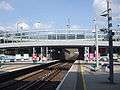 |
Newham | 3 |
28 March 1994[20] |
– |
0.456 |
51°30′32″N 0°03′18″E | – |
| Blackwall |  |
Tower Hamlets | 2 |
28 March 1994[20] |
– |
1.834 |
51°30′28.5″N 0°0′26″W | Near the site of Poplar railway station (1840–1926)[8][21] |
| Bow Church | 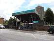 |
Tower Hamlets | 2 |
31 August 1987[20] |
– |
3.645 |
51°31′39″N 0°1′14.88″W | On the site of Bow railway station (1850–1944)[8][21] |
| Canary Wharf | 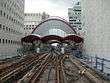 |
Tower Hamlets | 2 |
– |
19.359 |
51°30′18.36″N 0°1′15.24″W | Construction did not begin until after the original line opened, as the Canary Wharf development was not ready[5] | |
| Canning Town (High Level) |
 |
Newham | 3 |
28 March 1994[20] |
– |
16.382 |
51°30′50″N 0°0′29″E | The DLR City branch platforms were resited are above the Jubilee line platforms when the Jubilee Line extension opened on 14 May 1999.[26][27] Original station opened 1847.[8] |
| Canning Town (Low Level) |
 |
Newham | 3 |
– |
6.537 |
51°30′50″N 0°0′31″E | On site of North London Line platforms (1847–2006)[8] | |
| Crossharbour | 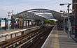 |
Tower Hamlets | 2 |
31 August 1987[20] |
4.050 |
51°29′44.87″N 0°0′52.17″W | On the site of Millwall Docks railway station (1871–1926)[8] | |
| Custom House for ExCeL | 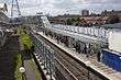 |
Newham | 3 |
28 March 1994[20] |
– |
3.383 |
51°30′34.7″N 0°1′33.22″E | Original station opened 1855–2006[8] |
| Cutty Sark for Maritime Greenwich |  |
Greenwich | 2 & 3 |
3 December 1999[20] |
– |
7.513 |
51°28′54.13″N 0°0′39.28″W | – |
| Cyprus | 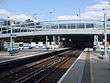 |
Newham | 3 |
28 March 1994[20] |
– |
1.482 |
51°30′31″N 0°03′50″E | – |
| Deptford Bridge | 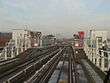 |
Lewisham | 2 & 3 |
20 November 1999[20] |
– |
4.650 |
51°28′27.84″N 0°1′21″W | – |
| Devons Road |  |
Tower Hamlets | 2 |
31 August 1987[20] |
– |
2.553 |
51°31′20″N 0°01′2.5″W | – |
| East India | 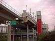 |
Tower Hamlets | 2 & 3 |
28 March 1994[20] |
Brunswick Wharf[29] |
3.765 |
51°30′33.48″N 0°0′7.56″W | – |
| Elverson Road | 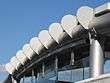 |
Greenwich | 2 & 3 |
20 November 1999[20] |
– |
1.954 |
51°28′7.19″N 0°0′58.93″W | – |
| Gallions Reach | 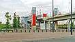 |
Newham | 3 |
28 March 1994[20] |
– |
1.122 |
51°30′32″N 0°04′18″E | – |
| Greenwich | 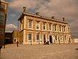 |
Greenwich | 2 & 3 |
20 November 1999[20] |
– |
5.415 |
51°28′41.16″N 0°0′50.4″W | Original station opened 1838[8] |
| Heron Quays |  |
Tower Hamlets | 2 |
31 August 1987[20] |
– |
8.291 |
51°30′10.52″N 0°1′17.65″W | Resited in 2002 when new development opened[24] |
| Island Gardens | 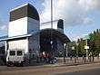 |
Tower Hamlets | 2 |
31 August 1987[20] |
Cubitt Town[28] |
2.997 |
51°29′16.9″N 0°0′37.8″W | The position planned before the railway originally opened was on the other side of Manchester Road.[4] The station was relocated underground with the opening of the Lewisham extension on 20 November 1999.[20] |
| King George V |  |
Newham | 3 |
2 December 2005[6] |
North Woolwich[14] |
1.645 |
51°30′7.1″N 0°3′46″E | Originally, the route was to terminate at airport.[14] |
| Langdon Park |  |
Tower Hamlets | 2 |
Carmen Street[5] |
3.910 |
51°30′54″N 0°0′50.4″W | Station safeguarded since original railway opened.[5] To the south of South Bromley railway station (1884–1944)[8] | |
| Lewisham |  |
Lewisham | 2 & 3 |
20 November 1999[20] |
– |
11.468 |
51°27′55.08″N 0°0′47.88″W | Original station opened 1849.[8] |
| Limehouse | 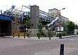 |
Tower Hamlets | 2 |
31 August 1987[20] |
Stepney East[28] |
9.087 |
51°30′44.64″N 0°2′22.92″W | Original station opened 1840[8] |
| London City Airport | 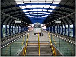 |
Newham | 3 |
2 December 2005[6] |
– |
4.526 |
51°30′13″N 0°2′56″E | Drew Primary School had to be demolished and relocated so land could be used for the construction of the station.[31] |
| Mudchute |  |
Tower Hamlets | 2 |
31 August 1987[20] |
– |
2.314 |
51°29′27.23″N 0°0′52.95″W | Station relocated on 20 November 1999 due to the Lewisham extension opening.[20] |
| Pontoon Dock | 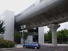 |
Newham | 3 |
2 December 2005[6] |
– |
1.174 |
51°30′8″N 0°1′55″E | – |
| Poplar |  |
Tower Hamlets | 2 |
31 August 1987[20] |
– |
3.047 |
51°30′27.77″N 0°1′1.99″W | – |
| Prince Regent | 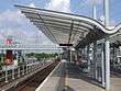 |
Newham | 3 |
28 March 1994[20] |
– |
3.092 |
51°30′34.01″N 0°2′0.36″E | – |
| Pudding Mill Lane |  |
Newham | 2 & 3 |
– |
0.769 |
51°32′2.76″N 0°0′49.68″W | Station safeguarded since original railway opening.[5] The station was resited and rebuilt on a new alignment on 28 April 2014 to handle expected crowds from the Queen Elizabeth Olympic Park and also the old site is now used as a portal for Crossrail[33] | |
| Royal Albert | 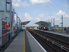 |
Newham | 3 |
28 March 1994[20] |
– |
1.655 |
51°30′31″N 0°02′47″E | – |
| Royal Victoria |  |
Newham | 3 |
28 March 1994[20] |
– |
4.279 |
51°30′33.04″N 0°1′4.84″E | East of the site of Tidal Basin railway station (1858–1943)[8] |
| Shadwell | 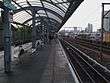 |
Tower Hamlets | 2 |
31 August 1987[20] |
– |
9.014 |
51°30′42.16″N 0°3′22.17″W | On the site of Shadwell and St George's East railway station (1840–1941)[8] |
| South Quay |  |
Tower Hamlets | 2 |
31 August 1987[20] |
– |
5.938 |
51°30′0.31″N 0°0′58.44″W | Between 12 February and 15 April 1996 there was no service south of Canary Wharf due to a bombing near South Quay.[20] The station was resited to make platform extensions easier as the previous site had tight curves at either end. It was resited on 26 October 2009.[11] |
| Star Lane |  |
Newham | 3 |
Cody Road[34] |
1.434 |
51°31′14.52″N 0°0′15.12″E | – | |
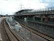
| Stratford (High Level) |
 |
Newham | 3 |
31 August 1987[20] |
– |
9.365 |
51°32′27″N 0°0′15″W | Original station opened 1839[8] Resited in 2007.[24] |
| Stratford (Low Level) |
 |
Newham | 3 |
– |
10.337 |
51°32′27″N 0°0′11″W | On site of North London Line platforms (1846–2006)[8] | |
| Stratford High Street | 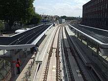 |
Newham | 3 |
Stratford Market[34] |
1.144 |
51°32′16.44″N 0°0′2.16″W | On site of Stratford Market station (1847–1957)[8] | |
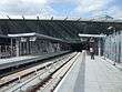
| Stratford International |  |
Newham | 3 |
– |
3.195 |
51°32′41.28″N 0°0′30.96″W | National Rail station opened 2009[8] | |
| Tower Gateway | 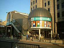 |
City of London | 1 |
31 August 1987[20] |
Tower Hill, Minories[28] |
4.101 |
51°30′38.2″N 0°4′29.18″W | Options before the railway opened included a separate terminus for Tower Hill and a tunnelled terminus at Aldgate East[4] |
| West Ham | 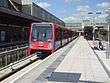 |
Newham | 3 |
– |
3.187 |
51°31′40.8″N 0°0′14.4″E | Original station opened 1901[8] | |
| West India Quay | 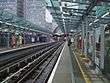 |
Tower Hamlets | 2 |
31 August 1987[20] |
– |
1.357 |
51°30′24.9″N 0°1′13.78″W | – |
| West Silvertown |  |
Newham | 3 |
2 December 2005[6] |
– |
2.068 |
51°30′10″N 0°1′21″E | – |
| Westferry | 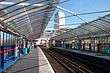 |
Tower Hamlets | 2 |
31 August 1987[20] |
West Ferry Road[35] |
6.653 |
51°30′33.74″N 0°1′36.11″W | – |
| Woolwich Arsenal |  |
Greenwich | 4 |
– |
14.684 |
51°29′24″N 0°4′8.4″E | Original station opened 1849.[8] |
Notes
- This only lists dates when the DLR stations or platforms opened.
- Names listed here are those that were proposed before opening and any renamings.
- Usage data is for 2016.
See also
- List of London railway stations
- List of London Underground stations
- List of former and unopened London Underground stations
- Category:Railway stations in London by borough
Footnotes
- Transport for London. "Docklands Light Railway". Transport for London. Retrieved 31 August 2011.
- Turlik (1997).
- Clayton (2000).
- Pearce, Hardy & Stannard (2000), pp. 4–15, 17–25, 28–31, 62–63, 75–79.
- Grant (1997).
- BBC News (6 December 2005). "DLR extension to airport is open". BBC News. Retrieved 28 June 2011.
- BBC News (12 January 2009). "Mayor opens new docklands station". BBC News. Retrieved 27 June 2011.
- Brown, Joe (2009). London Railway Atlas (2nd ed.). Ian Allan Publishing. pp. 22–25, 33–35, 57–58. ISBN 978-0-7110-3397-9.
- Transport for London. "Docklands Light Railway – Stratford International". Transport for London. Archived from the original on 6 December 2014. Retrieved 24 May 2011.
- Powell (2000), p. 130-131.
- Transport for London (26 October 2009). "DLR station 'moves' at the weekend". Transport for London. Retrieved 27 June 2011.
- Transport for London. "Docklands Light Railway – Dagenham Dock". Transport for London. Archived from the original on 27 September 2011. Retrieved 24 May 2011.
- Ove Arup & Partners (July 2005). DLR Horizon 2020 Study (PDF). pp. 34–38, 66. Retrieved 17 July 2011.
- Pearce, Hardy & Stannard (2000), pp. 76–77.
- "DLR to City Airport". AlwaysTouchOut.com. Archived from the original on 14 May 2013. Retrieved 15 November 2013.
- "London Connections" (PDF). Association of Train Operating Companies. Archived from the original (PDF) on 2 September 2011. Retrieved 20 May 2012.
- "Passenger Numbers - Docklands Light Railway Limited" (XLSX (after downloading zip)). What Do They Know. Transport for London. 8 June 2017. Retrieved 11 September 2017.
- Transport for London (31 August 2011). "Docklands Light Railway extension marks one year to go to the London 2012 Paralympic Games". Transport for London. Retrieved 31 August 2011.
- BBC News (31 August 2011). "New £211m DLR extension connecting Olympic venues opens". BBC News. Retrieved 31 August 2011.
- Pearce, Hardy & Stannard (2000), p. 75.
- Genealogy & Family History (1885). "Report of the Boundary Commissioners for England and Wales – Poplar: Divisions of New Borough (Map)". Eyre and Spottiswoode. Retrieved 16 July 2011.
- Day & Reed (2008), p. 198.
- Dynes, Michael (29 July 1991). "On the right lines for the Nineties; London Docklands". The Times. Retrieved 27 June 2011.
- "DLR history timeline". Transport for London. Archived from the original on 30 September 2007. Retrieved 27 June 2011.
- Butt (1995), p. 52.
- Clayton (2000), p. 164–179.
- Powell (2000), p. 130–131.
- Pearce, Hardy & Stannard (2000), pp. 5–6.
- Garland (1994), p. 63.
- BBC News (10 December 2007). "Mayor unveils new London station". BBC News. Retrieved 27 June 2011.
- LCACC (18 February 2012). "DLR London City Airport Extension". London City Airport Consultative Committee. Archived from the original on 17 April 2013. Retrieved 15 November 2013.
- Harris (2004), p. 82.
- Mayhew, Freddy (28 April 2014). "Pudding Mill Lane DLR station opens to public". Newham Recorder. Archant Community Media Ltd. Retrieved 6 May 2014.
- Pearce, Hardy & Stannard (2000), p. 77.
- Pearce, Hardy & Stannard (2000), p. 5.
References
- Brown, Joe (2009). London Railway Atlas (2nd ed.). Ian Allan Publishing. ISBN 978-0-7110-3397-9.
- Butt, R. V. J. (1995). The Directory of Railway Stations: details every public and private passenger station, halt, platform and stopping place, past and present (1st ed.). Sparkford: Patrick Stephens Ltd. ISBN 978-1-85260-508-7. OCLC 60251199.
- Clayton, Antony (2000). Subterranean City: Beneath the Streets of London. Historical Publications. ISBN 0-948667-69-9.CS1 maint: ref=harv (link)
- Day, John R; Reed, John (2008) [1963]. The Story of London's Underground. Capital Transport. ISBN 978-1-85414-316-7.CS1 maint: ref=harv (link)
- Garland, Ken (1994). Mr. Beck's Underground Map: A History. Harrow Weald: Capital Transport Publishing. ISBN 978-1854141682.CS1 maint: ref=harv (link)
- Grant, Cynthia (1997). Starting from scratch : The development of transport in London Docklands. London Docklands Development Corporation. ISBN 978-0953111404. OCLC 60213190.CS1 maint: ref=harv (link)
- Harris, Cyril M. (2004). What's in a name? (4th ed.). Capital Transport. ISBN 1-85414-241-0.CS1 maint: ref=harv (link)
- Pearce, Alan; Hardy, Brian; Stannard, Colin (2000). Docklands Light Railway Official Handbook (4 ed.). Capital Transport. ISBN 1-85414-223-2.CS1 maint: ref=harv (link)
- Powell, Kenneth (2000). The Jubilee Line Extension. Laurence King. ISBN 1-85669-184-5.CS1 maint: ref=harv (link)
- Turlik, Peter (1997). Initiating Urban Change: London Docklands before LDDC. London Docklands Development Corporation. ISBN 0-9531114-1-5.CS1 maint: ref=harv (link)
External links
| Stations |
| ||||||||||||
|---|---|---|---|---|---|---|---|---|---|---|---|---|---|
| Future |
| ||||||||||||
| Rolling stock |
| ||||||||||||
| |||||||||||||