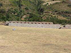
Limatambo District
Limatambo District is one of nine districts of the province Anta in Peru.[1]
Limatambo Lima Tampu | |
|---|---|
 | |
| Country | |
| Region | Cusco |
| Province | Anta |
| Capital | Limatambo |
| Government | |
| • Mayor | Jesús Vargas Santos |
| Area | |
| • Total | 512.92 km2 (198.04 sq mi) |
| Elevation | 2,554 m (8,379 ft) |
| Population (2005 census) | |
| • Total | 8,615 |
| • Density | 17/km2 (44/sq mi) |
| Time zone | UTC-5 (PET) |
| UBIGEO | 080306 |
Geography
One of the highest peaks of the district is Hatun Q'asa at 5,338 m (17,513 ft). Other mountains are listed below:[2]
- Anawillka Q'asa
- Anta Sirk'a
- Iskuyuq Punta
- Kuntur Marka
- Kuyuq
- Llama Wasi
- Llamaylla
- Muru Saywa
- Muyuq
- Pikchu Urqu
- Pitu Phaqcha
- Pukar
- Qullpa Qhata
- Ruq'a Pampa
- Sikun Punta
- Silla Q'asa
- Tiklla
- Tinkuq
- T'asta Q'asa
- Uma
- Uman Chunta
- Uqhu Pampa
- Wakayuq Pampa
- Waman Marka
- Waqra Q'asa
- Yana Pata
Ethnic groups
The people in the district are mainly indigenous citizens of Quechua descent. Quechua is the language which the majority of the population (79.74%) learnt to speak in childhood, 19.63% of the residents started speaking using the Spanish language (2007 Peru Census).[3]
See also
References
- (in Spanish) Instituto Nacional de Estadística e Informática. Banco de Información Distrital Archived 2008-04-23 at the Wayback Machine. Retrieved April 11, 2008.
- escale.minedu.gob.pe/ UGEL map Urubamba Province (Cusco Region)
- inei.gob.pe Archived 2013-01-27 at the Wayback Machine INEI, Peru, Censos Nacionales 2007, Frequencias: Preguntas de Población
| |
|---|---|
| Acomayo | |
| Anta | |
| Calca | |
| Canas | |
| Canchis | |
| Chumbivilcas | |
| Cusco | |
| Espinar | |
| La Convención | |
| Paruro | |
| Paucartambo | |
| Quispicanchi | |
| Urubamba | |
This article is issued from Wikipedia. The text is licensed under Creative Commons - Attribution - Sharealike. Additional terms may apply for the media files.