Lichtenstein, Baden-Württemberg
Lichtenstein is a municipality in the Tübingen administrative region in Baden-Württemberg, Germany. It lies at the foot of the Swabian Jura (plateau).
Lichtenstein | |
|---|---|
%2C_Albsteig%2C_Blick_auf_Lichtenstein_-_panoramio.jpg) Lichtenstein from the east | |
 Coat of arms | |
Location of Lichtenstein within Reutlingen district 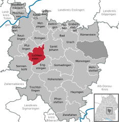  | |
 Lichtenstein 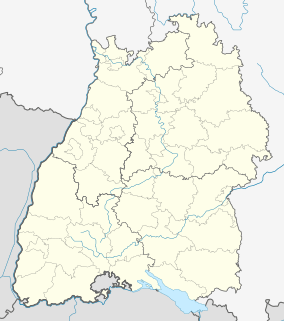 Lichtenstein | |
| Coordinates: 48°25′37″N 09°15′13″E | |
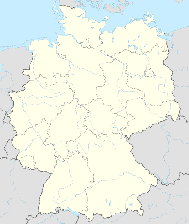
| Country | Germany |
| State | Baden-Württemberg |
| Admin. region | Tübingen |
| District | Reutlingen |
| Subdivisions | 4 Ortsteile |
| Area | |
| • Total | 34.24 km2 (13.22 sq mi) |
| Elevation | 507 m (1,663 ft) |
| Population (2018-12-31)[1] | |
| • Total | 9,239 |
| • Density | 270/km2 (700/sq mi) |
| Time zone | CET/CEST (UTC+1/+2) |
| Postal codes | 72805 |
| Dialling codes | 07129 |
| Vehicle registration | RT |
| Website | www |
History
The municipality of Lichtenstein was created on 1 January 1975 by the merger of Honau, Holzelfingen, and Unterhausen (which had in 1930 merged with Oberhausen). By the agreement made before this merger, Unterhausen changed its name to Lichtenstein, after the famous Lichtenstein Castle above the town. The towns of the municipality expanded substantially from 1975 to 1990 thanks to tourism. Lichtenstein expanded the most, first purchasing an old industrial site in 1979 to turn it into a new town center.[2]
Geography
The municipality (Gemeinde) of Lichtenstein covers 34.24 square kilometres (13.22 sq mi) of the Reutlingen district, in the state of the Federal Republic of Germany. It is physically located in the middle of the Swabian Jura, on the edge of the Middle Kuppenalb in the valley of the river Echaz. Elevation above sea level ranges from 466 meters (1,529 ft) to 836 meters (2,743 ft) Normalnull.[2]
The Greuthau, Hohenäcker-Imenberg, and Wonhalde-Spielberg Federally-protected nature reserves (Naturschutzgebiet) are located within the municipality.[2]
Politics
Lichtenstein has been twinned with Voreppe, France, since 1992.[3]
Coat of arms
The municipal coat of arms for Lichtenstein shows a white wing on a field of blue. This was the coat of arms of the extinct House of Lichtenstein. The pattern was awarded to the municipality by the Federal Ministry of the Interior on 13 August 1975.[2]
References
- "Bevölkerung nach Nationalität und Geschlecht am 31. Dezember 2018". Statistisches Landesamt Baden-Württemberg (in German). July 2019.
- "Lichtenstein". LEO-BW (in German). Baden-Württemberg. Retrieved 20 June 2020.
- "Partnerschaft - Brücke der Freundschaft" (in German). Municipality of Lichtenstein. Retrieved 20 June 2020.
External links
| Wikimedia Commons has media related to Lichtenstein (Württemberg). |
- Official website (in German)
Towns and municipalities in Reutlingen (district) | ||
|---|---|---|
Unincorporated: Gutsbezirk Münsingen | Coat of arms | |
| Authority control |
|
|---|