Leepa Valley
Leepa Valley (Urdu: وادیِ لیپہ) is located in Hattian Bala District of Azad Kashmir administered by Pakistan, about 83 kilometres (52 mi) from Muzaffarabad.[1] The valley is divided into the Reshian, Dao Khan, Leepa, and Chananian sections.[2]
Leepa Valley وادی لیپہ | |
|---|---|
Valley | |
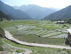 Paddy field in Leepa valley | |
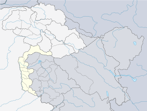 Leepa Valley Location in Azad Kashmir 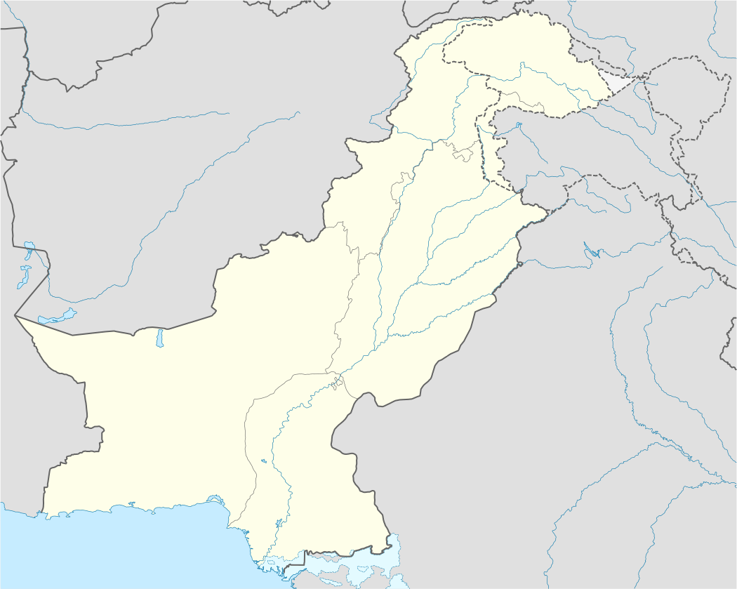 Leepa Valley Leepa Valley (Pakistan) | |
| Coordinates: 34.3136°N 73.8981°E | |
| Country | Pakistan |
| Territory | Azad Kashmir |
| District | Hattian Bala |
| Time zone | UTC+05:00 (PST) |
History
Leepa Valley was formerly part of Karnah tehsil of Kupwara district in Jammu and Kashmir. The valley is now part of Jhelum Valley District in Azad Kashmir, Pakistan. It has been an area of strife among the two neighboring countries.[3][4][5]
Population
The population of Leepa Valley is about 80,000.
Geography
Leepa valley is situated 10,000 feet (3,000 m) above sea level. Snowfall occurs regularly throughout the year.[6][7]
Rice and apple fields can be found frequently in the whole valley. The Line of Control, which separates it from Jammu and Kashmir, can be seen from anywhere while standing in the valley from east to west. Its lush green river fields in summer and typical wooden kashmiri houses present a wonderful view to the tourists.[8]
Languages
The main language which is spoken in the valley is Kashmiri, followed by Hindko, Pahari-Pothwari and Gojari.
References
- "Distance from Muzaffarabad to Leepa Valley". Google Maps. Retrieved 16 August 2019.
- Lava flow in Leepa Valley observed Daily Dawn Retrieved 13 August 2011.
- Tariq Naqash, Dawn.com (8 June 2017). "Pak Army responds to 'unprovoked' firing by Indian troops along LoC: ISPR".
- Naqash, Tariq (14 November 2017). "Elderly woman killed in Indian troops' firing across LoC".
- "Pakistani army says Indian fire kills 2 civilians along border". 25 October 2017.
- "Snow, landslides: Roads leading to Leepa, Neelum valleys blocked - The Express Tribune". 29 January 2017.
- "Roads blocked as new spell of snowfall begins in Leepa Valley - Pakistan - Dunya News".
- http://ajkcs.gov.pk/TourismLeepaValley.asp
External links
- https://ajktourism.gov.pk/leepa-valley
- Leepa Valley - Emerging Pakistan
