Lakewood Club, Michigan
Lakewood Club is a village in Dalton Township of Muskegon County in the U.S. state of Michigan. The population was 1,291 at the 2010 census.
Lakewood Club, Michigan | |
|---|---|
 Location of Lakewood Club, Michigan | |
| Coordinates: 43°22′16″N 86°15′37″W | |
| Country | United States |
| State | Michigan |
| County | Muskegon |
| Area | |
| • Total | 2.07 sq mi (5.36 km2) |
| • Land | 1.91 sq mi (4.96 km2) |
| • Water | 0.15 sq mi (0.40 km2) |
| Elevation | 679 ft (207 m) |
| Population | |
| • Total | 1,291 |
| • Estimate (2019)[3] | 1,292 |
| • Density | 675.38/sq mi (260.71/km2) |
| Time zone | UTC-5 (Eastern (EST)) |
| • Summer (DST) | UTC-4 (EDT) |
| ZIP code | 49457 |
| Area code(s) | 231 |
| FIPS code | 26-45340[4] |
| GNIS feature ID | 1618695[5] |
| Website | http://villageoflakewoodclub.org/ |
Geography
According to the United States Census Bureau, the village has a total area of 2.06 square miles (5.34 km2), of which 1.91 square miles (4.95 km2) is land and 0.15 square miles (0.39 km2) is water.[6]
Demographics
| Historical population | |||
|---|---|---|---|
| Census | Pop. | %± | |
| 1970 | 590 | — | |
| 1980 | 695 | 17.8% | |
| 1990 | 659 | −5.2% | |
| 2000 | 1,006 | 52.7% | |
| 2010 | 1,291 | 28.3% | |
| Est. 2019 | 1,292 | [3] | 0.1% |
| U.S. Decennial Census[7] | |||
2010 census
As of the census[2] of 2010, there were 1,291 people, 458 households, and 345 families living in the village. The population density was 675.9 inhabitants per square mile (261.0/km2). There were 507 housing units at an average density of 265.4 per square mile (102.5/km2). The racial makeup of the village was 93.5% White, 1.9% African American, 1.7% Native American, 0.2% Asian, 0.1% Pacific Islander, 0.6% from other races, and 2.0% from two or more races. Hispanic or Latino of any race were 3.4% of the population.
There were 458 households, of which 44.8% had children under the age of 18 living with them, 55.7% were married couples living together, 14.2% had a female householder with no husband present, 5.5% had a male householder with no wife present, and 24.7% were non-families. 17.7% of all households were made up of individuals, and 3% had someone living alone who was 65 years of age or older. The average household size was 2.82 and the average family size was 3.15.
The median age in the village was 31.7 years. 30.4% of residents were under the age of 18; 6.5% were between the ages of 18 and 24; 35.3% were from 25 to 44; 22.2% were from 45 to 64; and 5.7% were 65 years of age or older. The gender makeup of the village was 51.0% male and 49.0% female.
2000 census
As of the census[4] of 2000, there were 1,006 people, 350 households, and 263 families living in the village. The population density was 531.4 per square mile (205.5/km2). There were 368 housing units at an average density of 194.4 per square mile (75.2/km2). The racial makeup of the village was 90.46% White, 2.78% African American, 1.99% Native American, 0.60% Asian, 1.89% from other races, and 2.29% from two or more races. Hispanic or Latino of any race were 4.17% of the population.
There were 350 households, out of which 44.0% had children under the age of 18 living with them, 58.0% were married couples living together, 11.1% had a female householder with no husband present, and 24.6% were non-families. 19.1% of all households were made up of individuals, and 5.1% had someone living alone who was 65 years of age or older. The average household size was 2.87 and the average family size was 3.30.
In the village, the population was spread out, with 32.7% under the age of 18, 9.0% from 18 to 24, 33.5% from 25 to 44, 18.9% from 45 to 64, and 5.9% who were 65 years of age or older. The median age was 30 years. For every 100 females, there were 107.4 males. For every 100 females age 18 and over, there were 102.1 males.
The median income for a household in the village was $40,313, and the median income for a family was $41,205. Males had a median income of $36,833 versus $22,054 for females. The per capita income for the village was $13,451. About 15.6% of families and 15.5% of the population were below the poverty line, including 19.1% of those under age 18 and 16.7% of those age 65 or over.
External links
- Village of Lakewood Club - official village web site
References
- "2019 U.S. Gazetteer Files". United States Census Bureau. Retrieved July 25, 2020.
- "U.S. Census website". United States Census Bureau. Retrieved 2012-11-25.
- "Population and Housing Unit Estimates". United States Census Bureau. May 24, 2020. Retrieved May 27, 2020.
- "U.S. Census website". United States Census Bureau. Retrieved 2008-01-31.
- U.S. Geological Survey Geographic Names Information System: Lakewood Club, Michigan
- "US Gazetteer files 2010". United States Census Bureau. Archived from the original on 2012-07-02. Retrieved 2012-11-25.
- "Census of Population and Housing". Census.gov. Retrieved June 4, 2015.
Municipalities and communities of Muskegon County, Michigan, United States | ||
|---|---|---|
| Cities | 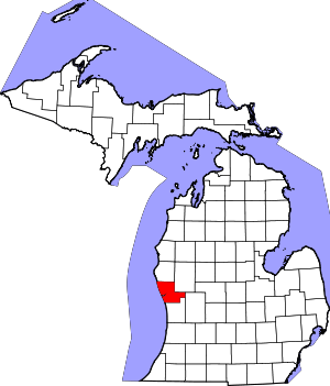 Map of Michigan highlighting Muskegon County.svg | |
| Villages | ||
| Charter townships | ||
| General law townships | ||
| CDPs | ||
| Other unincorporated community | ||
| Footnotes | ‡This populated place also has portions in an adjacent county or counties | |