Lake Manyara
Lake Manyara is the seventh-largest lake of Tanzania by surface area, at 470-square-kilometre (180 sq mi)[1]. It is a shallow, alkaline lake in the Natron-Manyara-Balangida branch of the East African Rift in Manyara Region in Tanzania.[2].The northwest quadrant of the lake (about 200 sq, km.) [3] is included within Lake Manyara National Park and it is part of the Lake Manyara Biosphere Reserve, established in 1981 by UNESCO as part of its Man and the Biosphere Programme. [4]
| Lake Manyara | |
|---|---|
 Overlook of Lake Manyara National Park. | |
 Lake Manyara | |
| Location | Tanzania |
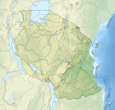
| Coordinates | 3°35′S 35°50′E |
| Lake type | Saline, alkaline, endorheic |
| Primary inflows | Simba River (from the north), Makayuni River (from the east) |
| Max. length | 40 km (25 mi) max |
| Max. width | 15 km (9.3 mi) max |
| Surface area | 181.5 sq mi (470 km2)[1] |
| Max. depth | 3.7 m (12 ft) |
| Surface elevation | 1,045 m (3,428 ft) |

There are differing explanations for how Lake Manyara got its name. The name Manyara may come from the Maasai word emanyara, which is the spiky, protective enclosure around a family homestead (boma). Possibly the 600 m high rift escarpment hems in the lake, like the enclosure around a Maasai boma[5]. Another theory is that the Mbugwe tribe, who live in the Lake Manyara area, may have given the lake its name based on the Mbugwe word manyero, meaning a trough or place where animals drink water[6].
References
- "Source book for the inland fisheries of Africa vol. 1". FAO.
- Foster, A. and C. Ebinger and E. Mbede and D. Rex (August 1997). "Tectonic development of the northern Tanzanian sector of the East African Rift System". Journal of the Geological Society. 154 (4): 689–700. doi:10.1144/gsjgs.154.4.0689.
- https://www.tanzaniatourism.go.tz/en/destination/manyara-national-park
- "Lake Manyara". UNESCO. Retrieved 16 June 2016.
- http://www.tanzania.eu/showpage-tanzania-lake_manyara_national_park.html
- https://www.jamiiforums.com/threads/maana-ya-manyara.60552/
- Deus, Dorothea; Richard Gloaguen and Peter Krause (2013). "Water Balance Modeling in a Semi-Arid Environment with Limited in situ Data Using Remote Sensing in Lake Manyara, East African Rift, Tanzania". Remote Sensing. 5: 1651–1680.
- Hughes, R. H.; Hughes, J. S. (1992). A directory of African wetlands. UNEP. p. 255.
- https://www.lakelubbers.com/lake-manyara-1672/
- Bayona, J.D.R. 2006. Oreochromis amphimelas. The IUCN Red List of Threatened Species 2006: e.T60629A12388607. https://doi.org/10.2305/IUCN.UK.2006.RLTS.T60629A12388607.en. Downloaded on 24 April 2019.
- BirdLife International (2019) Important Bird Areas factsheet: Lake Manyara. Downloaded from http://www.birdlife.org on 24/04/2019
- http://mtoculturalprogramme.tripod.com/id3.html