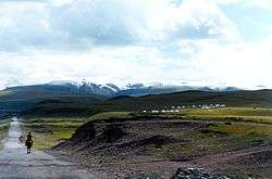
Kuqa, Xinjiang
Kuqa[4][5] is a county-level city in Aksu Prefecture, Xinjiang Uyghur Autonomous Region, China. Other names and variants of spelling of Kuqa are Kocha, Kuchu, Kuchar,[6][7] Kuchi, Kuchel, K'u-ch'e-chen, K'u-ch'e-hsien, Kuga, Kucha and K'u-ch'e.[8] It was once the homeland of the ancient Buddhist Kingdom of Kucha.
Kuqa كۇچار شەھىرى 库车市 Kuchar, Kucha, Kuche | |
|---|---|
 | |
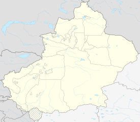
.png) Location of Kuchar County (red) within Aksu Prefecture (yellow) and Xinjiang | |
 Kuqa Location of the seat 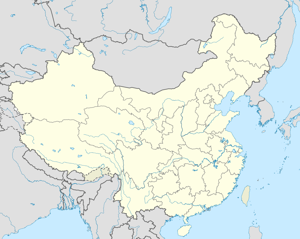 Kuqa Kuqa (China) | |
| Coordinates: 41°43′N 82°58′E | |
| Country | People's Republic of China |
| Province | Xinjiang |
| Prefecture-level divisions | Aksu |
| Area | |
| • Total | 15,200 km2 (5,900 sq mi) |
| Elevation | 1,072 m (3,517 ft) |
| Population (2015)[2] | |
| • Total | 492,535 |
| • Density | 32/km2 (84/sq mi) |
| Ethnic groups | |
| • Major ethnic groups | Uyghur[3] |
| Time zone | UTC+8 (China Standard) |
| Postal code | 842000 |
| Website | www |
| Kuqa, Xinjiang | |||||||||||
|---|---|---|---|---|---|---|---|---|---|---|---|
| Uyghur name | |||||||||||
| Uyghur | كۇچار شەھىرى | ||||||||||
| |||||||||||
| Chinese name | |||||||||||
| Simplified Chinese | 库车 | ||||||||||
| Traditional Chinese | 庫車 | ||||||||||
| |||||||||||
| Alternative Chinese name | |||||||||||
| Simplified Chinese | 龟兹 | ||||||||||
| Traditional Chinese | 龜茲 | ||||||||||
| |||||||||||
History
In 630, Xuanzang (玄奘; Xuán Zàng), a well-known Chinese Buddhist monk, scholar, traveler and translator visited Kucha during the Early Tang period.
In the book "Hudud ul-'alam min al-mashriq ila al-maghrib", written in 982 by an unknown Arab or Persian writer, and presented to Abu'l Haret Muhammad, the ruler of Guzgan, the following is written regarding Kucha:
"Kucha is located on the Chinese border and belongs to China, but the indigenous people, Dokuzoguzes, at times are engaged in raids and looting. This city has many advantages."
Mirza Muhammad Haidar Dughlat, a military general, in his historical book Tarikh-i-Rashidi used the word "Kūsān" for Kucha.
Mahmud Kashgari, in his Compendium of Turkic Languages (Divân-ı Lügati't-Türk), wrote the following about Kucha: "It is one of the cities built by Zülqarnayin (Alexander the Macedonian).".[9] He also wrote that Kucha was an Uyghur town.[10]
In 1758, the Qing Dynasty took control of the area, and the Chinese character name 'Kuche' (庫車) was made the name of the area.[11]
In an interview with Radio Free Asia, an officer at the Kuchar County Police Department reported that from June to December 2018, 150 people at the No. 1 Internment Camp in the Yengisher district of Kuchar county had died, corroborating earlier reports attributed to Himit Qari, former area police chief.[6][7]
On December 20, 2019, Kuqa County was disestablished and Kuqa City was created.[12]
Geography
The city is located at the southern periphery of the Tian Shan range, the northern portion of the Tarim Basin, and the centre of the autonomous region. It occupies part of the northeastern portion of Aksu Prefecture, bordering Xinhe County, Xayar County, and Luntai County, Heiing County, and Lopnur County in Bayingolin Mongol Autonomous Region.
Kuqa has a continental desert climate (Köppen BWk), with an average annual precipitation of 74.6 millimetres (2.94 in), a majority of which occurs in summer. The monthly 24-hour average temperature ranges from −7.2 °C (19.0 °F) in January to 25.3 °C (77.5 °F) in July, and the annual mean is 11.29 °C (52.3 °F). The frost-free period lasts for 266 days on average. With monthly percent possible sunshine ranging from 54% in March to 69% in September and October, sunshine is abundant and the city receives 2,712 hours of bright sunshine annually.
| Climate data for Kuqa (1971–2000) | |||||||||||||
|---|---|---|---|---|---|---|---|---|---|---|---|---|---|
| Month | Jan | Feb | Mar | Apr | May | Jun | Jul | Aug | Sep | Oct | Nov | Dec | Year |
| Average high °C (°F) | −1.3 (29.7) |
4.4 (39.9) |
12.7 (54.9) |
21.5 (70.7) |
26.8 (80.2) |
30.2 (86.4) |
32.0 (89.6) |
31.0 (87.8) |
26.4 (79.5) |
19.0 (66.2) |
9.0 (48.2) |
0.5 (32.9) |
17.7 (63.8) |
| Average low °C (°F) | −11.9 (10.6) |
−6.4 (20.5) |
1.7 (35.1) |
9.2 (48.6) |
14.0 (57.2) |
16.9 (62.4) |
18.7 (65.7) |
17.5 (63.5) |
12.7 (54.9) |
5.4 (41.7) |
−2.1 (28.2) |
−9.4 (15.1) |
5.5 (42.0) |
| Average precipitation mm (inches) | 1.8 (0.07) |
2.9 (0.11) |
3.4 (0.13) |
2.7 (0.11) |
8.7 (0.34) |
18.1 (0.71) |
12.9 (0.51) |
11.6 (0.46) |
7.0 (0.28) |
3.2 (0.13) |
1.1 (0.04) |
1.2 (0.05) |
74.6 (2.94) |
| Average precipitation days (≥ 0.1 mm) | 2.3 | 1.8 | 1.7 | 1.5 | 3.1 | 6.0 | 6.9 | 6.1 | 3.4 | 1.3 | 0.7 | 1.2 | 36.0 |
| Average relative humidity (%) | 64 | 52 | 40 | 31 | 34 | 39 | 41 | 44 | 45 | 49 | 55 | 66 | 47 |
| Mean monthly sunshine hours | 184.1 | 179.4 | 199.2 | 220.2 | 252.8 | 265.9 | 281.0 | 268.3 | 255.1 | 237.6 | 197.8 | 170.5 | 2,711.9 |
| Percent possible sunshine | 63 | 61 | 54 | 55 | 57 | 59 | 61 | 63 | 69 | 69 | 67 | 60 | 62 |
| Source: China Meteorological Administration[13] | |||||||||||||
Administrative divisions
Kuqa has four subdistricts, eight towns, six townships and one other area under its administration:[14][15][1][16]
Subdistricts (كوچا باشقارمىسى / 街道):
- Reste Subdistrict (Resitan; رەستە كوچا باشقارمىسى / 热斯坦街道), Saqsaq Subdistrict (Sakesake; ساقساق كوچا باشقارمىسى / 萨克萨克街道), Yengisheher Subdistrict (Xincheng; يېڭىشەھەر كوچا باشقارمىسى / 新城街道), Sherqiy Subdistrict (Dongcheng; شەرقىي شەھەر كوچا باشقارمىسى / 东城街道)
Towns (بازىرى / 镇):
- Uchar (Wuqia; ئۇچار بازىرى / 乌恰镇), Alakaga (Alahage, Alaqagha; ئالاقاغا بازىرى / 阿拉哈格镇), Chimen (Qiman; چىمەن بازىرى[17] / 齐满镇), Dongqotan (Dunkuotan; دۆڭقوتان بازىرى / 墩阔坦镇), Yaqa (Yaha; ياقا بازىرى[18] / 牙哈镇), Uzun[19] (Wuzun; ئۇزۇن بازىرى / 乌尊镇), Ishxila (Yixihala; ئىشخىلا بازىرى / 伊西哈拉镇), Erbatey (Erbatai; ئەرباتەي بازىرى[20] / 二八台镇)
Townships (يېزىسى / 乡):
- Uchosteng Township (Yuqiwusitang; ئۈچئۆستەڭ يېزىسى / 玉奇吾斯塘乡), Biyixbag Township[21] (Bixibage, Behishbagh; بېھىشباغ يېزىسى / 比西巴格乡), Xanqitam Township (Hanikatamu; خانقىتام يېزىسى / 哈尼喀塔木乡), Aqosteng Township (Akewusitang; ئاقئۆستەڭ يېزىسى / 阿克吾斯塘乡), Aghi Township (Age (pronounced ‘ah-guh’); ئاغى يېزىسى / 阿格乡), Tarim Township (Talimu; تارىم يېزىسى / 塔里木乡)
Other areas:
Economy
Agricultural products include wheat, corn, rice, cotton as well as pears, apricots, melons, grapes, pomegranates, figs, etc. Specialty products include Sanbei Sheep (三北羊) lambskin, white apricots and thin-shelled walnuts. Mineral resources include oil and coal. Industries include coal mining, tractor manufacturing and repair, construction and processing for non-staple foods.[22]
Demographics
| Year | Pop. | ±% p.a. |
|---|---|---|
| 2000 | 388,593 | — |
| 2010 | 462,588 | +1.76% |
| [15] | ||
As of 2015, 440,125 of the 492,535 residents of Kuqa County were Uyghur, 49,021 were Han Chinese and 3,389 were from other ethnic groups.[2]
As of 2002, the county had a population of 450,000.
As of 1999, 89.93% of the population of Kuqa County were Uyghur and 9.49% of the population was Han Chinese.[23]
Transportation
Kuqa is served by China National Highway 217, China National Highway 314[22] and the Southern Xinjiang Railway.
Kuqa Town
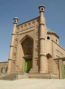
Kuqa is also the name of the central town (Chinese: 库车镇), located in the easternmost area of Kuqa. It is the second largest town of Aksu Prefecture. Its area size is 14,528.74 square meters and population 470,600, composed of fourteen peoples including the Uyghurs, Hans, Huis, and Mongols. Kuqa is a thriving town of oil and natural gas development of the Tarim Basin, and of tourism, as it was once the homeland of the ancient Buddhist Kingdom of Kucha. Its tourist attractions are:
Notable persons
- Qurban Mamut, former editor-in-chief of the official Xinjiang Cultural Journal (《新疆文化》) and detainee in the Xinjiang re-education camps[24][25]
Historical maps
Historical English-language maps including Kuqa:
_-_panoramio.jpg) Map including Kuqa (labeled as K'U-CH'E (KUCHA)) and surrounding region from the International Map of the World (AMS, 1950)[lower-alpha 1]
Map including Kuqa (labeled as K'U-CH'E (KUCHA)) and surrounding region from the International Map of the World (AMS, 1950)[lower-alpha 1] Map including Kuqa (labeled as Kuga/ Kuche/ Kuqaxian) (DMA, 1981)
 From the Operational Navigation Chart; map including Kuqa (K'u-ch'e) (DMA, 1985)[lower-alpha 2]
Notes
- From map: "THE DELINEATION OF INTERNATIONAL BOUNDARIES ON THIS MAP MUST NOT BE CONSIDERED AUTHORITATIVE"
- From map: "The representation of international boundaries is not necessarily authoritative."
References
- 库车市 [Kuqa City] (in Chinese). 库车市人民政府. 22 January 2019. Retrieved 9 June 2020.
总面积1.52万平方公里,辖8镇、6乡、4个街道办事处,
- 3-7 各地、州、市、县(市)分民族人口数 (in Chinese). شىنجاڭ ئۇيغۇر ئاپتونوم رايونى 新疆维吾尔自治区统计局 Statistic Bureau of Xinjiang Uygur Autonomous Region. Archived from the original on 2017-10-11. Retrieved 2017-09-03.
- 民族人口 (in Chinese). 库车市人民政府. 22 March 2019. Retrieved 11 June 2020.
库车县是以维吾尔族为主体的多民族聚居区。
- The official spelling is "Kuqa" according to Zhōngguó dìmínglù 中国地名录 (Beijing, SinoMaps Press 中国地图出版社 1997); ISBN 7-5031-1718-4; p. 306.
- Complete Atlas Of The World (3 ed.). Penguin Random House. 2016. p. 238 – via Internet Archive.
Kuqa
- Fred Hiatt (2 December 2019). "These journalists have confounded China's massive propaganda machine". Washington Post. Retrieved 10 June 2020.
It was Hoshur’s Oct. 29 story that confirmed the deaths of 150 people over the course of six months at the No. 1 Internment Camp in the Yengisher district of Kuchar county, “marking the first confirmation of mass deaths since the camps were introduced in 2017,” as the story notes.
- Shohret Hoshur, Joshua Lipes (29 October 2019). "At Least 150 Detainees Have Died in One Xinjiang Internment Camp: Police Officer". Radio Free Asia. Translated by Mamatjan Juma. Retrieved 10 June 2020.CS1 maint: uses authors parameter (link)
- Kuqa, China Page (in English)
- Atalay, Besim (2006). Divanü Lügati't - Türk. Ankara: Türk Tarih Kurumu Basımevi. ISBN 975-16-0405-2, Cilt I, sayfa 113, Cilt III, sayfa 219 ve 238
- Atalay, Besim (2006). Divanü Lügati't - Türk. Ankara: Türk Tarih Kurumu Basımevi. ISBN 975-16-0405-2, Cilt III, sayfa 219
- 西域历史中的龟兹. 龟兹网. 15 January 2017. Retrieved 11 June 2020.
乾隆二十三年(1758),龟兹归入清朝版图,定名库车。
- Chen Xinhui (陈新辉), Han Ting (韩婷), ed. (21 December 2019). 国务院批准撤销库车县设立县级库车市. People's Daily Online (in Chinese). Retrieved 14 July 2020.
- 中国地面国际交换站气候标准值月值数据集(1971-2000年) (in Chinese). China Meteorological Administration. Archived from the original on 2013-09-21. Retrieved 2010-06-19.
- 2019年统计用区划代码和城乡划分代码:库车县 [2019 Statistical Area Numbers and Rural-Urban Area Numbers: Kuqa County] (in Chinese). National Bureau of Statistics of the People's Republic of China. 2019. Retrieved 9 June 2019.
统计用区划代码 名称 652923001000 热斯坦街道 652923002000 萨克萨克街道 652923003000 新城街道 652923004000 东城街道 652923101000 乌恰镇 652923102000 阿拉哈格镇 652923103000 齐满镇 652923104000 墩阔坦镇 652923105000 牙哈镇 652923106000 乌尊镇 652923107000 伊西哈拉镇 652923108000 二八台镇 652923201000 玉奇吾斯塘乡 652923202000 比西巴格乡 652923203000 哈尼喀塔木乡 652923204000 阿克吾斯塘乡 652923205000 阿格乡 652923206000 塔里木乡 652923500000 库车经济技术开发区
- 库车县历史沿革 [Kuqa County Historical Development] (in Chinese). XZQH.org. 30 January 2015. Retrieved 9 June 2020.
2010年第六次人口普查,库车县常住总人口462588人,其中:热斯坦街道13298人,萨克萨克街道18156人,新城街道44184人,东城街道27114人,乌恰镇41557人,阿拉哈格镇38197人,齐满镇35871人,墩阔坦镇17965人,牙哈镇31856人,乌尊镇29243人,依西哈拉镇32132人,雅克拉镇1029人,玉奇吾斯塘乡27355人,比西巴格乡26131人,哈尼喀塔木乡35430人,阿克吾斯塘乡16027人,阿格乡6960人,塔里木乡3877人,水电二处2260人,二八台农场4413人,良种繁胄场2678人,库孜翁牧场1551人,草湖牧场1136人,库车种羊场3008人,库车监狱360人,克其力克农场800人。
- Communication Construction Administration Bureau of Xinjiang Uigur Autonomous Region (September 2007). "PRC: Xinjiang Regional Road Improvement Project (Korla-Kuqa Section)" (PDF). Asian Development Bank. p. 76. Retrieved 10 July 2020.
Distribution of Rural Poor Population in Kuche County{...}No. Town(ship){...}1 Hanikatamu{...}2 Talimu{...}3 Akewusitang{...}4 Age{...}5 Yuqiwusitang{...}6 Bixibage{...}7 Wuqia{...}8 Yixihala{...}9 Yaha{...}10 Wuzun{...}11 Qiman{...}12 Dunkuotan{...}13 Alahage{...}
- چىمەن (Variant Non-Roman Script - VS) at GEOnet Names Server, United States National Geospatial-Intelligence Agency
- ياقا (Variant Non-Roman Script - VS) at GEOnet Names Server, United States National Geospatial-Intelligence Agency
- Zhong Xingqi 钟兴麒, ed. (July 2008). 西域地名考录 (in Chinese). Beijing: 国家图书馆出版社. p. 1004. ISBN 978-7-5013-3628-9.
乌樽 wū zūn Uzun {...} 二、乡名。新疆库车县乌尊乡,在县东南13公里。“乌尊”是“乌樽”的另写。
- ئەرباتەي (Variant Non-Roman Script - VS) at GEOnet Names Server, United States National Geospatial-Intelligence Agency
- Biyixbag (Approved - N) at GEOnet Names Server, United States National Geospatial-Intelligence Agency
- 夏征农; 陈至立, eds. (September 2009). 辞海:第六版彩图本 [Cihai (Sixth Edition in Color)] (in Chinese). 上海. Shanghai: 上海辞书出版社. Shanghai Lexicographical Publishing House. p. 1264. ISBN 9787532628599.
- Morris Rossabi, ed. (2004). Governing China’s Multiethnic Frontiers (PDF). University of Washington Press. p. 179. ISBN 0-295-98390-6.
- Shohret Hoshur, Joshua Lipes (9 June 2020). "Prominent Uyghur Journalist Confirmed Detained After Nearly Three Years". Radio Free Asia. Translated by Elise Anderson. Retrieved 11 June 2020.
- Austin Ramzy (5 January 2019). "China Targets Prominent Uighur Intellectuals to Erase an Ethnic Identity". New York Times. Archived from the original on 12 April 2020. Retrieved 11 June 2020.
External links
| Wikimedia Commons has media related to Kuqa County. |