Kokshetau
Kokshetau, Kökshetaū (meaning Blue Mountain in Kazakh, Kazakh: Көкшетау, romanized: Kókshetaý; [køkɕetɑw] (![]()
Kokshetau | |
|---|---|
City | |
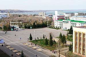 Kokshetau's central Ablai Khan Square | |
 Coat of arms | |
| Nicknames: the Area of Blue Lakes, Kazakh Pearl, the Area of Blue Mountains | |
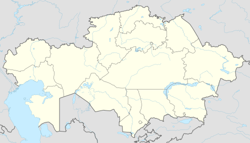 Kokshetau Location of Kokshetau in Kazakhstan 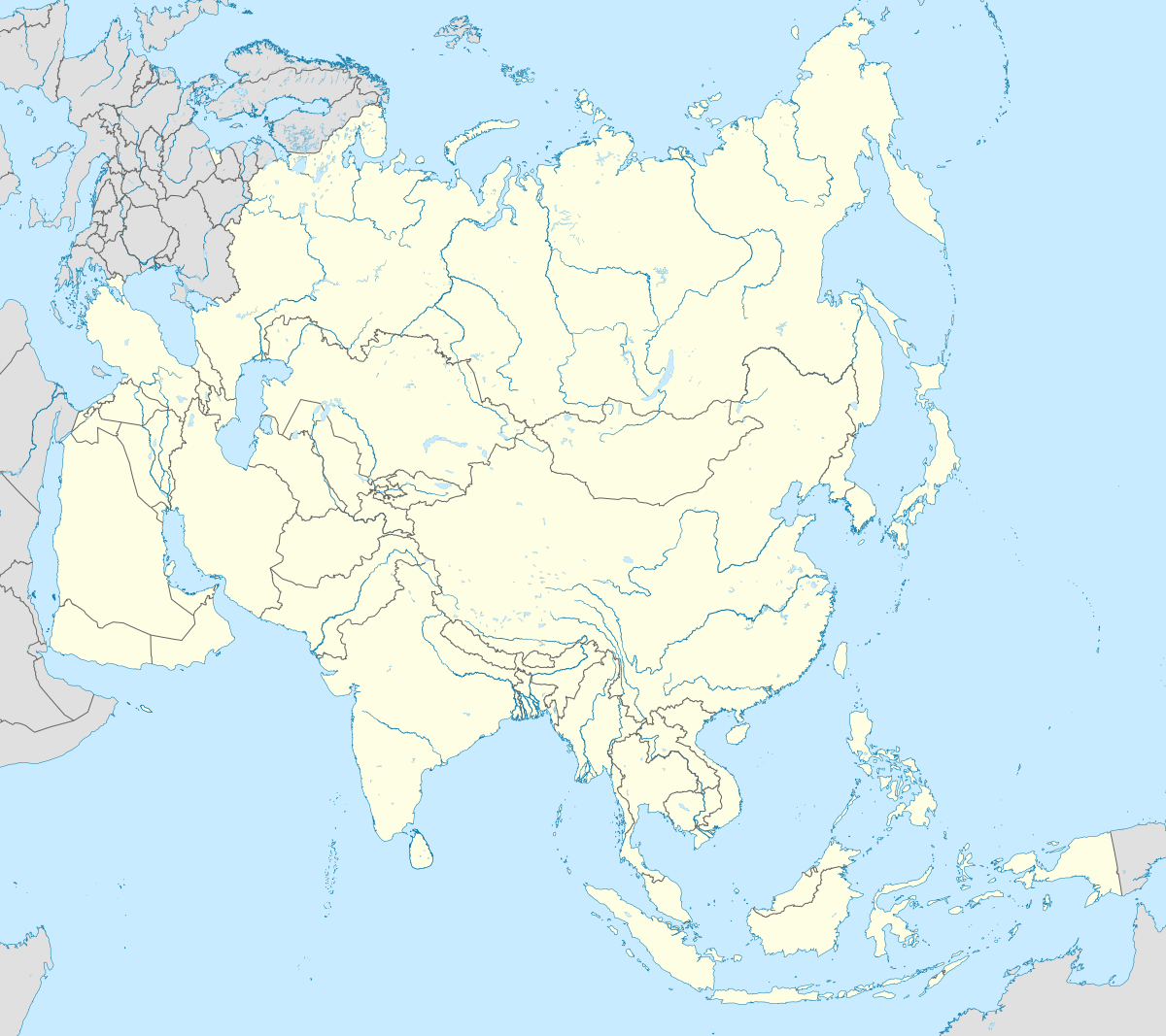 Kokshetau Kokshetau (Asia) | |
| Coordinates: 53°17′N 69°23′E | |
| Country | |
| Region | Akmola Region |
| Founded | 1824 |
| City status | 1862 |
| Government | |
| • Akim (mayor) | Amangeldy Khalaudanovich Smailov |
| Area | |
| • Total | 425 km2 (164 sq mi) |
| Elevation | 234 m (768 ft) |
| Population (2020)[1] | |
| • Total | 146 104 people |
| Time zone | UTC+6 (ALMT) |
| Postal code | 020000-020010 |
| Area code(s) | +7 7162 |
| Vehicle registration | C and 03 (region) |
| Website | http://kokshetau.akmo.gov.kz/ |
It has 146,104 inhabitants (2020 estimate), up from 123,389 (1999 census), while Akmola Region had a total population of 738,587 (2019 estimate), down from 1,061,820 (1989 census), making it the tenth most populous region in Kazakshtan. Kokshetau retains multiethnic population, with 58% ethnic Kazakhs (up from 36%), the rest being mostly 29% ethnic Russians (down from 42%) and other ethnic groups such as Ukrainian, Tatars and Germans.
The city is considered to have been founded in 1824, while it was granted city status in 1862. It is well known for its nature and tourist sites, such as Burabay and Zerenda, among others. Kokshetau is about 185 kilometres (115 mi) from Petropavl, 300 kilometres (190 mi) northwest of the national capital Nur-Sultan, 318 kilometres (198 mi) from Omsk, Russia, and 384 kilometres (239 mi) from Kostanay. The city is served by Kokshetau Airport.
Names and etymology
The name Kokshetau is of Kazakh origin literally meaning "a smoky-blue mountain", kokshe / "көкше" (meaning 'blue') and tau / "тау" (meaning 'mountain'). Until October 7, 1993 it was officially known as 'Kokchetav' (Russian: Кокчета́в, IPA: [koktɕɪˈtav]).
Following the collapse of the Soviet Union and independence of Kazakhstan, the city was renamed to the more Kazakh-sounding Kokshetau as part of the government's campaign to apply Kazakh names to cities. The former name is still commonly used in the Russian language, and by Russians in Kazakhstan as well as Kazakhs themselves.
History
Once the hills that surround the town were covered with the thick forest, numerous livestock flocks that belonged to Kazakh khans of Middle Zhuz were roaming along the steppes of Kokshetau tract. After Junior Zhuz (and later Middle Zhuz) voluntarily joined Russia, tsarism started strengthening its power in Kazakh steppes.
Kokshetau was founded in 1824 near the mountain called “Bukpa” as a settlement of the Cossack village. The name of the city is of Kazakh origin literally meaning "a smoky-blue mountain". In 1868 it became a district center of Omskaya gubernia in the Russian Empire, which further developed as a center of agricultural and animal husbandry and as a resort town.
In 1944 Kokchetav became the administrative center of the newly created Kokchetavskaya Oblast. In 1997 Kokshetau Oblast region was liquidated. In 1999 due to an administrative changes in the structure of Aqmola and North Kazakhstan regions Kokshetau became the center of Aqmola Oblast.
In late 1930s as a result of the Polish operation of the NKVD - USSR citizens of Polish nationality, related national operations, also against Kazakh SSR Germans, since 1939 many residents of the Poland's kresy wschodnie were forcibly settled in this region, and Kokchetav became the center of the Polish community in Kazakhstan.[2]
In May 1989 a significant event took place – Kokshetau and the American town of Waukesha became the twin towns.
Geography
Kokshetau is some 300 kilometres (190 mi) north-west of the national capital of Nur-Sultan. The Kokshetau area is known for its two national parks, Burabay and Kokshetau. The city of Kokshetau it is compactly located in the unique landscape – Bukpa Mountain, on the shores of Lake Kopa, forests and hills.
The foremost attraction of Kokshetau area is the Burabay State National Natural Park, combining 14 beautiful lakes located among the picturesque mountains covered with dense coniferous forests. The most significant one among them in terms of size, beauty and tourists admire is Lake Borovoe. The lake is located 70 km from the town. The mild mountain climate, clean and fresh air and the presence of healing mud make the stay here not only pleasant, but also health-friendly and therapeutic.
Time
The time offset from the UTC used by Kokshetau is 6 hours after UTC, or UTC+6:00. This is also used by most of Kazakhstan and Almaty.
Climate
Kokshetau lies in a cold semi-arid climate (Köppen climate classification BSk) zone with extreme continental influences. It has long, cold winters and hot summers. The average temperature in January is −15.3 °C (4.5 °F). In July the temperature averages 20.2 °C (68.4 °F). Yearly precipitation amounts to 313 mm (12.3 in).
| Climate data for Kokshetau | |||||||||||||
|---|---|---|---|---|---|---|---|---|---|---|---|---|---|
| Month | Jan | Feb | Mar | Apr | May | Jun | Jul | Aug | Sep | Oct | Nov | Dec | Year |
| Daily mean °C (°F) | −15.3 (4.5) |
−15.1 (4.8) |
−7.4 (18.7) |
4.0 (39.2) |
12.2 (54.0) |
18.4 (65.1) |
20.2 (68.4) |
16.8 (62.2) |
11.3 (52.3) |
2.5 (36.5) |
−6.1 (21.0) |
−11.8 (10.8) |
2.5 (36.5) |
| Average precipitation mm (inches) | 12.8 (0.50) |
11.3 (0.44) |
10.5 (0.41) |
17.9 (0.70) |
32.7 (1.29) |
40.2 (1.58) |
68.5 (2.70) |
43.6 (1.72) |
24.8 (0.98) |
22.8 (0.90) |
15.7 (0.62) |
11.7 (0.46) |
312.5 (12.3) |
| Average rainy days | 3.7 | 3.4 | 3.0 | 4.2 | 6.5 | 6.5 | 8.5 | 7.3 | 5.5 | 6.2 | 4.3 | 3.3 | 62.4 |
| Mean monthly sunshine hours | 89.0 | 127.0 | 196.0 | 227.0 | 277.0 | 306.0 | 313.0 | 250.0 | 190.0 | 118.0 | 88.0 | 75.0 | 2,256 |
| Source: NOAA (1961-1990)[3] | |||||||||||||
Demographics
| Year | Pop. | ±% |
|---|---|---|
| 1897 | 4,962 | — |
| 1959 | 52,909 | +966.3% |
| 1970 | 80,564 | +52.3% |
| 1979 | 103,162 | +28.0% |
| 1989 | 136,757 | +32.6% |
| 1999 | 123,389 | −9.8% |
| 2010 | 136,100 | +10.3% |
| 2014 | 140,847 | +3.5% |
| 2020 | 146,104 | +3.7% |
Kokshetau ranks fifth in terms of population in Northern Kazakhstan. It has changed its demographics, nowadays having more ethnic Kazakhs in a city that formerly had a Slavic majority.
Population
As of January 2020, the population of Kokshetau is 146,104, and the extended urbanized area has 160,431 inhabitants.
As of the 2020 Census, ethnic Kazakhs made up 58.05% of the city population, representing an increase from 36% in 1999. The ethnic makeup of the city's population as of year 2020 was:[4]
| Ethnicity | Number | Percentage |
|---|---|---|
| Kazakhs | 93,126 | 58.05% |
| Russians | 47,185 | 29.41% |
| Ukrainian | 4,618 | 2.88% |
| Tatars | 3,660 | 2.28% |
| Germans | 3,124 | 1.95% |
| others | - | 5.43% |
In 1989, Kokchetav (now Kokshetau) had a population of 136,757. The ethnic mix was about 18.5% Kazakh, 53% Russian and 28.5% other ethnic groups.
| Ethnicity | Number | Percentage |
|---|---|---|
| Russians | 74,481 | 53% |
| Kazakhs | 25,300 | 18.5% |
| others | - | 28.5% |
Religion
Islam is the predominant religion of the city. Other religions practiced are Christianity (primarily Russian Orthodox, Roman Catholicism, and Protestantism). Kokshetau has a beautiful mosque constructed in the beginning of the 20th century and a Russian Orthodox Church temple of Archangel Michael. In 1997, a Roman Catholic Church was built in Gothic style using red bricks. A new mosque for 1,200 people named after Nauan Khazret opened in 2015 and construction of a new Orthodox Church is underway.
Industry
After the collapse of the Soviet Union in 1991 most plants and factories in the city stopped their production for ever. At that moment the city had a number of grain mills and some dairy production. A gold mine operates north of the city.
Transport
Air
Kokshetau is served by Kokshetau International Airport (IATA Airport Code: KOV). It is located 12.5 km (7.8 mi) north-east from the centre of city. It serves mostly domestic flights. SCAT Airlines fly to and from Almaty and Aktau as well as FlyArystan operates three weekly flights to Almaty.
Education
Several universities are located in Kokshetau, among them:
- Kokshetau State University (named after Shoqan Walikhanov)
International relations
Notable people
- Nikolay Kuibyshev (b. 1893), Red Army Komkor (Valerian Kuibyshev's younger brother).
See also
References
- "Archived copy". Archived from the original on 2011-05-26. Retrieved 2009-10-22.CS1 maint: archived copy as title (link)
- Kate Brown, A Biography of No Place: From Ethnic Borderland to Soviet Heartland (Harvard University Press, 2004: ISBN 0-674-01168-6), pp. 173-74.
- "Kokshetay Climate Normals 1961-1990". National Oceanic and Atmospheric Administration. Retrieved January 10, 2013.
- "Численность населения Республики Казахстан по отдельным этносам на начало 2020 года". Stat.kz. Retrieved 2020-08-06.
External links
| Wikimedia Commons has media related to Kokshetau. |
- www.akmo.kz

- 360° QTVR fullscreen panoramas of the Kokshetau
Capital: Kokshetau | ||
| Districts | 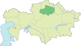 | |
| Major cities | ||
| Capital |  | |
|---|---|---|
| Other cities | ||
| Authority control |
|
|---|