Kizilto
Kizilto (Chinese: 克孜勒陶乡; pinyin: Kèzīlètáo Xiāng) is a township of Akto County in Xinjiang Uygur Autonomous Region, China. Located in the southeastern part of the county, the township covers an area of 3,882 square kilometers with a population of 9,700 (as of 2015[1]). It has 12 administrative villages under its jurisdiction. Its seat is at Ordolungozu Village (乌尔都隆窝孜村).[2]
Kizilto 克孜勒陶乡 Keziletao | |
|---|---|
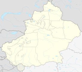 Kizilto Location of the township | |
| Coordinates: 38.5537367400°N 76.0725562557°E | |
| Country | People's Republic of China |
| Autonomous region | Xinjiang |
| Prefecture | Kizilsu |
| County | Akto |
| Area | |
| • Total | 3,882 km2 (1,499 sq mi) |
| Population (2015) | |
| • Total | 9,700 |
| [1] | |
| Time zone | UTC+8 (China Standard Time) |
| postal code | 845558 |
| Area code(s) | 653022 207 |
| Website | www.xjakt.gov.cn |
Name
The name of Kizilto is from Kyrgyz language, meaning "red mountains" (红山). This place is named after the red mountain stone on the south side of the Yigzya River (依格孜牙河).[3]
Geography and resources

Kizilto Township is located to the south of county seat Akto Town and on the eastern slope of Kunlun Mountains, and between 75°02′- 76°41′ east longitude and 38°06′- 38°56′ north latitude. The township is bordered by Kizil Township of Yingjisha County to the east, by Akdala Ranch and Qarlung Township to the south, by Bulungkol Township to the west, Wuqia Township of Yingjisha County to the north. Its maximum distance between east and west is 105 kilometers, and the maximum distance between north and south 75 kilometers. The seat of the township is 98 kilometers away from the county seat of Akto Town. It has a total area of 3,882 square kilometers, including 318.7 hectares of arable land, 86.8 hectares of forest land and 143,000 hectares of grassland. The economy of the township is mainly animal husbandry, and there are more high-quality summer grasses on shallow hillsides and river valleys. It mainly grows food crops such as wheat, corn and barley.
The average elevation of the township is 2,200 meters. The northwest is a cold mountain climate with an annual precipitation of 150–200 mm. The southeast is a shallow mountain area, it is a temperate continental arid climate with an average annual temperature of 10.9 ℃ and a frost-free period of 150 days. The main water system in the territory is the Yigzya River. There are precious animals such as snow chicken, yellow sheep and argali, and there are rare plants such as wild snow lotus, codonopsis, angelica, gymnadenia conopsea, cynomorium, daphnia, comfrey and cistanche. Mineral resources are mainly such as lead, zinc, iron, coal, marble and rock crystal.
Administrative divisions
The township of Kizilto has 12 villages under its jurisdiction.[4]
- 12 villages
- Arpalk Village (阿尔帕勒克村)
- Ejak Village (艾杰克村)
- Hongxing Village (红新村)
- Kapuka Village (喀普喀村)
- Karatash Village (喀拉塔什村)
- Karatashqimgan Village (喀拉塔什其木干村)
- Karawul Village (喀尔乌勒村)
- Ordolungozu Village (乌尔都隆窝孜村)
- Qimgan Village (其木干村)
- Tam Village (塔木村)
- Tampaz Village (塔木柏孜村)
- Toyundok Village (托云都克村)
- Unincorporated villages
- Qat (恰特)
References
- 克孜勒陶乡(概况). xjakt.gov.cn. 2018-06-04. Retrieved 2019-07-08.
- 阿克陶县行政区划和居民地名称. xjkz.gov.cn. 2018-05-04. Retrieved 2019-11-08.
- 克孜勒陶乡(概况). qianxi123.com. 2018-05-12. Retrieved 2019-11-08.
- 2018年克孜勒陶乡行政区划代码. National Bureau of Statistics of China. 2018-10-31. Retrieved 2019-11-08.