Kinloss
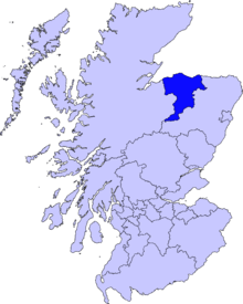
Kinloss (Gaelic: Cinn Lois) is a village in Moray, Scotland. It is located near the shore of Findhorn Bay, around 3 miles (5 km) from Findhorn and 2.5 miles (4 km) from Forres.[1] Northeast of the village is Kinloss Barracks, formerly RAF Kinloss which opened on 1 April 1939.[2]

It is believed that 1,000 aircraft were dismantled at Kinloss, after the end of the Second World War. Investigations are on for possible radioactive contamination in RAF Kinloss.[3]
The Cistercian Kinloss Abbey was created in 1150 by King David. Under abbot Robert Reid the abbey became a centre of academic excellence in the 1530s. It now lies almost completely ruined.
Climate
Like the rest of the plains of Scotland, Kinloss has an oceanic climate (Köppen: Cfb).[4] It is one of the mildest climates in this latitude, being milder than Angoon, Alaska for almost identical latitudinal coordinates, both influenced by the location on the west coast of the temperate zone, with freezing nights on the second. Although the Scottish village is on the mainland island of the United Kingdom, its record high is also higher, demonstrating that it is not just the effect of maritime.[5][6]
| Climate data for Kinloss, elevation: 5 m or 16 ft, 1961-1990 normals and extremes | |||||||||||||
|---|---|---|---|---|---|---|---|---|---|---|---|---|---|
| Month | Jan | Feb | Mar | Apr | May | Jun | Jul | Aug | Sep | Oct | Nov | Dec | Year |
| Record high °F (°C) | 59.2 (15.1) |
61.0 (16.1) |
64.8 (18.2) |
72.9 (22.7) |
81.0 (27.2) |
81.9 (27.7) |
87.1 (30.6) |
83.7 (28.7) |
79.2 (26.2) |
72.1 (22.3) |
64.4 (18.0) |
59.9 (15.5) |
87.1 (30.6) |
| Average high °F (°C) | 43.2 (6.2) |
43.9 (6.6) |
47.5 (8.6) |
51.3 (10.7) |
56.8 (13.8) |
62.2 (16.8) |
64.6 (18.1) |
64.2 (17.9) |
60.1 (15.6) |
55.2 (12.9) |
47.3 (8.5) |
44.2 (6.8) |
53.4 (11.9) |
| Daily mean °F (°C) | 37.8 (3.2) |
37.8 (3.2) |
41.2 (5.1) |
44.2 (6.8) |
49.5 (9.7) |
54.9 (12.7) |
57.6 (14.2) |
57.2 (14.0) |
53.6 (12.0) |
48.9 (9.4) |
41.7 (5.4) |
38.8 (3.8) |
46.9 (8.3) |
| Average low °F (°C) | 32.4 (0.2) |
31.6 (−0.2) |
34.9 (1.6) |
37.2 (2.9) |
42.3 (5.7) |
47.7 (8.7) |
50.7 (10.4) |
50.4 (10.2) |
47.3 (8.5) |
42.6 (5.9) |
36.1 (2.3) |
33.6 (0.9) |
40.6 (4.8) |
| Record low °F (°C) | 4.1 (−15.5) |
6.1 (−14.4) |
12.7 (−10.7) |
18.9 (−7.3) |
25.9 (−3.4) |
31.1 (−0.5) |
34.7 (1.5) |
34.3 (1.3) |
29.8 (−1.2) |
25.7 (−3.5) |
12.7 (−10.7) |
3.2 (−16.0) |
3.2 (−16.0) |
| Average precipitation inches (mm) | 2.09 (53.0) |
1.54 (39.0) |
1.81 (46.0) |
1.42 (36.0) |
1.81 (46.0) |
1.93 (49.0) |
2.17 (55.0) |
2.80 (71.0) |
2.28 (58.0) |
2.20 (56.0) |
2.44 (62.0) |
2.05 (52.0) |
24.54 (623) |
| Average precipitation days (≥ 1.0 mm) | 10.0 | 8.0 | 11.0 | 9.0 | 9.0 | 9.0 | 10.0 | 12.0 | 12.0 | 12.0 | 12.0 | 12.0 | 126 |
| Average snowy days | 6.0 | 7.0 | 5.0 | 3.0 | 0 | 0 | 0 | 0 | 0 | trace | 3.0 | 6.0 | 30 |
| Average relative humidity (%) | 80.5 | 78.0 | 76.5 | 76.0 | 75.5 | 76.0 | 77.0 | 78.5 | 79.0 | 79.5 | 81.0 | 81.5 | 78.3 |
| Mean monthly sunshine hours | 42.1 | 75.7 | 104.5 | 136.2 | 167.1 | 162.7 | 147.4 | 134.8 | 104.7 | 84.3 | 49.7 | 35.2 | 1,244.4 |
| Source: NOAA[6] | |||||||||||||
Education
Kinloss Primary School serves the village of Kinloss and surrounding area including the nearby village of Findhorn.
Secondary students are in the catchment zone of Forres Academy in Forres.[7]
See also
References
- Kinloss Parish and Town. The Imperial gazetteer of Scotland. vol. 2. by Rev. John Marius Wilson https://archive.org/stream/imperialgazettee02wilsuoft#page/234/mode/1up
- Crowther, Stuart. "RAF aim for a smooth transition for Kinloss base". STV Forres. Archived from the original on 16 June 2012. Retrieved 10 November 2011.
- "RAF Kinloss". Retrieved 20 May 2012.
- "Kinloss, Scotland Köppen Climate Classification (Weatherbase)". Weatherbase. Retrieved 14 March 2019.
- "O clima típico de qualquer lugar da Terra - Weather Spark". pt.weatherspark.com. Retrieved 24 March 2019.
- "Kinloss (03066) - WMO Weather Station". NOAA. Retrieved 24 March 2019.
- ""Forres Academy Handbook 2018-19" (PDF). Retrieved 7 October 2018.
External links
| Wikimedia Commons has media related to Kinloss. |
- Findhorn and Kinloss community website
- Catholic Encyclopedia article on Kinloss's Cistercian monastery
- Cistercian Abbeys: KINLOSS
- Kinloss Abbey
- grid reference NJ065615
Places in Moray | ||
|---|---|---|
|  | |