Khor Rori
Khawr Rawrī (Arabic: خور روري) or Khor Rori is a village in Dhofar Governorate, Oman, near Salalah. It is best known for being the center of the ancient south Arabian town of Sumhuram. The area represents a popular tourist spot within Oman and is a major breeding ground for birds.[1]
Khawr Rawrī خور روري | |
|---|---|
Village | |
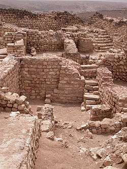 The Ruins of Khor Rori, a.k.a. "Sumhuram" | |
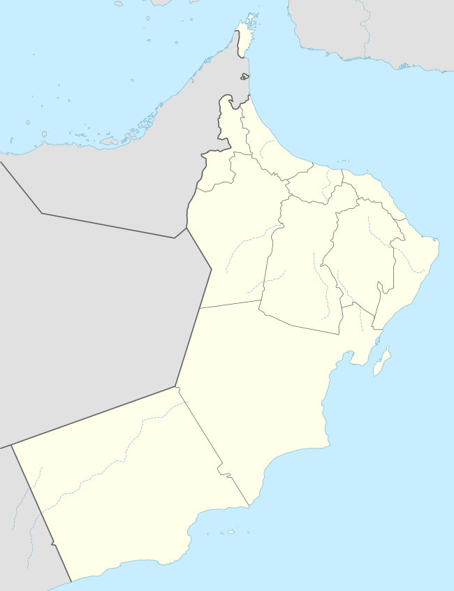 Khawr Rawrī Location in Oman | |
| Coordinates: 17°02′N 54°27′E | |
| Country | |
| Governorate | Dhofar Governorate |
| Time zone | UTC+4 (Oman Standard Time) |
The fortified city was founded as an outpost for the kingdom of Hadhramaut (Hadramautic 𐩢𐩳𐩧𐩣𐩥𐩩 ḥḍrmwt) at the end of the first century BC, initially it was founded primarily with defensive function then developed later into a city in the first century AD.[2] The foundation of the city by the king of Hardamaut is closely associated with rising importance of sea trade at the end of the first century BC between the Mediterranean and India. In this period, the Hadrami kingdom was economically and politically dependent on its ability to control the coastal region.[2]
History
Inscriptions at Khor Rori report that the town of Sumhuram (Hadramautic: s1mhrm), was founded on royal initiative and settled by Hadhrami emigrants. The Dhofar region was the main source of frankincense in the ancient period, and it seems likely that the foundation of the settlement by the Hadhramaut was in part motivated by wish to control the production of this valuable commodity. Most scholars identify Khor Rori with the frankincense exporting port of Moscha Limen mentioned in this region in the first century CE merchants guide, the Periplus of the Erythraean Sea.
The discovery of Khor Rori / Sumhuram is credited to the English explorer James Theodore Bent, with his wife Mabel, who identified the site during their travels in the region in January 1895.[3] The site has been excavated by the American Foundation for the Study of Man (AFSM) in the early 1950s and by the Italian Mission to Oman (IMTO) since 1994. The excavations have uncovered the ground plan of the settlement and has attested maritime contacts with the Ḥaḑramite homeland, India and the Mediterranean. It was inscribed in 2000, along with other sites along the Incense Route in Oman, as part of the World Heritage site "Land of Frankincense".
In 1908, J.G. Lorimer recorded Rakhyut in his Gazetteer of the Persian Gulf, noting its location as the eastern extremity of Dhofar proper. He wrote:
A remarkable lake or inlet of the sea running a mile or more inland ; it is the estuary of Wadi Dirbat from Jabal Samhan.
The inlet is divided from the sea by a sand bar over which the water flows at high tide. A peninsula, once fortified, adjoins the east side of the entrance. Remains of ancient buildings surround the lake. There is a fortified rock at the entrance to the inlet, which is called Khatiyah. This harbour is the ancient Moscha, or Abyssapolis.[4]
Other contexts
Some Mormons believe that this is the "land Bountiful" where Nephi from the Book of Mormon stayed during his travels from Jerusalem (First Nephi, chapter 17).[5]
References
- "Dhofar beckons lovers of nature tourism". Ministry of Tourism (Oman). 29 June 2011. Retrieved 26 November 2019.
- Alessandra & Roberto 2001, p. 249.
- The Bents published their discovery of Khor Rori (Abyssapolis) in Chapter XXI of their work Southern Arabia (London 1900).
- "'Gazetteer of Arabia Vol. I' [538] (569/1050)". Qatar Digital Library. Retrieved 26 November 2019. This article incorporates text from this source, which is in the public domain.
- Potter, George and Wellington, Richard. Lehi's Trail: From the Valley of Lemuel to Nephi's Harbor.http://maxwellinstitute.byu.edu/publications/jbms/?vol=15&num=2&id=415
Capital: Salalah | |
| Wilayats (provinces) | |
| Villages |
|