Kerrie, Victoria
Kerrie /ˈkɛri/ is a small town in the Macedon Ranges region of Victoria, Australia, featuring a town hall (1934) and the closed Kerrie State School (c. 1877).[1] The school was closed in 1991, but remains an important venue for community meetings and events. The buildings and grounds are heritage listed[2] and underwent external restoration during 2009–2010. Near the hall are the former tennis courts, now overgrown and in a state of disrepair.
| Kerrie Victoria | |||||||||||||||
|---|---|---|---|---|---|---|---|---|---|---|---|---|---|---|---|
 Kerrie Public Hall | |||||||||||||||
 Kerrie | |||||||||||||||
| Coordinates | 37°23′S 144°42′E | ||||||||||||||
| Population | 124 (?) | ||||||||||||||
| Postcode(s) | 3434 | ||||||||||||||
| Elevation | 630 m (2,067 ft) | ||||||||||||||
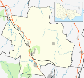
| Location |
| ||||||||||||||
| LGA(s) | Shire of Macedon Ranges | ||||||||||||||
| State electorate(s) | Macedon | ||||||||||||||
| Federal Division(s) | McEwen | ||||||||||||||
| |||||||||||||||
The Kerrie Valley is the source of domestic water for the nearby town of Romsey. The catchment reservoir consists of a dam on a tributary of the Bolinda Creek.
Kerrie Post Office opened on 10 July 1891 and closed in 1949.[3]
References
- Smith, Gavin (1994). All Wild and Lonely Bush. Romsey: Shire of Romsey Book Committee. ISBN 0-646-23834-5.
- Heritage Victoria. "Former Kerrie Primary School No.1290". Retrieved 30 May 2010.
- Premier Postal History. "Post Office List". Retrieved 11 April 2008.
| Wikimedia Commons has media related to Kerrie, Victoria. |
This article is issued from Wikipedia. The text is licensed under Creative Commons - Attribution - Sharealike. Additional terms may apply for the media files.