Kelly Township, Cooper County, Missouri
Kelly Township is one of fourteen townships in Cooper County, Missouri, USA. As of the 2000 census, its population was 676.[1]
Kelly Township | |
|---|---|
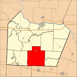 Location in Cooper County | |
| Coordinates: 38°46′39″N 92°47′46″W | |
| Country | |
| State | |
| County | Cooper |
| Area | |
| • Total | 66.69 sq mi (172.74 km2) |
| • Land | 66.61 sq mi (172.53 km2) |
| • Water | 0.08 sq mi (0.21 km2) 0.12% |
| Elevation | 873 ft (266 m) |
| Population (2000) | |
| • Total | 676 |
| • Density | 10.1/sq mi (3.9/km2) |
| Time zone | UTC-6 (CST) |
| • Summer (DST) | UTC-5 (CDT) |
| ZIP codes | 65025, 65081, 65237, 65276, 65348, 65354 |
| GNIS feature ID | 0766530 |
Kelly Township was named after John Kelley, a pioneer citizen.[2]
Geography
According to the United States Census Bureau, Kelly Township covers an area of 66.69 square miles (172.74 square kilometers); of this, 66.61 square miles (172.53 square kilometers, 99.88 percent) is land and 0.08 square miles (0.21 square kilometers, 0.12 percent) is water.
Cities, towns, villages
Extinct towns
- Petersburg at 38.801133°N 92.802414°W
(These towns are listed as "historical" by the USGS.)
Adjacent townships
- Palestine Township (north)
- Clark Fork Township (northeast)
- North Moniteau Township (east)
- South Moniteau Township (east)
- Willow Fork Township, Moniteau County (south)
- Mill Creek Township, Morgan County (southwest)
- Lebanon Township (west)
Cemeteries
The township contains these five cemeteries: Chilton, Hopewell, Howard, Masonic and Woods.
Major highways
School districts
- Cooper County C-4
- Moniteau County R-Vi School District
- Otterville R-Vi
- Pilot Grove C-4
Political districts
- Missouri's 6th congressional district
- State House District 117
- State Senate District 21
References
- United States Census Bureau 2008 TIGER/Line Shapefiles
- United States Board on Geographic Names (GNIS)
- United States National Atlas
- "United States Census Bureau American FactFinder". Archived from the original on 2020-02-12. Retrieved 2009-05-13.
- "Cooper County Place Names, 1928–1945 (archived)". The State Historical Society of Missouri. Archived from the original on 24 June 2016. Retrieved 24 September 2016.CS1 maint: BOT: original-url status unknown (link)
External links
Places adjacent to Kelly Township, Cooper County, Missouri | |
|---|---|
Municipalities and communities of Cooper County, Missouri, United States | ||
|---|---|---|
| Cities | 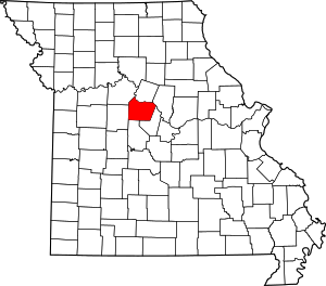 Map of Missouri highlighting Cooper County | |
| Villages | ||
| Townships | ||
| Unincorporated communities | ||
This article is issued from Wikipedia. The text is licensed under Creative Commons - Attribution - Sharealike. Additional terms may apply for the media files.