Karaiyamputhur
Karaiyamputhur is a village[1] in Bahour Commune of Bahour taluk in the Union Territory of Puducherry, India. It is one of the 11 Enclaves of Puducherry. Karaiyamputhur serves as a gateway to Puducherry - Panruti route. It lies on the southwesternmost tip of Puducherry district.
Karaiyamputhur | |
|---|---|
Village | |
 Karaiyamputhur Location in Puducherry, India  Karaiyamputhur Karaiyamputhur (India) | |
| Coordinates: 11.819437°N 79.649794°E | |
| Country | |
| State | Puducherry |
| District | Pondicherry |
| Taluk | Bahour |
| Commune | Bahour |
| Population (2001) | |
| • Total | 36,983 |
| Languages | |
| • Official | French, Tamil, English |
| Time zone | UTC+5:30 (IST) |
| PIN | 605 106 |
| Telephone code | 0413 |
| Vehicle registration | PY-01 |
| Sex ratio | 50% ♂/♀ |
Toponymy
The name Karaiyamputhur means new settlement on the banks of a river. Here the karai (banks) refers to Pennaiyar River banks. Pennaiyatrukaraiputhur may be the name which gets shortened to Karaiyamputhur.The original name may be Karaiyanputrur.
Geography
Karaiyamputhur is surrounded by villages of Tamil Nadu on all side. It is connected to Bahour, its Commune Headquarters by Frontier Road (RC-21).
Villages
Karaiyamputhur village panchayat consist of
- Karaiyamputhur
- Chinna Karaiyamputhur
- Panayadikuppam
Gallery
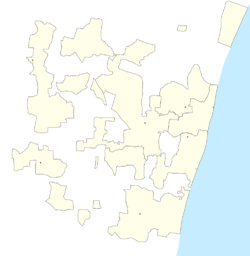
 Map of Karaiyamputhur Village Panchayat
Politics
Karaiyamputhur is a part of Nettapakkam (Union Territory Assembly constituency) which comes under Puducherry (Lok Sabha constituency)
References
- "Archived copy" (PDF). Archived from the original (PDF) on 27 September 2013. Retrieved 17 March 2013.CS1 maint: archived copy as title (link)