Kapelle
Kapelle (![]()
Kapelle | |
|---|---|
_huizen_op_kerkplein.JPG) Kapelle town centre | |
 Flag .svg.png) Coat of arms | |
.svg.png) Location in Zeeland | |
| Coordinates: 51°29′N 3°57′E | |
| Country | Netherlands |
| Province | Zeeland |
| Government | |
| • Body | Municipal council |
| • Mayor | Huub Hieltjes (acting) (VVD) |
| Area | |
| • Total | 49.63 km2 (19.16 sq mi) |
| • Land | 37.13 km2 (14.34 sq mi) |
| • Water | 12.50 km2 (4.83 sq mi) |
| Elevation | 1 m (3 ft) |
| Population (January 2019)[4] | |
| • Total | 12,785 |
| • Density | 344/km2 (890/sq mi) |
| Demonym(s) | Kapellenaar |
| Time zone | UTC+1 (CET) |
| • Summer (DST) | UTC+2 (CEST) |
| Postcode | 4420–4429 |
| Area code | 0113 |
| Website | www |
Population centers
- Biezelinge
- Eversdijk
- Kapelle
- Schore
- Wemeldinge
Topography
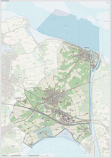
The municipality of Kapelle, June 2015
Transport
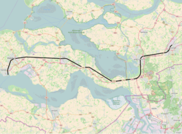
Passenger railway Vlissingen to Roosendaal (part of line 11), with stations (grouped by municipality, bolded), and official station abbreviations:
- Vlissingen (vs)
- Vlissingen Souburg (vss)
- Middelburg (mdb)
- Arnemuiden (arn)
- Goes (gs)
- Kapelle-Biezelinge (bzl)
- Kruiningen-Yerseke (krg) (mun. Reimerswaal)
- Krabbendijke (kbd)
- Rilland-Bath (rb)
- Bergen op Zoom (bgn)
- Roosendaal (rsd)
Famous people
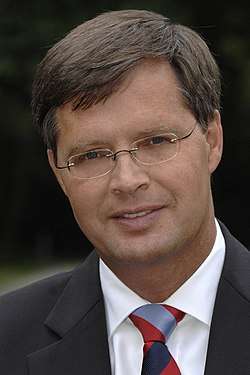
Jan Peter Balkenende, 2006
- Annie M.G. Schmidt (1911 in Kapelle – 1995) a Dutch writer, the mother of the Dutch theatrical song
- Jan Elburg (born 1919 in Wemeldinge – 1992) a Dutch poet
- Jan Peter Balkenende (born 1956 Biezelinge) a retired politician, Prime Minister of the Netherlands from 2002 to 2010
- Jan Kees de Jager (born 1969 in Kapelle) a retired Dutch politician, former Dutch finance minister
Sport
- François Marits (1884 in Kapelle – 1945) a Dutch sports shooter, competed at the 1924 Summer Olympics
- Jo de Roo (born 1937 in Schore) a Dutch former professional road racing cyclist
- John Karelse (born 1970 in Wemeldinge) a retired Dutch football goalkeeper with 421 club caps
International relations
Gallery
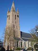 Kapelle, Hervormde, protestant church (Dutch Reformed)
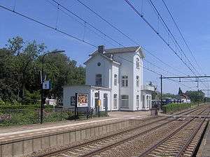 Kapelle Biezelinge Station
 Wemeldinge, monumentaal house
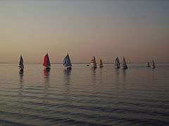 Zeilwedstrijd, Wemeldinge
References
- "Samenstelling" [Members] (in Dutch). Gemeente Kapelle. Archived from the original on 14 December 2013. Retrieved 11 December 2013.
- "Kerncijfers wijken en buurten" [Key figures for neighbourhoods]. CBS Statline (in Dutch). CBS. 2 July 2013. Retrieved 12 March 2014.
- "Postcodetool for 4421AA". Actueel Hoogtebestand Nederland (in Dutch). Het Waterschapshuis. Archived from the original on 21 September 2013. Retrieved 11 December 2013.
- "Bevolkingsontwikkeling; regio per maand" [Population growth; regions per month]. CBS Statline (in Dutch). CBS. 1 January 2019. Retrieved 1 January 2019.
- "Kapelle (Municipality, Zeeland, Netherlands) - Population Statistics and Location in Maps and Charts". www.citypopulation.de. Retrieved 2017-08-10.
External links

- Official website
Places adjacent to Kapelle | |
|---|---|
Municipalities of Zeeland | ||
|---|---|---|
 | ||
| ||
| Authority control |
|
|---|
This article is issued from Wikipedia. The text is licensed under Creative Commons - Attribution - Sharealike. Additional terms may apply for the media files.