Kalavryta
Kalavryta (Greek: Καλάβρυτα) is a town and a municipality in the mountainous east-central part of the regional unit of Achaea, Greece. The town is located on the right bank of the river Vouraikos, 24 kilometres (15 miles) south of Aigio, 40 km (25 miles) southeast of Patras and 62 km (39 miles) northwest of Tripoli. Notable mountains in the municipality are Mount Erymanthos in the west and Aroania or Chelmos in the southeast. Kalavryta is the southern terminus of the Diakopto-Kalavryta rack railway, built by Italian engineers between 1885 and 1895.
Kalavryta Καλάβρυτα | |
|---|---|
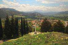
 Kalavryta, as seen from the memorial site. | |
 Kalavryta Location within the region  | |
| Coordinates: 38°2′N 22°7′E | |
| Country | Greece |
| Administrative region | West Greece |
| Regional unit | Achaea |
| Area | |
| • Municipality | 1,058.2 km2 (408.6 sq mi) |
| • Municipal unit | 531.8 km2 (205.3 sq mi) |
| Lowest elevation | 758 m (2,487 ft) |
| Population (2011)[1] | |
| • Municipality | 11,045 |
| • Municipality density | 10/km2 (27/sq mi) |
| • Municipal unit | 6,011 |
| • Municipal unit density | 11/km2 (29/sq mi) |
| Community | |
| • Population | 1,829 (2011) |
| Time zone | UTC+2 (EET) |
| • Summer (DST) | UTC+3 (EEST) |
| Postal code | 250 01 |
| Area code(s) | 26940 |
| Vehicle registration | ΑΧ |
| Website | http://www.kalavrita.gr/ |
History
Kalavryta is built near the ancient city of Cynaetha.
During the late Middle Ages, the town was the centre of the Barony of Kalavryta within the Frankish Principality of Achaea, until it was reconquered by the Byzantines in the 1270s. After that it remained under Byzantine control until the fall of the Despotate of the Morea to the Ottoman Turks in 1460. With the exception of a 30-year interlude of Venetian control, the town remained under Turkish rule until the outbreak of the Greek War of Independence in 1821, in whose early stages Kalavryta figures prominently: it was here that on 21 March 1821 the flag of the revolt was raised at the monastery of Agia Lavra by bishop Germanos III of Old Patras.

At the end of 1943, near Kalavryta, 81 German soldiers, led by Hauptmann Johannes Schober, were captured by Greek partisans. Four Germans were killed on the spot. Three were taken to hospital at Kalavryta but were later shot by the furious partisans. The rest were initially treated as prisoners of war until most were shot dead and some plunged over the cliff near Mazi from the force of the shots. Two German prisoners survived the execution and raised the alarm on the following day 8 December 1943.
On 13 December 1943, in retribution for the killing of the captured German soldiers, the Massacre of Kalavryta took place. German troops ordered all male residents of Kalavryta, aged 14 years and up, to gather in a field just outside the village. Some 1 300 women and girls were locked in a school which was then set on fire while the men were looking on from a hill outside the village. Fortunately for the women, an Austrian soldier unlocked the door of the building and the women and girls managed to escape. The Germans shot the soldier who had set them free. Then 696 boys and men were machine-gunned. Only 13 survived.[2] After that, they burnt down the town before they left and the next day they burnt down the monastery of Agia Lavra, the birthplace of the Greek War of Independence. After the war, the federal government of Germany offered gestures of atonement in the form of free school books for the high school, scholarships for orphans of the massacre and the building of a retirement home. However, German commanders, including Major Ebersberger who carried out the destruction of Kalavryta and Hauptmann Dohnert who led the firing party, were never brought to justice for their crimes.
Historical population

| Year | Community | Municipal unit | Municipality |
|---|---|---|---|
| 1981 | 2,015 | - | - |
| 1991 | 2,111 | 8,306 | - |
| 2001 | 1,942 | 8,580 | - |
| 2011 | 1,829 | 6,011 | 11,045 |
Landmarks


In Kastria, in the municipal unit of Kleitoria, there is the famous cave system Spilaio ton Limnon ("Cave of the Lakes") which is filled with beautiful lakes and strange rock formations. Kalavryta has a ski centre which is located east of town, on the slopes of Chelmos. The monastery of Agia Lavra is located on a hill 4 km (2 mi) southwest of Kalavryta. Another famous monastery nearby is Mega Spilaio which is located 8 km (5 mi) northeast.
Administration
The municipality Kalavryta was formed at the 2011 local government reform by the merger of the following 4 former municipalities, that became municipal units:[3]
The municipality has an area of 1,058.147 km2, the municipal unit 531.797 km2.[4]
Subdivisions
The municipal unit of Kalavryta is divided into the following communities:
- Ano Vlasia
- Ano Lousoi
- Doumena
- Drosato
- Flampoura (Flampoura, Neochori, Ortholithi)
- Goumenissa
- Kalavryta (Kalavryta, Avlonas, Vrachni, Krastikoi, Moni Agias Lavras, Souvardo)
- Kallifoni
- Kandalos
- Kato Lousoi (Kato Lousoi, Lousiko)
- Kato Vlasia (Kato Vlasia, Menychtaiika, Metochi)
- Kato Zachlorou
- Kerpini
- Kertezi
- Korfes
- Kouteli
- Kryoneri
- Lagovouni
- Lapanagoi
- Manesi Kalavryton (Manesi, Boumpoukas)
- Mikros Pontias (Mikros Pontias, Karousi, Lompokas, Megas Pontias)
- Petsakoi (Petsakoi, Bosi)
- Plataniotissa (Plataniotissa, Digela, Spartinou)
- Priolithos
- Profitis Ilias (Profitis Ilias, Mouriki)
- Rogoi
- Sigouni (Sigouni, Lefki)
- Skepasto
- Trechlo (Trechlo, Lapatheia)
- Valta
- Vilivina
Notable persons
- Asimakis Fotilas (1761–1835), politician and revolutionary leader
- Nikolaos Petimezas, military leader
- Anastasios Charalambis (1862–1949), military officer, PM of Greece
- Andreas Zaimis
See also
References
- "Απογραφή Πληθυσμού - Κατοικιών 2011. ΜΟΝΙΜΟΣ Πληθυσμός" (in Greek). Hellenic Statistical Authority.
- "TALES OF HORROR TOLD BY GREEKS," page 29, Sunday, October 8, 1944. The New York Times. This report was delayed by 10 months.
- Kallikratis law Greece Ministry of Interior (in Greek)
- "Population & housing census 2001 (incl. area and average elevation)" (PDF) (in Greek). National Statistical Service of Greece. Archived from the original (PDF) on 2015-09-21.
- "Detailed census results 1991" (PDF). Archived from the original (PDF) on 2016-03-03. (39 MB) (in Greek and French)
External links
| Wikimedia Commons has media related to Kalavryta. |
Places adjacent to Kalavryta | |
|---|---|
| Regional unit of Achaea | 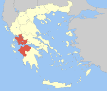 | |
|---|---|---|
| Regional unit of Aetolia-Acarnania | ||
| Regional unit of Elis | ||
| ||