Joanna, South Carolina
Joanna is a census-designated place (CDP) in Laurens County, South Carolina, United States, along the Bush River. The population was 2,427 at the 2010 census. It is part of the Greenville–Mauldin–Easley Metropolitan Statistical Area.
Joanna, South Carolina | |
|---|---|
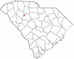 Location of Joanna, South Carolina. | |
| Coordinates: 34°24′53″N 81°48′51″W | |
| Country | United States |
| State | South Carolina |
| County | Laurens |
| Area | |
| • Total | 3.2 sq mi (8.2 km2) |
| • Land | 3.2 sq mi (8.2 km2) |
| • Water | 0.0 sq mi (0.0 km2) |
| Elevation | 600 ft (183 m) |
| Population (2000) | |
| • Total | 1,609 |
| • Density | 511/sq mi (197.2/km2) |
| Time zone | UTC-5 (Eastern (EST)) |
| • Summer (DST) | UTC-4 (EDT) |
| ZIP code | 29351 |
| Area code(s) | 864 |
| FIPS code | 45-36790[1] |
| GNIS feature ID | 1246175[2] |
History
The community was first settled in the 1760s. By the 1850s, the town was known as Martin's Depot, in honor of a local planter, Martin Kinard, who had helped bring the Laurens Railroad through. On April 30, 1865, Confederate President Jefferson Davis and his cabinet passed through the town on their flight from Richmond and spent the night at the Lafayette Young house, five miles to the southwest.[3] Martin's Depot was renamed Goldville in 1872. In 1948 the name of the town was again changed, to Joanna. Joanna was the name of the wife of a local industrialist.[4]
Geography
Joanna is located at 34°24′53″N 81°48′51″W.[5]
According to the United States Census Bureau, the CDP has a total area of 3.2 square miles (8.3 km2), all land.
Demographics
As of the census[1] of 2000, there were 1,609 people, 688 households, and 460 families residing in the CDP. The population density was 510.5 people per square mile (197.2/km2). There were 758 housing units at an average density of 240.5/sq mi (92.9/km2). The racial makeup of the CDP was 85.77% White, 11.75% African American, 0.12% Native American, 0.25% Asian, 1.24% from other races, and 0.87% from two or more races. Hispanic or Latino of any race were 2.05% of the population.
There were 688 households, out of which 27.5% had children under the age of 18 living with them, 48.8% were married couples living together, 12.5% had a female householder with no husband present, and 33.0% were non-families. 29.4% of all households were made up of individuals, and 17.4% had someone living alone who was 65 years of age or older. The average household size was 2.33 and the average family size was 2.88.
In the CDP, the population was spread out, with 23.1% under the age of 18, 6.7% from 18 to 24, 26.1% from 25 to 44, 23.9% from 45 to 64, and 20.3% who were 65 years of age or older. The median age was 41 years. For every 100 females, there were 86.2 males. For every 100 females age 18 and over, there were 83.4 males.
The median income for a household in the CDP was $27,891, and the median income for a family was $35,000. Males had a median income of $27,271 versus $19,338 for females. The per capita income for the CDP was $14,500. About 10.6% of families and 16.0% of the population were below the poverty line, including 26.3% of those under age 18 and 15.9% of those age 65 or over.
References
- "U.S. Census website". United States Census Bureau. Retrieved 2008-01-31.
- "US Board on Geographic Names". United States Geological Survey. 2007-10-25. Retrieved 2008-01-31.
- A Long Shadow: Michael B. Ballard, University of Georgia Press, p. 120
- "Communities". Laurens County Chamber of Commerce. Archived from the original on 13 January 2013. Retrieved 14 June 2014.
- "US Gazetteer files: 2010, 2000, and 1990". United States Census Bureau. 2011-02-12. Retrieved 2011-04-23.
External links
Municipalities and communities of Laurens County, South Carolina, United States | ||
|---|---|---|
| Cities | 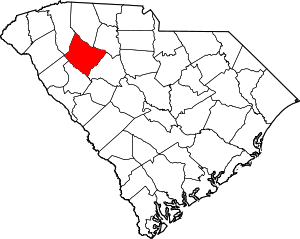 Map of South Carolina highlighting Laurens County | |
| Towns | ||
| CDPs | ||
| Unincorporated communities | ||
| Footnotes | ‡This populated place also has portions in an adjacent county or counties | |