Järva County
Järva County (Estonian: Järva maakond), or Järvamaa (German: Jerwen, Latin: Jervia), is one of 15 counties of Estonia. It is situated in the central part of the country and borders Lääne-Viru County to the east, Jõgeva County to the south-east, Viljandi County to the south, Pärnu County to the south-west, Rapla County to the west, and Harju County to the north. In January 2009, Järva County had a population of 29,940 – constituting 2.7% of the total population in Estonia.[2]
Järva County | |
|---|---|
 | |
 Flag  Coat of arms | |
 | |
| Country | Estonia |
| Capital | Paide |
| Government | |
| • Governor | Alo Aasma[1] |
| Area | |
| • Total | 2,459.58 km2 (949.65 sq mi) |
| Population (Jan 2017[2]) | |
| • Total | 30,841 |
| • Rank | 12th |
| • Density | 13/km2 (32/sq mi) |
| Ethnicity | |
| • Estonians | 94.8% |
| • Ukrainians | 0.9% |
| • Finns | 0.6% |
| ISO 3166 code | EE-51 |
| Vehicle registration | P |
| Website | jarva |
History
In the first centuries AD political and administrative subdivisions began to emerge. Two larger subdivisions appeared: the parish (kihelkond) and the county (maakond). The parish consisted of several villages. Nearly all parishes had at least one fortress. The defense of the local area was directed by the highest official, the parish elder. The county was composed of several parishes, also headed by an elder. By the 13th century the following major districts had developed in Estonia: Saaremaa (Osilia), Läänemaa (Rotalia or Maritima), Harjumaa (Harria), Rävala (Revalia), Virumaa (Vironia), Järvamaa (Jervia), Sakala (Saccala), and Ugandi (Ugaunia).[3]
County Government
The County Government (Estonian: Maavalitsus) is led by Governor (Estonian: maavanem), who is appointed by the Government of Estonia for a term of five years. Currently the Governor position is held by Alo Aasma.[1]
Municipalities
The county is subdivided into municipalities. There are two rural municipalities (Estonian: vallad – parishes) and one urban municipality (Estonian: linnad – towns) in Järva County. There are 217 villages in Järvamaa.

| Rank | Municipality | Type | Population (2018)[4] | Area km2[4] | Density[4] |
|---|---|---|---|---|---|
| 1 | Järva Parish | Rural | 9,121 | 1,223 | 7.5 |
| 2 | Paide | Urban | 10,898 | 443 | 24.6 |
| 3 | Türi Parish | Rural | 11,063 | 1,009 | 11.0 |
Images
 Seidla windmills
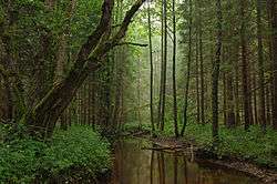 Tarvasjõgi river in Kõrvemaa Nature Park
 Albu Parish manor stone bridge on the Ambla river
 Roosna-Alliku manor
 Järva-Peetri church
 Lake Väinjärv
 Laupa manor
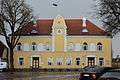 Paide Town Hall
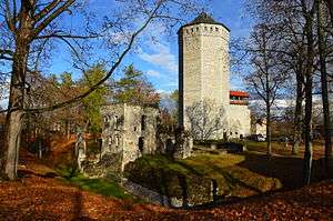 Paide Castle
References
- "Maavanem". Retrieved 24 September 2015.
- "Population by sex, ethnic nationality and County, 1 January". stat.ee. Statistics Estonia. 1 January 2009. Retrieved 2009-10-18.
- Estonia and the Estonians (Studies of Nationalities) Toivo U. Raun p.11 ISBN 0-8179-2852-9
- "Elanike demograafiline jaotus maakonniti". Kohaliku omavalitsuse portaal. Archived from the original on 2 March 2019. Retrieved 2 April 2018.
External links
| Wikimedia Commons has media related to Järva County. |
- Official website (in Estonian)
- Järvamaa Tourist Information
Geographic locale | ||||||||||||||||||||||||
|---|---|---|---|---|---|---|---|---|---|---|---|---|---|---|---|---|---|---|---|---|---|---|---|---|
| ||||||||||||||||||||||||