Ejdabrine
Ejdabrine, Ejd Aabrine, (/'iijdebrin/; Arabic: إجدَعِبرين), is a Sunni Muslim and Maronite Christian community[1] in the Koura District of Lebanon. Both religions coexist peacefully. It is beautiful and lush, and the jaouz river (/nahr-el-jaouz/; Arabic: نهر الجَوز) surrounds it. History of the village's name is unknown, but some say it refers to the unique trees that branch over the river.
Ejdabrine إجدَعِبرين Ijdeebrine | |
|---|---|
Village | |
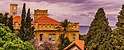 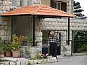 Ejdabrine Village | |
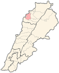
 Ejdabrine Location of Ejdabrine within Lebanon 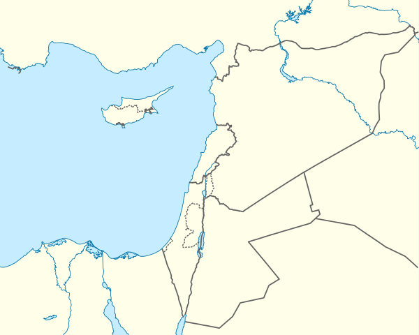 Ejdabrine Ejdabrine (Eastern Mediterranean)  Ejdabrine Ejdabrine (Mediterranean) | |
| Coordinates: 34°16′19″N 35°44′49″E | |
| Country | |
| Governorate | North Lebanon Governorate |
| District | Koura District |
| Area | |
| • Total | 2.73 km2 (1.05 sq mi) |
| Elevation | 336 m (1,102 ft) |
| Time zone | UTC+2 (EET) |
| • Summer (DST) | UTC+3 (EEST) |
| Area code(s) | +961 |
Melhem (مِلحم) is the biggest family in Ejdabrine.
Etymology
The root of the name is yet hindered unknown (only due to lack of follow up on references, who would mainly be the elders of the village), so the only reasonable analysis of the village's etymology, for now, would be the dissection of the name. Although, it is possible that name of this specific village comes from the unique trees near the jaouz river.
Equidistantly, the village share similarity in name with two other villages not geographically far from it. Abrine and Ijdabra are the two villages, both of which are located in the Batroun District. Since all three names are a transliteration from Arabic, the connection is closer than is made out to be.
Abrine (Arabic: عبرين), Ijdabra (Arabic: إجدَعَبر), and Ejdabrine (Arabic: إجدَعِبرين). ِ"Abr" (Arabic: عبر) means across. "Ijd" or "Ejd" (Arabic: إجد) means [go] find. The "ine" (Arabic: ين) is a common Arabic tool used to make a word refer to two in which "Abrine" would mean "two paths". So Ejdabrine in whole would literally mean, "[go] find two paths". If the meaning of the name truly is this, geographically speaking, one logical explanation would go back to the jaouz river trees in which the name is in reference to that. Another possibility of the name is the literal entrance to the village, which, in turn, is hard to explain how it might reference to the name, and that might be a reason why the name may not actually refer to the village's entrance.
Of course, the translation is not limited to that as "Ejd" could mean a variety of things. Several of those meanings could be "renewed", "grandfather", "[I] found", and, in Arabic, the word is a variation of "prowess" or "strength". Same with "Abr" in which the word could also mean a variety of things.
Another possibility is that this name comes from another language or is a mix of Arabic with a different language. The different language could vary from Phoenician (Greek), French, Spanish, and, least likely, Canaanite. Canaanite is least likely because the modern view of the village shows no signs of Canaanite touch. Languages like French and Spanish are in the list because of a long history of counter interactions between both Arabs and the Spanish and it can be seen today how many Arabic words are similar to Spanish, especially in this village where the thickness of the words is greater. French is a possibility because many of the village's inhabitants are able to speak the language on a level, yet even though, the language isn't as large as it would be in other areas of Lebanon.
All of this is speculation and the only possible analysis until a reference is taken hold of, and the only valid references in existence are the elders of the village and whomever they informed because as can be seen today, the village is a place of simple-times where people go to farm and spend time with family and members of the community.
Geography
Abrine & Ijdabra
Ejdabrine being at Southernmost of the Koura District, the villages, Abrine and Ijdabra, are located in the Batroun District. Abrine is about 26 km Southwest of Ejdabrine, and Ijdabra is right below Abrine, the two separated only by the Batroun-Tannourine Road and the Cross of Hope in between the two villages, leaning more into Ijdabra.
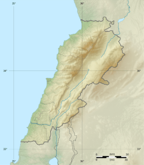
The Jaouz River
Geographically tucked below the rise of the mountain in this area, this river is not central to the village and it can rarely be seen, save at the site itself. That being said, the jaouz river is not solely for Ejdabrine. 1,000m above sea level and 38 km long, the river starts along from Tannourine El-Tahta in the Batroun District, passes through Boustane El-Assi, then Ras Nhach, goes further North into the Koura District along South of Ejdabrine, and meets the Mediterranean Sea in Western Batroun, near Seaside Road.[2][3]
References
- "Municipal and ikhtiyariah elections in Northern Lebanon" (PDF). The Monthly. March 2010. p. 22. Archived from the original on 3 June 2016. Retrieved 1 November 2016.CS1 maint: BOT: original-url status unknown (link)
- "Nahr-El-Jaouz". ResearchGate. December 2016.
- "Nahr-El-Jaouz". Lebanon Traveler. July 4, 2018.
External links
- Ijdaabrine, Localiban