Herne, Belgium
Herne (Dutch pronunciation: [ˈɦɛrnə]; French: Hérinnes-lez-Enghien) is a municipality in the province of Flemish Brabant, in Flanders, one of the three regions of Belgium. It is also situated in the Pajottenland. The municipality comprises the towns of Herfelingen, Herne proper and Sint-Pieters-Kapelle. On January 1, 2006, Herne had a total population of 6,407. The total area is 44.63 km² which gives a population density of 144 inhabitants per km². Herne is also situated in the Pajottenland.
Herne | |
|---|---|
 | |
 Flag  Coat of arms | |
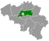
 Herne Location in Belgium
Location of Herne in Flemish Brabant  | |
| Coordinates: 50°43′N 04°02′E | |
| Country | Belgium |
| Community | Flemish Community |
| Region | Flemish Region |
| Province | Flemish Brabant |
| Arrondissement | Halle-Vilvoorde |
| Government | |
| • Mayor | Kris Poelaert (CD&V) |
| • Governing party/ies | CD&V |
| Area | |
| • Total | 44.63 km2 (17.23 sq mi) |
| Population (2018-01-01)[1] | |
| • Total | 6,643 |
| • Density | 150/km2 (390/sq mi) |
| Postal codes | 1540, 1541 |
| Area codes | 02, 054 |
| Website | www.herne.be |
References
- "Wettelijke Bevolking per gemeente op 1 januari 2018". Statbel. Retrieved 9 March 2019.
External links

Places adjacent to Herne, Belgium | ||||||||||
|---|---|---|---|---|---|---|---|---|---|---|
| ||||||||||
This article is issued from Wikipedia. The text is licensed under Creative Commons - Attribution - Sharealike. Additional terms may apply for the media files.