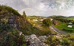
Hatné
Hatné (Hungarian: Hatna) is a village and municipality in Považská Bystrica District in the Trenčín Region of north-western Slovakia.
Hatné | |
|---|---|
Municipality | |
 | |
 Hatné Location of Hatné in the Trenčín Region 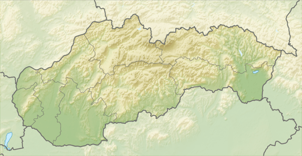 Hatné Hatné (Slovakia) | |
| Coordinates: 49°11′N 18°23′E | |
| Country | Slovakia |
| Region | Trenčín |
| District | Považská Bystrica |
| First mentioned | 1321 |
| Area | |
| • Total | 5.435 km2 (2.098 sq mi) |
| Elevation | 390 m (1,280 ft) |
| Population | |
| • Total | 564 |
| • Density | 100/km2 (270/sq mi) |
| Postal code | 018 02 (pošta Dolná Mariková) |
| Area code(s) | 421-42 |
| Car plate | PB |
| Website | www.hatne.sk |
History
In historical records the village was first mentioned in 1321.
Geography
The municipality lies at an altitude of 390 metres and covers an area of 5.435 km². It has a population of about 564 people.
Genealogical resources
The records for genealogical research are available at the state archive "Statny Archiv in Bytca, Slovakia"
- Roman Catholic church records (births/marriages/deaths): 1756-1895 (parish B)
External links
![]()
Municipalities of Považská Bystrica District | ||
|---|---|---|
This article is issued from Wikipedia. The text is licensed under Creative Commons - Attribution - Sharealike. Additional terms may apply for the media files.