Harlem Heights, Florida
Harlem Heights is an unincorporated community and census-designated place (CDP) in Lee County, Florida, United States. The population was 1,975 at the 2010 census,[3] up from 1,065 at the 2000 census. It is part of the Cape Coral-Fort Myers, Florida Metropolitan Statistical Area.
Harlem Heights, Florida | |
|---|---|
 Location in Lee County and the state of Florida | |
| Coordinates: 26°31′0″N 81°55′41″W | |
| Country | United States |
| State | |
| County | Lee |
| Area | |
| • Total | 0.79 sq mi (2.05 km2) |
| • Land | 0.65 sq mi (1.68 km2) |
| • Water | 0.14 sq mi (0.37 km2) |
| Elevation | 3 ft (1 m) |
| Population (2010) | |
| • Total | 1,975 |
| • Density | 3,052/sq mi (1,178.2/km2) |
| Time zone | UTC-5 (Eastern (EST)) |
| • Summer (DST) | UTC-4 (EDT) |
| FIPS code | 12-28937[1] |
| GNIS feature ID | 1853257[2] |
Geography
Harlem Heights is located southwest of the center of Lee County at 26°31′00″N 81°55′41″W.[4] It is bordered to the west, across Pine Ridge Road, by the Iona CDP. Gladiolus Drive is the main east-west road across the community. It is 10 miles (16 km) south of the center of Fort Myers and 6 miles (10 km) north of Fort Myers Beach.
According to the United States Census Bureau, the Harlem Heights CDP has a total area of 0.77 square miles (2.0 km2), of which 0.66 square miles (1.7 km2) are land and 0.2 square miles (0.4 km2), or 18.14%, are water.[5]
Demographics
As of the census[1] of 2000, there were 1,065 people, 303 households, and 236 families residing in the CDP. The population density was 1,341.4 people per square mile (520.5/km2). There were 402 housing units at an average density of 506.3/sq mi (196.5/km2). The racial makeup of the CDP was 42.72% White, 36.06% African American, 0.38% Asian, 16.71% from other races, and 4.13% from two or more races. Hispanic or Latino of any race were 55.02% of the population.
There were 303 households, out of which 40.3% had children under the age of 18 living with them, 39.3% were married couples living together, 33.7% had a female householder with no husband present, and 22.1% were non-families. 16.8% of all households were made up of individuals, and 3.0% had someone living alone who was 65 years of age or older. The average household size was 3.51 and the average family size was 3.92.
In the CDP, the population was spread out, with 33.6% under the age of 18, 10.3% from 18 to 24, 29.7% from 25 to 44, 18.5% from 45 to 64, and 7.9% who were 65 years of age or older. The median age was 29 years. For every 100 females, there were 100.9 males. For every 100 females age 18 and over, there were 91.6 males.
The median income for a household in the CDP was $28,611, and the median income for a family was $27,056. Males had a median income of $22,826 versus $20,000 for females. The per capita income for the CDP was $8,963. About 27.4% of families and 27.5% of the population were below the poverty line, including 35.3% of those under age 18 and 18.2% of those age 65 or over.
References
- "U.S. Census website". United States Census Bureau. Retrieved 2008-01-31.
- "US Board on Geographic Names". United States Geological Survey. 2007-10-25. Retrieved 2008-01-31.
- "Profile of General Population and Housing Characteristics: 2010 Census Summary File 1 (DP-1), Harlem Heights CDP, Florida". American FactFinder. U.S. Census Bureau. Archived from the original on February 13, 2020. Retrieved November 21, 2019.
- "US Gazetteer files: 2010, 2000, and 1990". United States Census Bureau. 2011-02-12. Retrieved 2011-04-23.
- "U.S. Gazetteer Files: 2019: Places: Florida". U.S. Census Bureau Geography Division. Retrieved November 21, 2019.
Municipalities and communities of Lee County, Florida, United States | ||
|---|---|---|
| Cities | 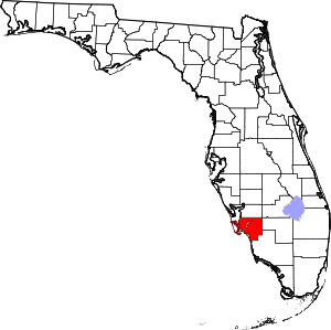 | |
| Town | ||
| Village | ||
| CDPs |
| |
| Unincorporated community | ||