Hédouville
Hédouville is a commune in the Val-d'Oise department in Île-de-France in northern France.
Hédouville | |
|---|---|
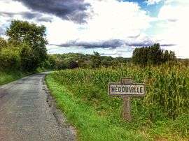 The road entering the village of Hédouville | |
.svg.png) Coat of arms | |
Location of Hédouville 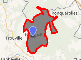
| |
 Hédouville  Hédouville | |
| Coordinates: 49°09′16″N 2°10′15″E | |
| Country | France |
| Region | Île-de-France |
| Department | Val-d'Oise |
| Arrondissement | Pontoise |
| Canton | Saint-Ouen-l'Aumône |
| Intercommunality | Vallée du Sausseron |
| Government | |
| • Mayor (2014–2020) | Eric Couppe |
| Area 1 | 5.28 km2 (2.04 sq mi) |
| Population (2017-01-01)[1] | 282 |
| • Density | 53/km2 (140/sq mi) |
| Time zone | UTC+01:00 (CET) |
| • Summer (DST) | UTC+02:00 (CEST) |
| INSEE/Postal code | 95304 /95690 |
| Elevation | 41–182 m (135–597 ft) |
| 1 French Land Register data, which excludes lakes, ponds, glaciers > 1 km2 (0.386 sq mi or 247 acres) and river estuaries. | |
Geography
Hédouville is bordering north Île-de-France towards Picardy. The town is part of the Parc Naturel Régional du Véxin Français.
Toponymy
The town name has German origins from Haidulf (name) and Latin villa (domain). Hédouville therefore means Domain of Haidulf.
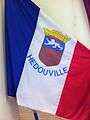 A flag with the coat of arms of Hédouville
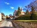 A view of the church of Hédouville
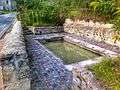 The washing place
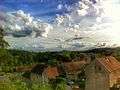 Looking south-west in the village
References
- Association of Mayors of the Val d’Oise (in French)
- "Populations légales 2017". INSEE. Retrieved 6 January 2020.
External links
| Wikimedia Commons has media related to Hédouville. |
- Mérimée database - Cultural heritage (in French)
- Land use (IAURIF) (in English)
| Authority control |
|---|
This article is issued from Wikipedia. The text is licensed under Creative Commons - Attribution - Sharealike. Additional terms may apply for the media files.