Gurjaani
Gurjaani (Georgian: გურჯაანი) is a town in Kakheti, a region in eastern Georgia, and the seat of the Gurjaani Municipality. It is located in the Alazani River Plain, at an elevation of 415 m above sea level.
Gurjaani გურჯაანი | |
|---|---|
Town | |
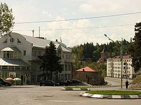 Liberty Street, Gurjaani in 2011. | |
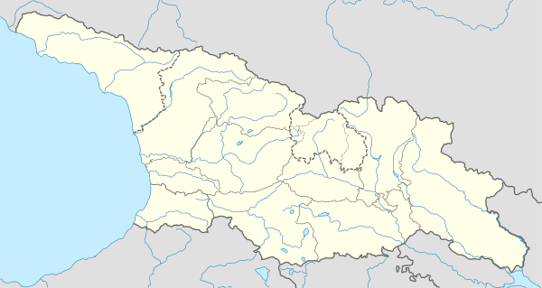 Gurjaani Location of Gurjaani 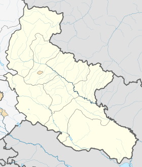 Gurjaani Gurjaani (Kakheti) | |
| Coordinates: 41°45′N 45°48′E | |
| Country | |
| Region | Kakheti |
| Municipality | |
| Town | 1934 |
| Elevation | 415 m (1,362 ft) |
| Population (2014)[1] | |
| • Total | 8,024 |
| Website | gurjaani.ge |
Gurjaani is first recorded as a village in a historical document of the early 16th century. It acquired the status of a town in Soviet Georgia in 1934. As of the 2014 census, Gurjaani had the population of 8,024. The town is the center of the largest wine-making region of Georgia.
Background
Gurjaani is situated in the fertile Alazani Plain, at 415 m above sea level, and 110 km east of Georgia's capital of Tbilisi. It is the center of an important region of viticulture and wine-making. Important landmarks of the town are Akhtala, a historic spa, locally known for its mud bathes, and the early medieval Gurjaani Kvelatsminda Church, the only example of a two-domed design in Georgia. There are also several museums, the largest of which is the Gurjaani Museum of Local Lore and History.
History
.jpg)
.jpg)
The territory of Gurjaani has not been systematically studied archaeologically. Occasional and incidental finds, such as burials, pottery, and Byzantine coins, suggest it was a home to an established settlement in the early Middle Ages. Gurjaani is first documented as a village in a charter issued in the name of King Alexander I of Kakheti (r. 1476–1511), granting the locale an exemption from taxation. In historical documents Gurjaani is frequently mentioned together with the toponym of Kakhtubani, which is now one of the town's neighborhoods and home to the Kvelatsminda Church. Gurjaani was in possession of the Andronikashvili noble family. As a result of a series of marauding inroads from the mountains of neighboring Dagestan, Gurjaani had been virtually depopulated by the 1770s.[2]
Gurjaani rose to a larger settlement when a railway line was constructed in Kakheti in 1915. It became a center of the newly created homonymous district—a predecessor of the present-day municipality—in 1930 and became a town in 1934. During Soviet-era industrialization, Gurjaani had wine-making, canning, distilling, brick-making, and mechanical repair plants.
The post-Soviet political and economic crisis took its toll on Gurjaani in the 1990s. The population dwindled, industry declined, and violent crime was on the rise. An armed group with ties to the Mkhedrioni paramilitary organization was implicated in several high-profile murders.[3] The Mkhedrioni itself was in de facto control of the Gurjaani district from 1992 to 1995.[4] Despite political and relative economic stability achieved in the 2000s, Gurjaani still lacks some elements of proper urban infrastructure and services.
Population
As of the 2014 national census, Gurjaani had the population of 8,024, with an ethnic Georgian majority.[1]
| Population | 1989 census | 2002 census | 2014 census |
|---|---|---|---|
| Total | 12,594[5] | 10,029[5] | 8,024[1] |
People from Gurjaani
- Bela Chekurishvili - poet
Twin towns – sister cities

Notes
- "Population Census 2014: Number of Population by Administrative-Territorial Units and sex". National Statistics Office of Georgia. Retrieved 22 October 2016.
- Gamkrelidze, Gela; Mindorashvili, Davit; Bragvadze, Zurab; Kvatsadze, Marine, eds. (2013). "გურჯაანი [Gurjaani]". ქართლის ცხოვრების ტოპოარქეოლოგიური ლექსიკონი [Topoarchaeological dictionary of Kartlis tskhovreba (The history of Georgia)] (PDF) (in Georgian) (1st ed.). Tbilisi: Georgian National Museum. pp. 170–171. ISBN 978-9941-15-896-4.
- "Georgian former paramilitary detained in Azerbaijan". Democracy & Freedom Watch. 27 June 2014. Retrieved 22 October 2016.
- Gotua, Giorgi (2012). "Different Governments in Tbilisi, Same People in Regions: Local Elites in the Years of Independence (The Example of Gurjaani District, Georgia)". In Voronkov, Viktor; Khutsishvili, Sophia; Horan, John (eds.). Changing Identities: Armenia, Azerbaijan, Georgia (PDF). Tbilisi: Heinrich Boell Foundation. p. 209. ISBN 978-9941-0-4712-1.
- "საქართველოს მოსახლეობის 2002 წლის პირველი ეროვნული საყოველთაო აღწერის შედეგები, ტომი II [Results of the first national census of the population of Georgia in 2002, volume II]" (PDF) (in Georgian). National Statistics Office of Georgia. 2003. Retrieved 22 October 2016.
- "დამეგობრებული ქალაქები". gurjaani.gov.ge (in Georgian). Gurjaani. Retrieved 2020-02-13.
References
| Wikivoyage has a travel guide for Gurjaani. |
Cities, towns and townlets in Georgia | ||
|---|---|---|
| Autonomous Republic of Abkhazia |   | |
| Autonomous Republic of Adjara | ||
| Guria | ||
| Imereti | ||
| Kakheti | ||
| Mtskheta-Mtianeti | ||
| Samegrelo-Zemo Svaneti | ||
| Samtskhe-Javakheti |
| |
| Racha-Lechkhumi and Kvemo Svaneti | ||
| Kvemo Kartli | ||
| Shida Kartli | ||
| Cities with local government | ||
| Capital city | ||