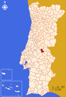
Gavião, Portugal
Gavião (Portuguese pronunciation: [ɡɐviˈɐ̃w] (![]()
Gavião | |
|---|---|
 Flag  Coat of arms | |
 | |
| Coordinates: 39°27′N 7°56′W | |
| Country | |
| Region | Alentejo |
| Intermunic. comm. | Alto Alentejo |
| District | Portalegre |
| Parishes | 4 |
| Government | |
| • President | Jorge Martins Jesus (PS) |
| Area | |
| • Total | 294.59 km2 (113.74 sq mi) |
| Population (2011) | |
| • Total | 4,132 |
| • Density | 14/km2 (36/sq mi) |
| Time zone | UTC±00:00 (WET) |
| • Summer (DST) | UTC+01:00 (WEST) |
| Local holiday | November 23 |
| Website | http://www.cm-gaviao.pt |
The municipality is bounded by Mação to the West and North, Nisa to the East, Crato to the Southeast, Ponte de Sor to the Southwest and Abrantes to the West.
Gavião received a foral from King D. Manuel I of Portugal on November the 23rd of 1519, nowadays, that day is celebrated as municipal holiday.
Natives
References
- Instituto Nacional de Estatística
- Eurostat Archived October 7, 2012, at the Wayback Machine
- Diário da República. "Law nr. 11-A/2013, page 552 53" (pdf) (in Portuguese). Retrieved 9 July 2014.
External links
| Authority control |
|
|---|
This article is issued from Wikipedia. The text is licensed under Creative Commons - Attribution - Sharealike. Additional terms may apply for the media files.