Gassville, Arkansas
Gassville (formerly Mount Pleasant and Turkey's Neck) is a city in Baxter County, Arkansas, United States. According to the 2010 census, the city population was 2,078.
Gassville, Arkansas | |
|---|---|
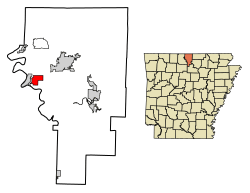 Location of Gassville in Baxter County, Arkansas. | |
| Coordinates: 36°16′59″N 92°29′24″W | |
| Country | United States |
| State | Arkansas |
| County | Baxter |
| Incorporated | January 20, 1903 |
| Named for | P. A. Cox, town founder and a talkative man nicknamed a "gasser"[1] |
| Government | |
| • Type | Mayor-city council |
| Area | |
| • Total | 3.43 sq mi (8.89 km2) |
| • Land | 3.43 sq mi (8.89 km2) |
| • Water | 0.00 sq mi (0.00 km2) |
| Elevation | 764 ft (233 m) |
| Population (2010) | |
| • Total | 2,078 |
| • Estimate (2019)[3] | 2,158 |
| • Density | 628.97/sq mi (242.85/km2) |
| Time zone | UTC-6 (Central (CST)) |
| • Summer (DST) | UTC-5 (CDT) |
| ZIP code | 72635 |
| Area code(s) | 870 |
| FIPS code | 05-26050 |
| GNIS feature ID | 0077002 |
| Website | http://www.gassville.com/ |
Geography
Gassville is located at 36°16′59″N 92°29′24″W (36.283160, -92.490124).[4]
According to the United States Census Bureau, the city has a total area of 3.6 square miles (9.3 km2), all land.
Major highways
Education
Gassville is served by the Cotter School District and students attend Cotter High School to graduate from public schooling.[5]
Demographics
| Historical population | |||
|---|---|---|---|
| Census | Pop. | %± | |
| 1910 | 198 | — | |
| 1920 | 191 | −3.5% | |
| 1930 | 227 | 18.8% | |
| 1940 | 228 | 0.4% | |
| 1950 | 273 | 19.7% | |
| 1960 | 233 | −14.7% | |
| 1970 | 434 | 86.3% | |
| 1980 | 859 | 97.9% | |
| 1990 | 1,167 | 35.9% | |
| 2000 | 1,706 | 46.2% | |
| 2010 | 2,078 | 21.8% | |
| Est. 2019 | 2,158 | [3] | 3.8% |
| U.S. Decennial Census[6] 2014 Estimate[7] | |||
As of the census[8] of 2010, there were 2,158 people, 688 households, and 502 families residing in the city. The population density was 508.1 people per square mile (192.6/km2). There were 712 housing units at an average density of 208.3 per square mile (80.4/km2). The racial makeup of the city was 97.83% White, 0.18% Black or African American, 0.41% Native American, 0.29% Asian, 0.06% Pacific Islander, 0.35% from other races, and 0.88% from two or more races. 1.17% of the population were Hispanic or Latino of any race.
There were 653 households, out of which 34.5% had children under the age of 18 living with them, 56.0% were married couples living together, 12.7% had a female householder with no husband present, and 27.4% were non-families. 23.9% of all households were made up of individuals, and 11.3% had someone living alone who was 65 years of age or older. The average household size was 2.45 and the average family size was 2.89.
In the city, the population was spread out, with 26.8% under the age of 18, 6.8% from 18 to 24, 27.5% from 25 to 44, 20.2% from 45 to 64, and 18.6% who were 65 years of age or older. The median age was 37 years. For every 100 females, there were 84.8 males. For every 100 females age 18 and over, there were 78.5 males.
The median income for a household in the city was $25,478, and the median income for a family was $30,481. Males had a median income of $22,955 versus $17,267 for females. The per capita income for the city was $12,221. About 11.7% of families and 18.9% of the population were below the poverty line, including 25.4% of those under age 18 and 14.0% of those age 65 or over.
Notable events
On February 4, 2006, Gassville police officer Jim Sell was fatally shot when attempting to apprehend Jacob D. Robida, a fugitive wanted in connection with a Massachusetts hate crime.
On February 5, 2008, Gassville was devastated by a tornado. The town was sealed off, due to the possibility of gas leaks causing an explosion.
External links
- Map of Gassville (US Census Bureau)
- Map of Baxter County (US Census Bureau)
- Baxter County Historical and Genealogical Society
References
- "Gassville, Arkansas". 2011. Retrieved November 10, 2011.
- "2019 U.S. Gazetteer Files". United States Census Bureau. Retrieved June 30, 2020.
- "Population and Housing Unit Estimates". United States Census Bureau. May 24, 2020. Retrieved May 27, 2020.
- "US Gazetteer files: 2010, 2000, and 1990". United States Census Bureau. 2011-02-12. Retrieved 2011-04-23.
- School District Reference Map (2010 Census) Baxter County, AR (PDF) (Map). US Census Bureau. Retrieved 2011-07-12.
- "Census of Population and Housing". Census.gov. Retrieved June 4, 2015.
- "Annual Estimates of the Resident Population for Incorporated Places: April 1, 2010 to July 1, 2014". Archived from the original on May 22, 2015. Retrieved June 4, 2015.
- "U.S. Census website". United States Census Bureau. Retrieved 2008-01-31.
Municipalities and communities of Baxter County, Arkansas, United States | ||
|---|---|---|
| Cities | 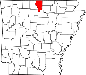 Map of Arkansas highlighting Baxter County | |
| Towns | ||
| CDP | ||
| Unincorporated communities | ||
| Footnotes | ‡This populated place also has portions in an adjacent county or counties | |