French Hainaut
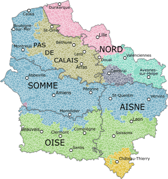
French Hainaut (French: Hainaut français [ɛno fʁɑ̃sɛ]) is one of two areas in France that form the département du Nord, the eastern part. It corresponds roughly with the Arrondissement of Avesnes-sur-Helpe (east), Arrondissement of Cambrai (south-west) and Arrondissement of Valenciennes (north-west).
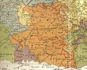
Until the 17th century it was an integral part of the County of Hainaut, ruled by the Burgundians and later the Habsburgs. In a series of wars between France and Spain, this southern part of Hainaut was conquered by France, together with the adjacent smaller Cambrésis or the Bishopric of Cambrai to the south-west, loosely associated with it, and the similar area to these two combined in the west, southern Flanders, which borders on the English Channel (French: la Manche). Together these formed the French province of Flandre immediately before the French Revolution, which became the current Nord département.
References
- Gilbert of Mons, Chronicle of Hainaut, Boydell Press, 2005.