Forney, Texas
Forney is a city in Kaufman County, Texas, United States, and has been named by the Texas legislature as the "Antique Capital of Texas". It is part of the Dallas–Fort Worth metroplex. Its population was 14,661 at the 2010 census,[5] up from 5,588 at the 2000 census.
Forney, Texas | |
|---|---|
.jpg) Downtown Forney, Texas | |
| Nicknames: "City Without Limits"; "Antique Capital of Texas" | |
 Location of Forney in Kaufman County, Texas | |
| Coordinates: 32°45′5″N 96°28′2″W | |
| Country | |
| State | |
| County | Kaufman |
| Government | |
| • Type | Council-Manager |
| • City Council | Mayor Mary Penn Shaun Myers (Mayor Pro Tem) Mike Thomas Robbie Powers Kevin Moon Derald Cooper David Johnson |
| • City Manager | Anthony Carson |
| Area | |
| • Total | 14.83 sq mi (38.40 km2) |
| • Land | 14.81 sq mi (38.35 km2) |
| • Water | 0.02 sq mi (0.05 km2) |
| Elevation | 472 ft (144 m) |
| Population (2010) | |
| • Total | 14,661 |
| • Estimate (2019)[2] | 27,236 |
| • Density | 1,839.40/sq mi (710.21/km2) |
| Time zone | UTC-6 (CST) |
| • Summer (DST) | UTC-5 (CDT) |
| ZIP code | 75126 |
| Area code(s) | 214, 469, 972 |
| FIPS code | 48-26604[3] |
| GNIS feature ID | 1336039[4] |
| Website | cityofforney |


Geography
Forney is located in northwestern Kaufman County at 32°45'5" North, 96°28'2" West (32.751521, -96.467225).[6] U.S. Route 80 passes through the city as a four-lane limited access highway, leading west 20 miles (32 km) to the center of Dallas and east 11 miles (18 km) to Terrell.
According to the United States Census Bureau, in 2010 the city had a total area of 13.2 square miles (34.1 km2), of which 0.02 square miles (0.05 km2), or 0.13%, were water.[5]
Forney is approximately four miles (6 km) southeast of Lake Ray Hubbard, which was formerly known as Forney Lake.
Weather
On April 3, 2012, an EF-3 tornado struck the city as part of the tornado outbreak of the same date. Several homes were completely destroyed, and many others were severely damaged in the Diamond Creek subdivision. The tornado caused significant roof damage to Crosby Elementary School in Forney. A car in the parking lot of the school was tossed about 300 yards and found in a field. Less severe damage was reported in downtown Forney and to a dry cleaning business. Despite the severe damage, no deaths occurred. However, seven people sustained injuries from the tornado.[7] No deaths were reported from either the Forney tornado or any other tornado that day.
Demographics
| Historical population | |||
|---|---|---|---|
| Census | Pop. | %± | |
| 1880 | 317 | — | |
| 1890 | 811 | 155.8% | |
| 1910 | 1,114 | — | |
| 1920 | 1,345 | 20.7% | |
| 1930 | 1,216 | −9.6% | |
| 1940 | 1,295 | 6.5% | |
| 1950 | 1,425 | 10.0% | |
| 1960 | 1,544 | 8.4% | |
| 1970 | 1,745 | 13.0% | |
| 1980 | 2,483 | 42.3% | |
| 1990 | 4,070 | 63.9% | |
| 2000 | 5,588 | 37.3% | |
| 2010 | 14,661 | 162.4% | |
| Est. 2019 | 27,236 | [2] | 85.8% |
| U.S. Decennial Census[8] | |||
As of the census[9] of 2010, there were 14,661 people, 4,784 households. There were 4,985 housing units.. The racial makeup of the city was 11,841 White (80.8%), 1,463 African American (10%), 108 Native American (0.7%), 157 Asian (1.1%), 3 Pacific Islander (0.0%), 760 from other races (5.2%), and 329 (2.2%) from two or more races. 2,342 (16%) of the population were Hispanic or Latino of any race.
Education
The Forney Independent School District serves Forney, Talty, an annex of Mesquite, and part of the community of Heartland. Forney is served by several elementary schools, Warren Middle School, Brown Middle School, Forney High School, and North Forney High School. In 2010, the district received an academic rating of "Exemplary" based on the test results of the Texas Assessment of Knowledge and Skills (TAKS). The district also has an eBook program, where students in high school, middle school, and elementary school beginning in the fifth grade are provided with a laptop for schoolwork.
Notable people
- Darlene Cates, actress
- Stormy Daniels, actress, stripper, screenwriter, and director[10]
- Tex Erwin, Major League Baseball player
- Evan Gattis, MLB player, Houston Astros
- Josh Geer, MLB player, San Diego Padres
- Caleb Hanie, NFL player
- William Madison McDonald, politician, educator, businessman
- John Wiley Price, Dallas County commissioner
- Don Willett, associate justice of Texas Supreme Court
Climate
The climate in this area is characterized by hot, humid summers and generally mild to cool winters. According to the Köppen climate classification system, Forney has a humid subtropical climate, abbreviated "Cfa" on climate maps.[11]
References
- "2019 U.S. Gazetteer Files". United States Census Bureau. Retrieved August 7, 2020.
- "Population and Housing Unit Estimates". United States Census Bureau. May 24, 2020. Retrieved May 27, 2020.
- "State and County Quick Facts". United States Census Bureau. Archived from the original on 10 May 2012. Retrieved 26 March 2012.
- "US Board on Geographic Names". United States Geological Survey. 2007-10-25. Retrieved 2008-01-31.
- "Geographic Identifiers: 2010 Census Summary File 1 (G001), Forney city, Texas". American FactFinder. U.S. Census Bureau. Archived from the original on February 13, 2020. Retrieved April 19, 2019.
- "US Gazetteer files: 2010, 2000, and 1990". United States Census Bureau. 2011-02-12. Retrieved 2011-04-23.
- Retrieved 3 April 2012.
- "Census of Population and Housing". Census.gov. Retrieved June 4, 2015.
- "Forney city, Texas Demographic Profile". United States Census Bureau. Archived from the original on 2020-02-12.
- Chozick, Amy (August 28, 2018). "Stormy Daniels Isn't Backing Down". Vogue.
- Climate Summary for Forney, Texas
| Wikimedia Commons has media related to Forney, Texas. |
External links
| Wikivoyage has a travel guide for Forney. |
- Official website
- Forney Chamber of Commerce
- Forney Historic Preservation League & Spellman Museum of Forney History
- Forney Independent School District
- Forney Economic Development Corporation
- Online Local News, Sports, Discussion Boards, Online Business Directory, and Event Calendar in Forney, Texas
- Forney entry in Handbook of Texas Online
Municipalities and communities of Kaufman County, Texas, United States | ||
|---|---|---|
| Cities | 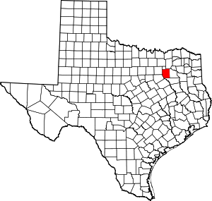 Kaufman County map | |
| Towns | ||
| Villages | ||
| CDPs | ||
| Other unincorporated communities | ||
| Footnotes | ‡This populated place also has portions in an adjacent county or counties | |
| Authority control |
|
|---|