Folignano
Folignano is a comune (municipality) in the Province of Ascoli Piceno in the Italian region Marche, located about 90 kilometres (56 mi) south of Ancona and about 6 kilometres (4 mi) southeast of Ascoli Piceno. As of 31 December 2004, it had a population of 9,214 and an area of 14.8 square kilometres (5.7 sq mi).[3]
Folignano | |
|---|---|
| Comune di Folignano | |
Location of Folignano 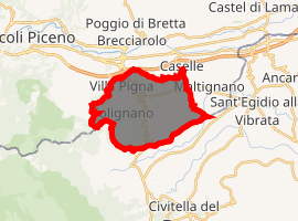
| |
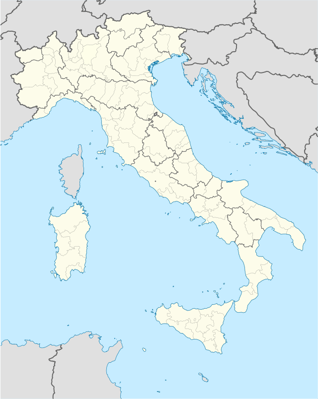 Folignano Location of Folignano in Italy  Folignano Folignano (Marche) | |
| Coordinates: 42°49′N 13°38′E | |
| Country | Italy |
| Region | Marche |
| Province | Province of Ascoli Piceno (AP) |
| Frazioni | Castel Folignano, Villa Pigna, Piane di Morro, Case di Coccia |
| Area | |
| • Total | 14.8 km2 (5.7 sq mi) |
| Elevation | 310 m (1,020 ft) |
| Population (Dec. 2004)[2] | |
| • Total | 9,214 |
| • Density | 620/km2 (1,600/sq mi) |
| Demonym(s) | Folignanesi |
| Time zone | UTC+1 (CET) |
| • Summer (DST) | UTC+2 (CEST) |
| Postal code | 63040 |
| Dialing code | 0736 |
| Website | Official website |
The municipality of Folignano contains the frazioni (subdivisions, mainly villages and hamlets) Castel Folignano, Case di Coccia, Sant'Antonio, San Cipriano, San Benedetto, Piane di Morro and Villa Pigna.
Folignano borders the following municipalities: Ascoli Piceno, Civitella del Tronto, Maltignano, Sant'Egidio alla Vibrata.
The historical center of the town is divided in several zone: Capolavilla (head of the town), Spiazzo (Square), Colle Pasquale (Pasquale hill), Pielavilla (feet of the town).
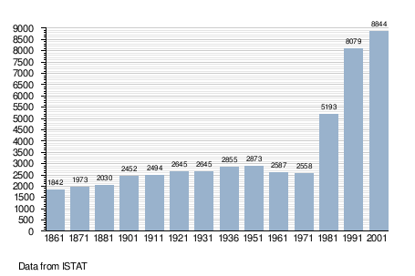
Demographic evolution
References
- "Superficie di Comuni Province e Regioni italiane al 9 ottobre 2011". Istat. Retrieved 16 March 2019.
- "Popolazione Residente al 1° Gennaio 2018". Istat. Retrieved 16 March 2019.
- All demographics and other statistics: Italian statistical institute Istat.