Featherbed Moss
Featherbed Moss is a flat-topped hill, 541 metres (1,775 ft) high, in the Peak District in the county of Derbyshire in England.[1] It is sometimes mistakenly thought to be a joint county top.[2]
| Featherbed Moss | |
|---|---|
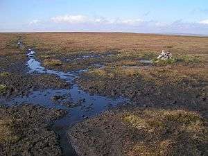 Cairn on Featherbed Moss at the track junction to Lady Cross | |
| Highest point | |
| Elevation | 541 m (1,775 ft) [1] |
| Prominence | 10 m[1] |
| Parent peak | Black Hill[2] |
| Listing | none |
| Coordinates | 53.5070°N 1.9314°W |
| Geography | |
| Location | Derbyshire, England |
| Parent range | Peak District |
| OS grid | SE046011 |
| Topo map | OS Landranger 110; OL1W |
Description
Featherbed Moss is a treeless, domed summit covered by moist peaty moorland vegetation. It rises south of Chew Reservoir. To the south the land falls increasingly steeply into the Torside Reservoir and, to the east into the ravine of the Crowden Great Brook through which the Pennine Way runs from north to south.[2]
References
- Featherbed Moss at themountainguide.co.uk. Retrieved 10 Mar 2016.
- Featherbed Moss at www.hill-bagging.co.uk. Retrieved 10 Mar 2016.
Peaks of the Peak District of England | ||
|---|---|---|
| Marilyns |  | |
| Other peaks |
| |
List of peaks of the Peak District | ||
This article is issued from Wikipedia. The text is licensed under Creative Commons - Attribution - Sharealike. Additional terms may apply for the media files.