Everson, Pennsylvania
Everson is a borough in Fayette County, Pennsylvania, United States. The population was 793 at the 2010 census.[3] It was incorporated in 1903.
Everson, Pennsylvania | |
|---|---|
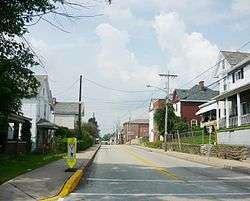 Brown Street | |
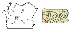 Location of Everson in Fayette County, Pennsylvania. | |
 Everson Location in Pennsylvania  Everson Everson (the United States) | |
| Coordinates: 40°5′26″N 79°35′13″W | |
| Country | United States |
| State | Pennsylvania |
| County | Fayette |
| Established | 1903 |
| Government | |
| • Mayor | Tim Shoemaker |
| Area | |
| • Total | 0.22 sq mi (0.56 km2) |
| • Land | 0.22 sq mi (0.56 km2) |
| • Water | 0.00 sq mi (0.00 km2) |
| Elevation | 1,070 ft (330 m) |
| Population (2010) | |
| • Total | 793 |
| • Estimate (2019)[2] | 749 |
| • Density | 3,467.59/sq mi (1,338.85/km2) |
| Time zone | UTC-4 (EST) |
| • Summer (DST) | UTC-5 (EDT) |
| Area code(s) | 724 |
Geography
Everson is located on the northern edge of Fayette County at 40°5′26″N 79°35′13″W (40.090582, -79.587043).[4] It is on the south side of Jacobs Creek, a tributary of the Youghiogheny River and which forms the border with Westmoreland County. The borough of Scottdale is to the north, directly across the creek from Everson. The city of Connellsville is 6 miles (10 km) to the south.
According to the United States Census Bureau, Everson has a total area of 0.19 square miles (0.50 km2), all of it land.[3]
Demographics
| Historical population | |||
|---|---|---|---|
| Census | Pop. | %± | |
| 1890 | 905 | — | |
| 1910 | 1,759 | — | |
| 1920 | 1,988 | 13.0% | |
| 1930 | 1,900 | −4.4% | |
| 1940 | 1,809 | −4.8% | |
| 1950 | 1,520 | −16.0% | |
| 1960 | 1,304 | −14.2% | |
| 1970 | 1,143 | −12.3% | |
| 1980 | 1,032 | −9.7% | |
| 1990 | 939 | −9.0% | |
| 2000 | 842 | −10.3% | |
| 2010 | 793 | −5.8% | |
| Est. 2019 | 749 | [2] | −5.5% |
| Sources:[5][6][7] | |||
As of the census[6] of 2000, there were 842 people, 351 households, and 233 families residing in the borough. The population density was 3,869.6 people per square mile (1,477.7/km²). There were 385 housing units at an average density of 1,769.4 per square mile (675.7/km²). The racial makeup of the borough was 96.08% White, 3.44% African American, 0.12% Asian, and 0.36% from two or more races.
There were 351 households, out of which 29.6% had children under the age of 18 living with them, 49.0% were married couples living together, 10.0% had a female householder with no husband present, and 33.6% were non-families. 29.3% of all households were made up of individuals, and 16.2% had someone living alone who was 65 years of age or older. The average household size was 2.40 and the average family size was 2.94.
In the borough the population was spread out, with 22.4% under the age of 18, 7.8% from 18 to 24, 29.6% from 25 to 44, 19.1% from 45 to 64, and 21.0% who were 65 years of age or older. The median age was 39 years. For every 100 females, there were 98.6 males. For every 100 females age 18 and over, there were 91.5 males.
The median income for a household in the borough was $25,500, and the median income for a family was $30,769. Males had a median income of $25,972 versus $17,188 for females. The per capita income for the borough was $12,928. About 13.9% of families and 15.9% of the population were below the poverty line, including 27.8% of those under age 18 and 12.5% of those age 65 or over.
Education
Everson is served by the Southmoreland School District.
Notable natives
- B. Smith (Barbara Smith), television personality and restaurant operator
References
- "2019 U.S. Gazetteer Files". United States Census Bureau. Retrieved July 28, 2020.
- "Population and Housing Unit Estimates". United States Census Bureau. May 24, 2020. Retrieved May 27, 2020.
- "Geographic Identifiers: 2010 Census Summary File 1 (G001), Everson borough, Pennsylvania". American FactFinder. U.S. Census Bureau. Archived from the original on February 13, 2020. Retrieved July 7, 2016.
- "US Gazetteer files: 2010, 2000, and 1990". United States Census Bureau. 2011-02-12. Retrieved 2011-04-23.
- "Census of Population and Housing". U.S. Census Bureau. Retrieved 11 December 2013.
- "U.S. Census website". United States Census Bureau. Retrieved 2008-01-31.
- "Incorporated Places and Minor Civil Divisions Datasets: Subcounty Resident Population Estimates: April 1, 2010 to July 1, 2012". Population Estimates. U.S. Census Bureau. Archived from the original on 11 June 2013. Retrieved 11 December 2013.
Pittsburgh metropolitan area | ||
|---|---|---|
| Counties | 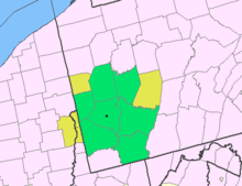 Map of the Pittsburgh Tri-State with green counties in the metropolitan area and yellow counties in the combined area | |
| Major cities | ||
| Cities and towns 15k–50k (in 2010) | ||
| Airports | ||
| Topics | ||
| ||
Municipalities and communities of Fayette County, Pennsylvania, United States | ||
|---|---|---|
| Cities |  | |
| Boroughs | ||
| Townships | ||
| CDPs | ||
| Unincorporated communities |
| |
| Footnotes | ‡This populated place also has portions in an adjacent county or counties | |