Evansville, Alaska
Evansville is a census-designated place (CDP) in Yukon-Koyukuk Census Area, Alaska, United States. The population was 15 at the 2010 census, down from 28 in 2000.
Evansville, Alaska | |
|---|---|
 Aerial view of Evansville (left) and its neighbor Bettles (right) | |
 Location of Evansville, Alaska | |
| Coordinates: 66°54′11″N 151°29′57″W | |
| Country | United States |
| State | Alaska |
| Census Area | Yukon-Koyukuk |
| Government | |
| • State senator | Donny Olson (D) |
| • State rep. | John Lincoln (D) |
| Area | |
| • Total | 22.4 sq mi (58 km2) |
| • Land | 22.2 sq mi (57.5 km2) |
| • Water | 0.2 sq mi (0.5 km2) |
| Population (2010) | |
| • Total | 15 |
| Time zone | UTC-9 (Alaska (AKST)) |
| • Summer (DST) | UTC-8 (AKDT) |
| Area code(s) | 907 |
| FIPS code | 02-23790 |
Geography
Evansville is located at 66°54′11″N 151°29′57″W (66.902950, -151.499190).[1]
According to the United States Census Bureau, the CDP has a total area of 22.4 square miles (58 km2), of which, 22.2 square miles (57 km2) of it is land and 0.2 square miles (0.52 km2) of it (0.85%) is water.
Demographics
| Historical population | |||
|---|---|---|---|
| Census | Pop. | %± | |
| 1970 | 57 | — | |
| 1980 | 94 | 64.9% | |
| 1990 | 33 | −64.9% | |
| 2000 | 28 | −15.2% | |
| 2010 | 15 | −46.4% | |
| U.S. Decennial Census[2] | |||
Evansville first appeared on the 1970 U.S. Census as an unincorporated village. In 1980, it was made a census-designated place (CDP).
As of the census[3] of 2000, there were 28 people, 12 households, and 6 families residing in the CDP. The population density was 1.3 people per square mile (0.5/km2). There were 30 housing units at an average density of 1.4/sq mi (0.5/km2). The racial makeup of the CDP was 46.43% White, 50.00% Native American, and 3.57% from two or more races.
There were 12 households, out of which 25.0% had children under the age of 18 living with them, 41.7% were married couples living together, 8.3% had a female householder with no husband present, and 50.0% were non-families. 33.3% of all households were made up of individuals, and 16.7% had someone living alone who was 65 years of age or older. The average household size was 2.33 and the average family size was 3.33.
In the CDP, the population was spread out, with 28.6% under the age of 18, 7.1% from 18 to 24, 25.0% from 25 to 44, 14.3% from 45 to 64, and 25.0% who were 65 years of age or older. The median age was 34 years. For every 100 females, there were 115.4 males. For every 100 females age 18 and over, there were 100.0 males.
The median income for a household in the CDP was $53,750, and the median income for a family was $54,583. Males had a median income of $30,833 versus $0 for females. The per capita income for the CDP was $15,746. There were no families and 4.3% of the population living below the poverty line, including no under eighteens and none of those over 64.
References
- "US Gazetteer files: 2010, 2000, and 1990". United States Census Bureau. 2011-02-12. Retrieved 2011-04-23.
- "U.S. Decennial Census". Census.gov. Retrieved June 6, 2013.
- "U.S. Census website". United States Census Bureau. Retrieved 2008-01-31.
Municipalities and communities of Yukon–Koyukuk Census Area, Alaska, United States | ||
|---|---|---|
| Cities | 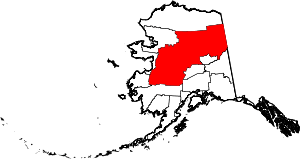 Yukon–Koyukuk Census Area map | |
| CDPs | ||
| Unincorporated communities | ||
| Ghost towns | ||