Ehrenfeld, Pennsylvania
Ehrenfeld is a borough in Cambria County, Pennsylvania, United States. It is part of the Johnstown, Pennsylvania Metropolitan Statistical Area. The population was 228 at the 2010 census.[3]
Ehrenfeld, Pennsylvania | |
|---|---|
Borough | |
_(7158535804).jpg) Ehrenfeld from a passing Pennsylvanian train | |
 Location of Ehrenfeld in Cambria County, Pennsylvania. | |
 Ehrenfeld Location of Ehrenfeld in Cambria County, Pennsylvania. | |
| Coordinates: 40°22′20″N 78°46′35″W | |
| Country | United States |
| State | Pennsylvania |
| County | Cambria |
| Incorporated | 1956 |
| Government | |
| • Type | Borough council |
| Area | |
| • Total | 0.45 sq mi (1.15 km2) |
| • Land | 0.43 sq mi (1.12 km2) |
| • Water | 0.01 sq mi (0.03 km2) |
| Elevation | 1,837 ft (560 m) |
| Population (2010) | |
| • Total | 228 |
| • Estimate (2019)[2] | 210 |
| • Density | 486.11/sq mi (187.83/km2) |
| Time zone | UTC-5 (Eastern (EST)) |
| • Summer (DST) | UTC-4 (EDT) |
| ZIP code | 15956 |
| Area code(s) | 814 |
| FIPS code | 42-22712 |
Geography
Ehrenfeld is located in south-central Cambria County at 40°22′20″N 78°46′35″W (40.372273, -78.776394),[4] in the valley of the Little Conemaugh River. It is bordered to the east by the borough of Summerhill and to the southwest by the borough of South Fork. U.S. Route 219 passes through the eastern part of Ehrenfeld, with access from one exit (Pennsylvania Route 53). US 219 leads north 10 miles (16 km) to Ebensburg, the county seat, and southwest 33 miles (53 km) to Somerset. Johnstown, the largest city in Cambria County, is 13 miles (21 km) to the southwest via US 219 and Pennsylvania Route 56.
According to the United States Census Bureau, the borough of Ehrenfeld has a total area of 0.44 square miles (1.15 km2), of which 0.43 square miles (1.12 km2) is land and 0.01 square miles (0.03 km2), or 2.98%, is water.[3]
Demographics
| Historical population | |||
|---|---|---|---|
| Census | Pop. | %± | |
| 1890 | 567 | — | |
| 1960 | 566 | — | |
| 1970 | 397 | −29.9% | |
| 1980 | 360 | −9.3% | |
| 1990 | 307 | −14.7% | |
| 2000 | 234 | −23.8% | |
| 2010 | 228 | −2.6% | |
| Est. 2019 | 210 | [2] | −7.9% |
| Sources:[5][6][7] | |||
At the 2000 census there were 234 people, 90 households, and 65 families in the borough. The population density was 600.5 people per square mile (231.7/km²). There were 97 housing units at an average density of 248.9 per square mile (96.0/km²). The racial makeup of the borough was 100.00% White.[6] There were 90 households, 30.0% had children under the age of 18 living with them, 57.8% were married couples living together, 10.0% had a female householder with no husband present, and 26.7% were non-families. 24.4% of households were made up of individuals, and 15.6% were one person aged 65 or older. The average household size was 2.60 and the average family size was 3.11.
The age distribution was 24.8% under the age of 18, 7.7% from 18 to 24, 25.2% from 25 to 44, 26.5% from 45 to 64, and 15.8% 65 or older. The median age was 39 years. For every 100 females there were 98.3 males. For every 100 females age 18 and over, there were 97.8 males.
The median household income was $28,125 and the median family income was $30,500. Males had a median income of $25,000 versus $15,781 for females. The per capita income for the borough was $11,037. About 10.0% of families and 11.4% of the population were below the poverty line, including 7.9% of those under the age of eighteen and none of those sixty five or over.
History
In 1901, General Electric Company built the first alternating current power plant at Ehrenfeld. The plant, designed to eliminate the difficulties in long-distance direct current transmission, was built for the Webster Coal and Coke Company.[8]
Notable person
Actor Charles Bronson was born and raised in Ehrenfeld.
References
- "2019 U.S. Gazetteer Files". United States Census Bureau. Retrieved July 28, 2020.
- "Population and Housing Unit Estimates". United States Census Bureau. May 24, 2020. Retrieved May 27, 2020.
- "Geographic Identifiers: 2010 Demographic Profile Data (G001): Ehrenfeld borough, Pennsylvania". U.S. Census Bureau, American Factfinder. Archived from the original on March 12, 2015. Retrieved March 12, 2015.
- "US Gazetteer files: 2010, 2000, and 1990". United States Census Bureau. 2011-02-12. Retrieved 2011-04-23.
- "Census of Population and Housing". U.S. Census Bureau. Retrieved 11 December 2013.
- "U.S. Census website". United States Census Bureau. Retrieved 2008-01-31.
- "Incorporated Places and Minor Civil Divisions Datasets: Subcounty Resident Population Estimates: April 1, 2010 to July 1, 2012". Population Estimates. U.S. Census Bureau. Archived from the original on 11 June 2013. Retrieved 11 December 2013.
- Notice in: History of coaluse (seen Dec. 2010)
Municipalities and communities of Cambria County, Pennsylvania, United States | ||
|---|---|---|
| City | 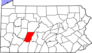 | |
| Boroughs |
| |
| Townships | ||
| CDPs |
| |
| Unincorporated communities | ||
| Footnotes | ‡This populated place also has portions in an adjacent county or counties | |