Drexel, North Carolina
Drexel is a town in Burke County, North Carolina, United States. The population was 1,858 at the 2010 census.[5] It is part of the Hickory–Lenoir–Morganton Metropolitan Statistical Area.
Drexel, North Carolina | |
|---|---|
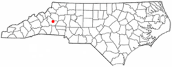 Location in North Carolina | |
| Coordinates: 35°45′26″N 81°36′24″W | |
| Country | United States |
| State | North Carolina |
| County | Burke |
| Area | |
| • Total | 1.38 sq mi (3.58 km2) |
| • Land | 1.38 sq mi (3.58 km2) |
| • Water | 0.00 sq mi (0.00 km2) |
| Elevation | 1,194 ft (364 m) |
| Population (2010) | |
| • Total | 1,858 |
| • Estimate (2019)[2] | 1,854 |
| • Density | 1,341.53/sq mi (518.09/km2) |
| Time zone | UTC-5 (Eastern (EST)) |
| • Summer (DST) | UTC-4 (EDT) |
| ZIP code | 28619 |
| Area code(s) | 828 |
| FIPS code | 37-17860[3] |
| GNIS feature ID | 1020029[4] |
| Website | www |
Geography
Drexel is located in eastern Burke County at 35°45′26″N 81°36′24″W (35.757137, -81.606714).[6] It is 6 miles (10 km) east of Morganton, the county seat.
According to the United States Census Bureau, the town has a total area of 1.4 square miles (3.5 km2), all of it land.[5]
Demographics
| Historical population | |||
|---|---|---|---|
| Census | Pop. | %± | |
| 1920 | 392 | — | |
| 1930 | 781 | 99.2% | |
| 1940 | 681 | −12.8% | |
| 1950 | 988 | 45.1% | |
| 1960 | 1,146 | 16.0% | |
| 1970 | 1,431 | 24.9% | |
| 1980 | 1,392 | −2.7% | |
| 1990 | 1,746 | 25.4% | |
| 2000 | 1,938 | 11.0% | |
| 2010 | 1,858 | −4.1% | |
| Est. 2019 | 1,854 | [2] | −0.2% |
| U.S. Decennial Census[7] | |||
As of the census[3] of 2000, there were 1,938 people, 759 households, and 503 families residing in the town. The population density was 1,383.9 people per square mile (534.5/km2). There were 811 housing units at an average density of 579.1 per square mile (223.7/km2). The racial makeup of the town was 84.47% White, 3.87% African American, 0.41% Native American, 6.97% Asian, 3.41% from other races, and 0.88% from two or more races. Hispanic or Latino of any race were 3.97% of the population.
There were 759 households, out of which 31.2% had children under the age of 18 living with them, 48.7% were married couples living together, 13.3% had a female householder with no husband present, and 33.6% were non-families. 30.3% of all households were made up of individuals, and 13.8% had someone living alone who was 65 years of age or older. The average household size was 2.40 and the average family size was 3.00.
In the town, the population was spread out, with 25.4% under the age of 18, 7.1% from 18 to 24, 28.0% from 25 to 44, 19.8% from 45 to 64, and 19.7% who were 65 years of age or older. The median age was 38 years. For every 100 females, there were 81.3 males. For every 100 females age 18 and over, there were 75.4 males.
The median income for a household in the town was $35,086, and the median income for a family was $41,917. Males had a median income of $28,500 versus $22,827 for females. The per capita income for the town was $18,463. About 4.9% of families and 7.1% of the population were below the poverty line, including 4.9% of those under age 18 and 15.0% of those age 65 or over.
References
- "2019 U.S. Gazetteer Files". United States Census Bureau. Retrieved July 27, 2020.
- "Population and Housing Unit Estimates". United States Census Bureau. May 24, 2020. Retrieved May 27, 2020.
- "U.S. Census website". United States Census Bureau. Retrieved 2008-01-31.
- "US Board on Geographic Names". United States Geological Survey. 2007-10-25. Retrieved 2008-01-31.
- "Geographic Identifiers: 2010 Demographic Profile Data (G001): Drexel town, North Carolina". U.S. Census Bureau, American Factfinder. Archived from the original on February 12, 2020. Retrieved February 13, 2014.
- "US Gazetteer files: 2010, 2000, and 1990". United States Census Bureau. 2011-02-12. Retrieved 2011-04-23.
- "Census of Population and Housing". Census.gov. Retrieved June 4, 2015.
External links
Municipalities and communities of Burke County, North Carolina, United States | ||
|---|---|---|
| Cities | 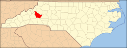 Burke County map | |
| Towns | ||
| Townships |
| |
| CDPs | ||
| Unincorporated communities | ||
| Footnotes | ‡This populated place also has portions in an adjacent county or counties | |