Dolores, Eastern Samar
Dolores (IPA: [ˌdoˈlorɛs]), officially the Municipality of Dolores (Waray: Bungto han Dolores; Tagalog: Bayan ng Dolores), is a 5th class municipality in the province of Eastern Samar, Philippines. According to the 2015 census, it has a population of 42,866 people.[3]
Dolores | |
|---|---|
| Municipality of Dolores | |
| Motto(s): Sirak Dolores! | |
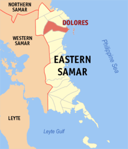 Map of Eastern Samar with Dolores highlighted | |
OpenStreetMap 
| |
.svg.png) Dolores Location within the Philippines | |
| Coordinates: 12°03′N 125°29′E | |
| Country | |
| Region | Eastern Visayas (Region VIII) |
| Province | Eastern Samar |
| District | Lone District |
| Barangays | 46 (see Barangays) |
| Government | |
| • Type | Sangguniang Bayan |
| • Mayor | Shonny Niño R. Carpeso |
| • Vice Mayor | Ronald A. Ong |
| • Congressman | Maria Fe R. Abunda |
| • Municipal Council | Councilors
|
| • Electorate | 8,365 voters (2019) |
| Area | |
| • Total | 308.58 km2 (119.14 sq mi) |
| Population (2015 census)[3] | |
| • Total | 42,866 |
| • Density | 140/km2 (360/sq mi) |
| • Households | 9,416 |
| Demonym(s) | Doloresnon |
| Economy | |
| • Income class | 5th municipal income class |
| • Poverty incidence | 47.28% (2015)[4] |
| • Revenue (₱) | 120,903,388.44 (2016) |
| Time zone | UTC+8 (PST) |
| ZIP code | 6817 |
| PSGC | |
| IDD : area code | +63 (0)55 |
| Climate type | tropical rainforest climate |
| Native languages | Waray Tagalog |
Dolores is a coastal town bounded on the east by the Pacific Ocean in the Eastern Visayas region of the Philippines. It has many beaches and small islands. Most of the populace speak and understand English.
History
In 1948, the barrios of Can-avid, Carolina, Barok, Cansangaya, Mabuhay, Camantang, Canilay, Pandol and Balagon, formerly part of this town, were separated into the municipality of Can-avid, Eastern Samar, by virtue of Republic Act No. 264.[5]
Barangays
Dolores is politically subdivided into 46 barangays.[6]
- Aroganga
- Bonghon
- Buenavista
- Cabago-an
- Caglao-an
- Cagtabon
- Dampigan
- Dapdap
- Del Pilar
- Denigpian
- Gap-ang
- Japitan
- Jicontol
- Hilabaan
- Hinolaso
- Libertad
- Magongbong
- Magsaysay
- Malaintos
- Malobago
- Osmeña
- Barangay 1 (Poblacion)
- Barangay 2 (Poblacion)
- Barangay 3 (Poblacion)
- Barangay 4 (Poblacion)
- Barangay 5 (Poblacion)
- Barangay 6 (Poblacion)
- Barangay 7 (Poblacion)
- Barangay 8 (Poblacion)
- Barangay 9 (Poblacion)
- Barangay 10 (Poblacion)
- Barangay 11 (Poblacion)
- Barangay 12 (Poblacion)
- Barangay 13 (Poblacion)
- Barangay 14 (Poblacion)
- Barangay 15 (Poblacion)
- Rizal
- San Isidro (Malabag)
- San Pascual
- San Roque
- San Vicente
- Santa Cruz
- Santo Niño
- Tanauan
- Villahermosa
- Tikling
Demographics
|
| ||||||||||||||||||||||||||||||||||||||||||||||||
| Source: Philippine Statistics Authority[3][7][8][9] | |||||||||||||||||||||||||||||||||||||||||||||||||
The population of Dolores in the 2015 census was 42,866 people,[3] with a density of 140 inhabitants per square kilometre or 360 inhabitants per square mile.
Climate
| Climate data for Dolores, Eastern Samar | |||||||||||||
|---|---|---|---|---|---|---|---|---|---|---|---|---|---|
| Month | Jan | Feb | Mar | Apr | May | Jun | Jul | Aug | Sep | Oct | Nov | Dec | Year |
| Average high °C (°F) | 27 (81) |
27 (81) |
28 (82) |
29 (84) |
30 (86) |
30 (86) |
29 (84) |
29 (84) |
29 (84) |
29 (84) |
28 (82) |
28 (82) |
29 (83) |
| Average low °C (°F) | 22 (72) |
22 (72) |
22 (72) |
23 (73) |
24 (75) |
24 (75) |
24 (75) |
24 (75) |
24 (75) |
24 (75) |
23 (73) |
23 (73) |
23 (74) |
| Average precipitation mm (inches) | 97 (3.8) |
64 (2.5) |
69 (2.7) |
58 (2.3) |
98 (3.9) |
161 (6.3) |
167 (6.6) |
140 (5.5) |
158 (6.2) |
171 (6.7) |
169 (6.7) |
154 (6.1) |
1,506 (59.3) |
| Average rainy days | 17.1 | 13.4 | 14.8 | 15.2 | 21.1 | 25.2 | 26.8 | 25.4 | 25.5 | 26.5 | 23.0 | 20.3 | 254.3 |
| Source: Meteoblue [10] | |||||||||||||
Economy
Major sources of livelihood in Dolores include farming and fishing, according to the Department of the Interior and Local Government (DILG) Region VIII.[11]
Languages
The languages spoken are Waray-Waray, Bisaya and others Cebuano, locals are also literate in both English and Filipino. Most of the people are predominantly Roman Catholic, and some belonging to other Christian denominations as well as minority religious sects.
Transportation
Pedicabs and tricycles are the means of transportation within the town, while multi-cabs, jeepneys, and vans are the means of transportation to neighboring and distant towns within the province. Several bus companies are also operating from the town going to Manila or Tacloban City and vice versa.
Dolores has an airfield where the abandoned Picardo Airport is located. The airport has an unusable short runway.
Education
Dolores has 32 public elementary schools, 4 public high schools with 1 Tech-Voc (Technical and Vocational) high school, and 1 private college.
Elementary Schools
- Dolores Central Elementary School
- Aroganga Elementary School
- Magongbong Elementary School
- Buenavista Elementary School
- Cabago-an Elementary School
- Caglao-an Elementary School
- Cagtabon Elementary School
- Dampigan Elementary School
- Dapdap Central Elementary School
- Del Pilar Elementary School
- Denigpian Elementary School
- Gap-ang Elementary School
- Japitan Elementary School
- Jicontol Elementary School
- Hilabaan Elementary School
- Hinolaso Elementary School
- Libertad Elementary School
- Magasaysay Elementary School
- Malabago Elementary School
- Osmeña Elementary School
- Rizal Elementary School
- San Isidro (Malabag) Elementary School
- San Pascual Elementary School
- San Roque Elementary School
- San Vicente Elementary School
- Santa Cruz Elementary School
- Santo Niño Elementary School
- Tanauan Elementary School
- Villahermosa Elementary School
- Bonghon Elementary School
- Malaintos Elementary School
- Tikling Elementary School
Secondary Schools
- Dolores National High School
- Hilabaan National High School
- Hinolaso National High School
- Caglao-an National High School
- Dapdap National Technical and Vocational High School
Colleges/Universities
References
- "Municipality". Quezon City, Philippines: Department of the Interior and Local Government. Retrieved 31 May 2013.
- "Province: Eastern Samar". PSGC Interactive. Quezon City, Philippines: Philippine Statistics Authority. Retrieved 12 November 2016.
- Census of Population (2015). "Region VIII (Eastern Visayas)". Total Population by Province, City, Municipality and Barangay. PSA. Retrieved 20 June 2016.
- "PSA releases the 2015 Municipal and City Level Poverty Estimates". Quezon City, Philippines. Retrieved 12 October 2019.
- "An act to create the municipality of Can-avid in the province of Samar". LawPH.com. Retrieved 2011-04-08.
- "Philippine Statistics Authority | Republic of the Philippines". nap.psa.gov.ph. Retrieved 2018-04-20.
- Census of Population and Housing (2010). "Region VIII (Eastern Visayas)". Total Population by Province, City, Municipality and Barangay. NSO. Retrieved 29 June 2016.
- Censuses of Population (1903–2007). "Region VIII (Eastern Visayas)". Table 1. Population Enumerated in Various Censuses by Province/Highly Urbanized City: 1903 to 2007. NSO.
- "Province of Eastern Samar". Municipality Population Data. Local Water Utilities Administration Research Division. Retrieved 17 December 2016.
- "Dolores, Eastern Samar : Average Temperatures and Rainfall". Meteoblue. Retrieved 30 December 2018.
- "FAST FACTS: Dolores, Eastern Samar". Rappler. Retrieved 2018-04-20.
External links and references
- Dolores Profile at PhilAtlas.com
- Philippine Standard Geographic Code
- Philippine Census Information
- Local Governance Performance Management System
- Department of Interior and Local Government
Places adjacent to Dolores, Eastern Samar | ||||||||||
|---|---|---|---|---|---|---|---|---|---|---|
| ||||||||||