Dock Junction, Georgia
Dock Junction is a census-designated place (CDP) in Glynn County, Georgia, United States. It is part of the 'Brunswick, Georgia Metropolitan Statistical Area'. The population was 7,721 at the 2010 census. Its original name was Arco until the 1970s, the name deriving from the Atlantic Refining Company.[3]
Dock Junction, Georgia | |
|---|---|
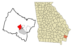 Location in Glynn County and the state of Georgia | |
| Coordinates: 31°12′4″N 81°30′25″W | |
| Country | United States |
| State | Georgia |
| County | Glynn |
| Area | |
| • Total | 10.6 sq mi (27.7 km2) |
| • Land | 9.5 sq mi (24.7 km2) |
| • Water | 1.1 sq mi (3 km2) |
| Elevation | 3 ft (1 m) |
| Population (2010) | |
| • Total | 7,721 |
| • Density | 728.4/sq mi (278.7/km2) |
| Time zone | UTC-5 (Eastern (EST)) |
| • Summer (DST) | UTC-4 (EDT) |
| FIPS code | 13-23200[1] |
| GNIS feature ID | 1867239[2] |
Geography
Dock Junction is located at 31°12′4″N 81°30′25″W (31.201106, -81.506921).[4]
According to the United States Census Bureau, the CDP has a total area of 10.7 square miles (28 km2), of which 9.6 square miles (25 km2) is land and 1.1 square miles (2.8 km2) (10.66%) is water.
Demographics
| Historical population | |||
|---|---|---|---|
| Census | Pop. | %± | |
| 1950 | 4,160 | — | |
| 1960 | 5,417 | 30.2% | |
| 1970 | 6,009 | 10.9% | |
| 1980 | 6,189 | 3.0% | |
| 1990 | 7,094 | 14.6% | |
| 2000 | 6,951 | −2.0% | |
| 2010 | 7,721 | 11.1% | |
| source:[5] | |||
As of the census[1] of 2000, there were 6,951 people, 2,805 households, and 1,924 families residing in the CDP. The population density was 728.2 people per square mile (281.0/km2). There were 3,085 housing units at an average density of 323.2 per square mile (124.7/km2). The racial makeup of the CDP was 68.41% White, 29.06% African American, 0.19% Native American, 0.37% Asian, 0.13% Pacific Islander, 0.96% from other races, and 0.88% from two or more races. Hispanic or Latino of any race were 3.04% of the population.
There were 2,805 households, out of which 31.5% had children under the age of 18 living with them, 47.8% were married couples living together, 16.1% had a female householder with no husband present, and 31.4% were non-families. 26.5% of all households were made up of individuals, and 9.7% had someone living alone who was 65 years of age or older. The average household size was 2.48 and the average family size was 2.97.
In the CDP, the population was spread out, with 26.2% under the age of 18, 8.7% from 18 to 24, 29.5% from 25 to 44, 22.3% from 45 to 64, and 13.3% who were 65 years of age or older. The median age was 36 years. For every 100 females, there were 96.1 males. For every 100 females age 18 and over, there were 91.0 males.
The median income for a household in the CDP was $28,371, and the median income for a family was $31,655. Males had a median income of $25,769 versus $20,168 for females. The per capita income for the CDP was $14,768. About 17.2% of families and 18.8% of the population were below the poverty line, including 26.6% of those under age 18 and 12.5% of those age 65 or over.
Education
The community's public schools are operated by Glynn County School System.
Zoned schools serving sections of the CDP include:[6]
- Glyndale Elementary School (GES), Golden Isles Elementary School (GIE), Goodyear Elementary School (GOE), and Sterling Elementary School (SES)[7]
- Glynn Middle School (GMS), Jane Macon Middle School (JMS), Needwood Middle School (NMS), and Risley Middle School (RMS)[8]
- Brunswick High School (BHS) and Glynn Academy (GA)[9]
References
- "U.S. Census website". United States Census Bureau. Retrieved 2008-01-31.
- "US Board on Geographic Names". United States Geological Survey. 2007-10-25. Retrieved 2008-01-31.
- Temple, Robert D. Edge Effects: The Border-Name Places, (2nd edition, 2009), iUniverse, page 323.
- "US Gazetteer files: 2010, 2000, and 1990". United States Census Bureau. 2011-02-12. Retrieved 2011-04-23.
- "CENSUS OF POPULATION AND HOUSING (1790-2000)". U.S. Census Bureau. Retrieved 2010-07-30.
- "2010 CENSUS - CENSUS BLOCK MAP (INDEX): Dock Junction CDP, GA." U.S. Census Bureau. Retrieved on March 13, 2019. Pages 1 and 2.
- "Elementary School Zones Map." Glynn County School System. Retrieved on March 13, 2019.
- "Middle School Zones Map." Glynn County School System. Retrieved on March 13, 2019. Detail maps: GMS, JMS, NMS, and RMS.
- "High School Zones Map." Glynn County School System. Retrieved on March 13, 2019.
Municipalities and communities of Glynn County, Georgia, United States | ||
|---|---|---|
| City | 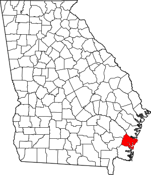 Map of Georgia highlighting Glynn County | |
| CDPs | ||
| Unincorporated communities | ||
| Ghost towns | ||