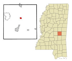
Decatur, Mississippi
Decatur is a town in Newton County, Mississippi. The population was 1,841 at the 2010 census. It is the county seat of Newton County.[3] This town is named after war hero Stephen Decatur, Jr.[4]
Decatur, Mississippi | |
|---|---|
 Location of Decatur, Mississippi | |
 Decatur, Mississippi Location in the United States | |
| Coordinates: 32°26′22″N 89°6′43″W | |
| Country | United States |
| State | Mississippi |
| County | Newton |
| Area | |
| • Total | 5.56 sq mi (14.40 km2) |
| • Land | 5.51 sq mi (14.28 km2) |
| • Water | 0.04 sq mi (0.11 km2) |
| Elevation | 430 ft (131 m) |
| Population (2010) | |
| • Total | 1,841 |
| • Estimate (2019)[2] | 1,705 |
| • Density | 309.21/sq mi (119.38/km2) |
| Time zone | UTC-6 (Central (CST)) |
| • Summer (DST) | UTC-5 (CDT) |
| ZIP code | 39327 |
| Area code(s) | 601 |
| FIPS code | 28-18180 |
| GNIS feature ID | 0669185 |
| Website | http://www.decaturms.org/index.php |
Geography
Decatur is located at 32°26′22″N 89°6′43″W (32.439557, -89.112047).[5]
According to the United States Census Bureau, the town has a total area of 1.0 square mile (2.6 km2), all land.
Demographics
| Historical population | |||
|---|---|---|---|
| Census | Pop. | %± | |
| 1880 | 47 | — | |
| 1910 | 283 | — | |
| 1920 | 319 | 12.7% | |
| 1930 | 654 | 105.0% | |
| 1940 | 773 | 18.2% | |
| 1950 | 1,225 | 58.5% | |
| 1960 | 1,340 | 9.4% | |
| 1970 | 1,311 | −2.2% | |
| 1980 | 1,148 | −12.4% | |
| 1990 | 1,248 | 8.7% | |
| 2000 | 1,426 | 14.3% | |
| 2010 | 1,841 | 29.1% | |
| Est. 2019 | 1,705 | [2] | −7.4% |
| U.S. Decennial Census[6] | |||
As of the census[7] of 2000, there were 1,426 people, 407 households, and 269 families residing in the town. The population density was 1,379.9 people per square mile (534.5/km2). There were 463 housing units at an average density of 448.0 per square mile (173.6/km2). The racial makeup of the town was 66.41% White, 32.54% African American, 0.56% Native American, 0.14% Asian, and 0.35% from two or more races. Hispanic or Latino of any race were 1.05% of the population.
There were 407 households, out of which 31.0% had children under the age of 18 living with them, 44.5% were married couples living together, 18.2% had a female householder with no husband present, and 33.9% were non-families. 30.7% of all households were made up of individuals, and 9.6% had someone living alone who was 65 years of age or older. The average household size was 2.30 and the average family size was 2.85.
In the town, the population was spread out, with 16.5% under the age of 18, 41.8% from 18 to 24, 16.4% from 25 to 44, 14.9% from 45 to 64, and 10.3% who were 65 years of age or older. The median age was 21 years. For every 100 females, there were 100.6 males. For every 100 females age 18 and over, there were 97.3 males.
The median income for a household in the town was $28,333, and the median income for a family was $37,115. Males had a median income of $28,875 versus $20,000 for females. The per capita income for the town was $10,839. About 14.8% of families and 19.4% of the population were below the poverty line, including 28.7% of those under age 18 and 10.3% of those age 65 or over.
Notable people
- Lamar Blount, former end in the National Football League[8]
- Charles Evers, first post-Reconstruction African American mayor in Mississippi
- Medgar Evers, Civil Rights Activist
References
- "2019 U.S. Gazetteer Files". United States Census Bureau. Retrieved July 26, 2020.
- "Population and Housing Unit Estimates". United States Census Bureau. May 24, 2020. Retrieved May 27, 2020.
- "Find a County". National Association of Counties. Archived from the original on 2011-05-31. Retrieved 2011-06-07.
- Gannett, Henry (1905). The Origin of Certain Place Names in the United States. Govt. Print. Off. pp. 102.
- "US Gazetteer files: 2010, 2000, and 1990". United States Census Bureau. 2011-02-12. Retrieved 2011-04-23.
- "Census of Population and Housing". Census.gov. Retrieved June 4, 2015.
- "U.S. Census website". United States Census Bureau. Retrieved 2008-01-31.
- Kenneth R. Crippen (10 November 2009). The Original Buffalo Bills: A History of the All-America Football Conference Team, 1946-1949. McFarland. p. 224. ISBN 978-0-7864-4619-3.
Municipalities and communities of Newton County, Mississippi, United States | ||
|---|---|---|
| Cities | 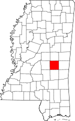 Map of Mississippi highlighting Newton County | |
| Towns | ||
| CDPs | ||
| Other unincorporated communities | ||
| Indian reservation | ||
| Footnotes | ‡This populated place also has portions in an adjacent county or counties | |