Dahegam
Dahegam is a city and a municipality in Gandhinagar district in the state of Gujarat, India.
Dehgam Dehagam | |
|---|---|
city | |
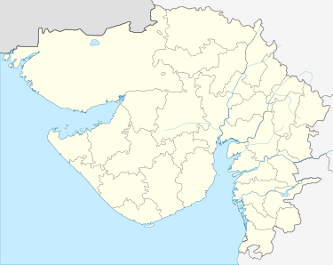 Dehgam Location in Gujarat, India  Dehgam Dehgam (India) | |
| Coordinates: 23.17°N 72.82°E | |
| Country | |
| State | Gujarat |
| District | Gandhinagar |
| Government | |
| • Type | Municipality |
| Elevation | 73 m (240 ft) |
| Population (2011) | |
| • Total | 42,632 [1] |
| Languages | |
| • Official | Gujarati, Hindi |
| Time zone | UTC+5:30 (IST) |
| Vehicle registration | GJ18 |
| Website | gujaratindia |
History
Dahegam has 800 years of history. During 1257 AD, Gujarat was under the Khilji dynasty. Jafar Khan of the Tughlak dynasty had overpowered King Ram Ray Rathod of Idar. The Mughals took control of a majority of the Gujarat during this period. Later, the Marathas administered the region during 1753 AD. Damaji Gaikwad is considered to be most significant ruler. Dahegam taluka was founded in 1875 AD during Gaekwad rule and it soon become a major political center in the area. It was conferred municipality or nagarpalika status in 1987 as a part of Ahmedabad district. When Ahmedabad district was halved in 1998, Dahegam became a part of Gandhinagar district.[2]
Geography
Dahegam is located at 23.17°N 72.82°E.[3] It has an average elevation of 73 metres (239 feet).
Demographics
As of 2001 India census,[4] Dahegam had a population of 38,083. Males constitute 52% of the population and females 48%. Dahegam has an average literacy rate of 65%, higher than the national average of 59.5%: male literacy is 73% and, female literacy is 58%. In Dahegam, 14% of the population is under 6 years of age.
There are more than 100 small towns included in the whole Dehgam taluka. The taluka has different kinds of communities and religious people and all people lives with great harmony. Thakor community is the majority in the Dehgam taluka. Though the Dahegam has different religious communities, all are living in unity and that is the reason why dahegam is not divided into many parts. There are two big statues in this town, one of Babasaheb Ambedkar at Bus Depot and other Sardar Vallabhbhai Patel at Nehru Cross Roads.
References
- "Dehgam Population Census 2011".
- "Dahegam City History". HopAroundIndia.com. Archived from the original on 24 September 2015. Retrieved 9 March 2015.
- Falling Rain Genomics, Inc - Dahegam
- "Census of India 2001: Data from the 2001 Census, including cities, villages and towns (Provisional)". Census Commission of India. Archived from the original on 16 June 2004. Retrieved 1 November 2008.