Cropwell, Alabama
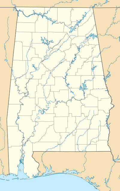
Cropwell, also known as Coosa or Coosa Valley, is a neighborhood of Pell City, Alabama, United States. Cropwell is a small town and an unincorporated community. Cropwell is located along Alabama State Route 34, 2.5 miles (4.0 km) south-southwest of downtown Pell City. Cropwell has its own post office with ZIP code 35054.[2] Cropwell was originally called Coosa or Coosa Valley until 1837, when it began to be called Cropwell.[3] A post office operated under the name Coosa during 1833 and 1834. A post office was then established under the name Cropwell in 1837.[4]
Cropwell, Alabama | |
|---|---|
Neighborhood | |
 Cropwell, Alabama | |
| Coordinates: 33°33′08″N 86°16′09″W | |
| Country | United States |
| State | Alabama |
| County | St. Clair |
| Elevation | 479 ft (146 m) |
| Time zone | UTC-6 (Central (CST)) |
| • Summer (DST) | UTC-5 (CDT) |
| ZIP code | 35054 |
| Area code(s) | 205, 659 |
| GNIS feature ID | 164624[1] |
Demographics
| Historical population | |||
|---|---|---|---|
| Census | Pop. | %± | |
| 1880 | 105 | — | |
| U.S. Decennial Census[5] | |||
Cropwell appeared on the 1880 U.S. Census with 105 residents. The population in Cropwell (zip 35054) is 3,936. There are 151 people per square mile aka population density. The median age in Cropwell (zip 35054) is 52.5, the US median age is 37.4. The number of people per household in Cropwell (zip 35054) is 2.2, the US average of people per household is 2.6.
References
- "Cropwell". Geographic Names Information System. United States Geological Survey.
- United States Postal Service (2012). "USPS - Look Up a ZIP Code". Retrieved 2012-02-15.
- Foscue, Virginia (1989). Place Names in Alabama. Tuscaloosa: The University of Alabama Press. p. 42. ISBN 0-8173-0410-X.
- "St. Clair". Jim Forte Postal History. Retrieved 6 November 2014.
- "U.S. Decennial Census". Census.gov. Archived from the original on May 12, 2015. Retrieved June 6, 2013.
Municipalities and communities of St. Clair County, Alabama, United States | ||
|---|---|---|
| Cities | 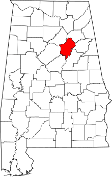 Map of Alabama highlighting St. Clair County | |
| Towns | ||
| Unincorporated communities | ||
| Former towns | ||
| Footnotes | ‡This populated place also has portions in an adjacent county or counties | |