Cransac
Cransac is a commune in the Aveyron department in southern France.
Cransac | |
|---|---|
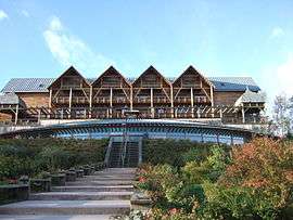 The thermal baths | |
 Coat of arms | |
Location of Cransac 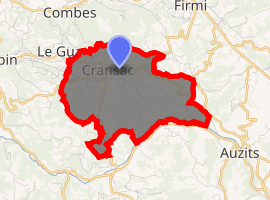
| |
 Cransac 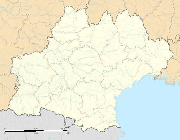 Cransac | |
| Coordinates: 44°31′33″N 2°17′07″E | |
| Country | France |
| Region | Occitanie |
| Department | Aveyron |
| Arrondissement | Villefranche-de-Rouergue |
| Canton | Enne et Alzou |
| Intercommunality | Bassin de Decazeville Aubin |
| Government | |
| • Mayor (2008–2014) | Jean Paul Linol |
| Area 1 | 6.91 km2 (2.67 sq mi) |
| Population (2017-01-01)[1] | 1,508 |
| • Density | 220/km2 (570/sq mi) |
| Time zone | UTC+01:00 (CET) |
| • Summer (DST) | UTC+02:00 (CEST) |
| INSEE/Postal code | 12083 /12110 |
| Elevation | 274–470 m (899–1,542 ft) (avg. 277 m or 909 ft) |
| 1 French Land Register data, which excludes lakes, ponds, glaciers > 1 km2 (0.386 sq mi or 247 acres) and river estuaries. | |
The town was a coal-mining centre until the mine closed in 1962.[2] Cransac has mineral springs, known in the middle ages. There are iron-mines in the neighbourhood. Hills to the north of the town contain disused coal-mines which have been on fire for centuries. About 8 kilometres (8,000 m) to the south is the fine Renaissance château of Bournazel, built for the most part by Jean de Buisson, baron of Bournazel, about 1545. The barony of Bournazel became a marquisate in 1624.[3]

Smoke escaping from the "Burning Mountain"
Population
| Year | Pop. | ±% |
|---|---|---|
| 1962 | 2,356 | — |
| 1968 | 3,244 | +37.7% |
| 1975 | 2,870 | −11.5% |
| 1982 | 2,520 | −12.2% |
| 1990 | 2,180 | −13.5% |
| 1999 | 1,821 | −16.5% |
| 2008 | 1,681 | −7.7% |
See also
References
- "Populations légales 2017". INSEE. Retrieved 6 January 2020.
- "The Burning Mountain". Experience (my) France. Retrieved 2017-05-29.
-

| Wikimedia Commons has media related to Cransac. |
| Authority control |
|
|---|
This article is issued from Wikipedia. The text is licensed under Creative Commons - Attribution - Sharealike. Additional terms may apply for the media files.