Cotopaxi, Colorado
Cotopaxi is a census-designated place and U.S. post office in Fremont County, Colorado, United States. The population as of the 2010 census was 47,[3] 44 of whom were non-Hispanic white people. The Cotopaxi Post Office has the ZIP code 81223.[2] It was a small train stop on the Denver and Rio Grande Western Railroad along the Arkansas River.[4] Though there is a store serving the main highway through the town (U.S. 50), there are no major businesses in Cotopaxi (owing to the small population) except for a whitewater rafting business that attracts thousands of tourists each year to ride on the Arkansas River.[5]
Cotopaxi, Colorado | |
|---|---|
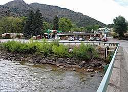 Cotopaxi and Highway 50 | |
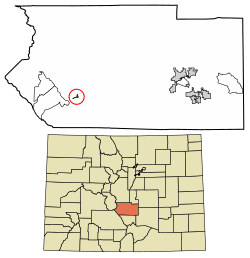 Location of Cotopaxi in Fremont County, Colorado. | |
 Cotopaxi Location within the state of Colorado | |
| Coordinates: 38°22′16″N 105°41′14″W | |
| Country | |
| State | |
| County | Fremont County[1] |
| Government | |
| • Type | Unincorporated community |
| Area | |
| • Total | 0.31 sq mi (0.81 km2) |
| • Land | 0.31 sq mi (0.81 km2) |
| • Water | 0.0 sq mi (0.0 km2) |
| Elevation | 6,362 ft (1,939 m) |
| Population (2010) | |
| • Total | 47 |
| • Density | 150/sq mi (58.0/km2) |
| Time zone | UTC-7 (MST) |
| • Summer (DST) | UTC-6 (MDT) |
| ZIP Code[2] | 81223 |
| FIPS code | 08-17485 |
| GNIS feature ID | 191769 |
History
The township was named after Cotopaxi Volcano, one of the highest active volcanoes in the world, located in Ecuador.[5] Henry Thomas was the man responsible for naming Cotopaxi. He was an early prospector to the western territory in the mid-nineteenth century.[4] Cotopaxi is also known for its early failed colony of approximately 63 Russian-Jewish immigrants who first settled there in early 1882.[6][7] These colonists, most of whom were related, traveled to Colorado in hopes of starting a successful farming community and to reap the benefits of the new Homestead Act, which would grant each head male of a family 160 acres (65 ha) of land.[8] When the colonists arrived in Cotopaxi, they discovered that only half of the houses that were promised to be built upon their arrival had actually been erected; this forced many of the families to live out of small makeshift canvas houses during the first winter.[9] In addition to the housing problems, the colonists faced an extreme shortage of supplies that were needed to support them through the first winter and to plant their crops.[8] Desperate to plant their crops, the colonists soon opened large lines of credit with the local store to buy the seeds and equipment they needed to get their crops planted. The variety of crops that the colonists chose to plant mostly consisted of potatoes and corn. The immigrants soon discovered, however, that the climate in the Colorado mountains was only suitable for growing crops for less than four months out of the year, and the first frost of winter killed most of what was still planted in the fields. This failed season of crops forced the immigrants to look for jobs elsewhere to help pay off their fast-growing debt to the local store.[9] They soon found work with the Denver and Rio Grande Railroad which had decided to lay down more tracks to the west over Marshall Pass.[9] The men of the colony were paid three dollars a day, which helped the struggling settlement get through its first winter. The colonists made it to spring, but the second crop was also a failure, and entire families soon started leaving. Only about six families remained in Cotopaxi to plant a third crop, which was wiped out by a large blizzard, and this officially ended the attempted farming colony in early June 1884.[8]
Geography
Cotopaxi is located in southwestern Fremont County at 38°22′16″N 105°41′14″W (38.371002,-105.687275). It lies on both sides of the Arkansas River, 33 miles (53 km) west of Cañon City, the county seat, and 25 miles (40 km) southeast of Salida.
Highways
Economy
Businesses
Today, Cotopaxi has a few small businesses, the most notable of which is the Cotopaxi General Store. This general store was opened in the early 1920s and has since been connected to a Sinclair gas station.[4]
Lodging
The Loma Linda Motel and KOA Kampground, located 1.5 miles (2.4 km) east of Cotopaxi,[11] along U.S. Highway 50 provides a mix of lodging from cabins to campsites.
Education
Cotopaxi is home to Cotopaxi School District Fremont RE-3.[12] The school district directs the educational needs of western Fremont County including Cotopaxi and the surrounding communities of Coaldale, Howard, Swissvale, Wellsville and the Copper Gulch area. Cotopaxi has two schools, Cotopaxi K-8 School and Cotopaxi High School located north of U.S. Highway 50.
See also
- Outline of Colorado
- State of Colorado
- Colorado cities and towns
- Colorado census designated places
- Colorado counties
- Colorado metropolitan areas
- Colorado cities and towns
References
- "US Board on Geographic Names". United States Geological Survey. 2007-10-25. Retrieved 2008-01-31.
- "ZIP Code Lookup". United States Postal Service. December 15, 2006. Archived from the original (JavaScript/HTML) on September 3, 2007. Retrieved December 15, 2006.
- Colorado Trend Report 2: State and Complete Places (Sub-state 2010 Census Data). Archived 2012-07-11 at Archive.today Missouri Census Data Center. Accessed 2011-02-25.
- Jerry Klinger, "Cotopaxi- The Failed Russian Jewish Agricultural Colony, 1882-1884". Jewish Magazine (2008)
- "Cotopaxi". The Official Site of Colorado Tourism (2010)
- http://www.jewish-american-society-for-historic-preservation.org/images/Cotopaxi.pdf
- http://www.jewish-american-society-for-historic-preservation.org/completedprgms1/cotopaxicolorado.html
- Nancy Oswald, "Cotopaxi Colorado History- Hard Times: The Jewish Colony at Cotopaxi" Archived 2010-12-17 at the Wayback Machine. Reprint Arkansas River Tours (2005)
- Flora Jane Satt, "Cotopaxi, Colorado: Russian Jewish Colony". Colorado University (1950)
- "Census of Population and Housing". Census.gov. Retrieved June 4, 2016.
- "Cotopaxi / Arkansas River KOA & Loma Linda Motel". Retrieved 11 November 2013.
- "Cotopaxi School District Fremont RE-3". Retrieved 11 November 2013.
Municipalities and communities of Fremont County, Colorado, United States | ||
|---|---|---|
| Cities |  Map of Colorado highlighting Fremont County | |
| Towns | ||
| CDPs | ||
| Unincorporated communities | ||
| Ghost towns | ||