Clinton Township, Elkhart County, Indiana
Clinton Township is one of sixteen townships in Elkhart County, Indiana. As of the 2010 census, its population was 4,624.[3]
Clinton Township | |
|---|---|
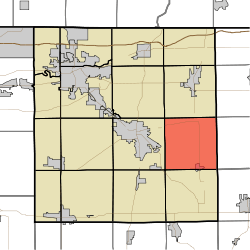 Location of Clinton Township in Elkhart County | |
| Coordinates: 41°34′05″N 85°42′29″W | |
| Country | United States |
| State | Indiana |
| County | Elkhart |
| Government | |
| • Type | Indiana township |
| Area | |
| • Total | 35.78 sq mi (92.7 km2) |
| • Land | 35.73 sq mi (92.5 km2) |
| • Water | 0.06 sq mi (0.2 km2) |
| Elevation | 915 ft (279 m) |
| Population (2010) | |
| • Total | 4,624 |
| • Density | 129.4/sq mi (50.0/km2) |
| FIPS code | 18-13726[2] |
| GNIS feature ID | 453231 |
History
Clinton Township was named for the son of a pioneer settler.[4]
Geography
According to the 2010 census, the township has a total area of 35.78 square miles (92.7 km2), of which 35.73 square miles (92.5 km2) (or 99.86%) is land and 0.06 square miles (0.16 km2) (or 0.17%) is water.[3] Fish Lake is in this township.
Cities and towns
- Millersburg (north three-quarters)
Adjacent townships
- Middlebury Township (north)
- Newbury Township, LaGrange County (northeast)
- Eden Township, LaGrange County (east)
- Perry Township, Noble County (southeast)
- Benton Township (south)
- Jackson Township (southwest)
- Elkhart Township (west)
- Jefferson Township (northwest)
Cemeteries
The township contains at least six cemeteries: Clinton Brick Mennonite, Clinton Union, Nisley, Rock Run, Thomas, and Woodlawn [5]
References
- "Clinton Township, Elkhart County, Indiana". Geographic Names Information System. United States Geological Survey. Retrieved 2009-09-24.
- United States Census Bureau cartographic boundary files
- "US Board on Geographic Names". United States Geological Survey. 2007-10-25. Retrieved 2008-01-31.
- "U.S. Census website". United States Census Bureau. Retrieved 2008-01-31.
- "Population, Housing Units, Area, and Density: 2010 - County -- County Subdivision and Place -- 2010 Census Summary File 1". United States Census. Archived from the original on 2020-02-12. Retrieved 2013-05-10.
- History of Elkhart County, Indiana. Chas. C. Chapman Co. 1881. pp. 692.
- Cemeteries of Elkhart County, Indiana, Vol I 1990, p. 2, 94-180
External links
Municipalities and communities of Elkhart County, Indiana, United States | ||
|---|---|---|
| Cities | Map of Indiana highlighting Elkhart County | |
| Towns | ||
| Townships | ||
| CDPs | ||
| Unincorporated communities | ||
| Footnotes | ‡This populated place also has portions in an adjacent county or counties | |
This article is issued from Wikipedia. The text is licensed under Creative Commons - Attribution - Sharealike. Additional terms may apply for the media files.