City of Brussels
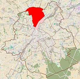
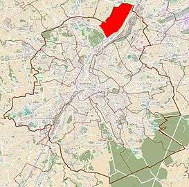
The City of Brussels (French: ville de Bruxelles [vil də bʁysɛl] or alternatively Bruxelles-Ville [bʁysɛl vil]; Dutch: Stad Brussel [stɑd ˈbrʏsəl][2] or Brussel-Stad) is the largest municipality and historical centre of the Brussels-Capital Region, and the capital of Belgium.[3] Besides the strict centre, it also covers the immediate northern outskirts where it borders municipalities in Flanders. It is the administrative centre of the European Union, thus often dubbed, along with the region, the EU's capital city.
City of Brussels | |
|---|---|
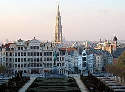 Panorama of the city centre from the Mont des Arts/Kunstberg | |
 Flag  Coat of arms | |
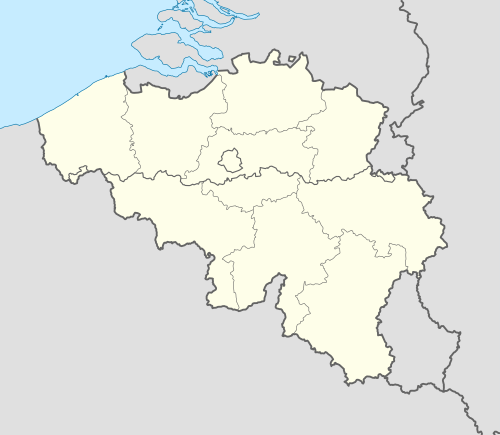 City of Brussels Location in Belgium
The City of Brussels within Brussels-Capital Region 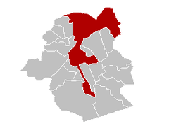 | |
| Coordinates: 50°50′48″N 04°21′09″E | |
| Country | Belgium |
| Community | Flemish Community French Community |
| Region | Brussels |
| Arrondissement | Brussels |
| Government | |
| • Mayor (list) | Philippe Close (PS) |
| • Governing party/ies | PS - MR |
| Area | |
| • Total | 32.61 km2 (12.59 sq mi) |
| Population (2018-01-01)[1] | |
| • Total | 179,277 |
| • Density | 5,500/km2 (14,000/sq mi) |
| Postal codes | 1000, 1020, 1030 1040, 1050, 1060 1083, 1120, 1130 1190 |
| Area codes | 02 |
| Website | www.brussels.be |
The City of Brussels is a municipality consisting of the central historic town and certain additional areas within the greater Brussels-Capital Region, namely Haren, Laeken and Neder-Over-Heembeek to the north, as well as Avenue Louise/Louizalaan and the Bois de la Cambre/Ter Kamerenbos park to the south.
As of 1 January 2017, the City of Brussels had a total population of 176,545. The total area is 32.61 km2 (12.59 sq mi) which gives a population density of 5,475 inhabitants per square kilometre (14,180/sq mi). As of 2007, there were approximately 50,000 registered non-Belgians in the City of Brussels.[4] In common with all of Brussels' municipalities, it is legally bilingual (French–Dutch).
Territorial history
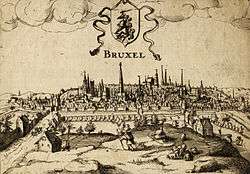
At first, the City of Brussels was simply defined, being the area within the second walls of Brussels, the modern-day small ring. As the city grew, the surrounding villages grew as well, eventually growing into a contiguous city, though the local governments retained control of their respective areas.
The construction of Avenue Louise/Louizalaan was commissioned in 1847 as a monumental avenue bordered by chestnut trees that would allow easy access to the popular recreational area of the Bois de la Cambre/Ter Kamerenbos. However, fierce resistance to the project was put up by the town of Ixelles (which was then still separate from Brussels) through whose land the avenue was supposed to run. After years of fruitless negotiations, Brussels finally annexed the narrow band of land needed for the avenue plus the Bois de la Cambre itself in 1864. That decision accounts for the unusual southeastern protrusion of the City of Brussels and for Ixelles being split in two separate parts. Part of the Université libre de Bruxelles' Solbosch campus is also part of the City of Brussels, partially accounting for the bulge in the southeast end.
Unlike most of the municipalities in Belgium, the ones located in the Brussels-Capital Region were not merged with others during mergers occurring in 1964, 1970, and 1975.[5] However, a few neighbouring municipalities have been merged into the City of Brussels, including Haren, Laeken and Neder-Over-Heembeek in 1921.[6] These comprise the northern bulge in the municipality. To the south-east is also a strip of land along Avenue Louise that was annexed from Ixelles.
Districts
Pentagon
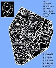
Central District
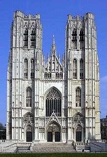
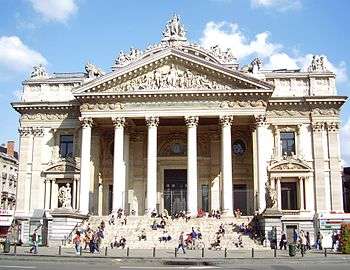
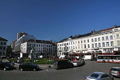
It is in the heart of Saint-Géry/Sint-Goriks Island, formed by the Senne river, and on which a first keep was built around 979, that the origin of Brussels is located. Today, the neighbourhood around the Halles Saint-Géry/Sint-Gorikshallen, a former covered market, is one of the trendiest districts of the capital. In this Central District (French: Quartier du Centre, Dutch: Centrumwijk), there are some vestiges of the 13th-century first walls of Brussels, which surrounded the area between the first port on the Senne, the old Romanesque church (later replaced by the Brabantine Gothic Cathedral of St. Michael and St. Gudula), and the former ducal palace of Coudenberg in today's Royal District. In the centre of this triangle are the Grand Place (Brussels' main square); the Îlot Sacré district, which takes its name from its resistance to demolition projects, itself crossed by the Royal Saint-Hubert Galleries; the Saint-Jacques/Sint-Jacobs district, which welcomed the pilgrims on their way to Santiago de Compostela; as well as the Brussels Stock Exchange building, built on the site of a former convent, whose remains have been uncovered.
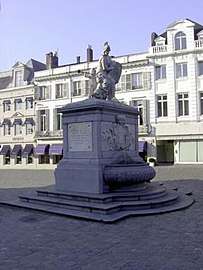
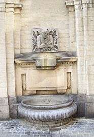 Le Cracheur fountain
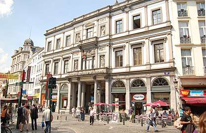
Royal District
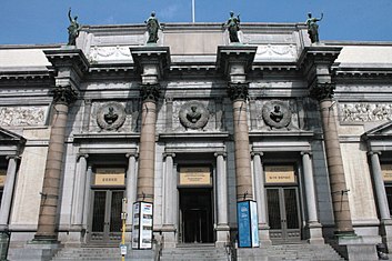
The Royal District (French: Quartier Royal, Dutch: Koninklijke Wijk or Koningswijk) is thus named because it houses, on the one hand, the Place Royale/Koningsplein ("Royal Square" or "King's Square"), built under Charles-Alexander of Lorraine on the Coudenberg hill, on the site of the former Palace of the Dukes of Brabant, of which certain levels of foundation still exist, and on the other hand, the Royal Palace of Brussels, which faces Brussels' Park, on the other side of which is the Belgian House of Parliament (Palace of the Nation). Below the Royal District is the Central Station and the Mont des Arts/Kunstberg where the Royal Library of Belgium, the Royal Belgian Film Archive (Cinematek), the Brussels Centre for Fine Arts, the Museum of Cinema, the Musical Instrument Museum (MIM), the BELvue Museum, and the Royal Museums of Fine Arts of Belgium are located.
 Museum Square
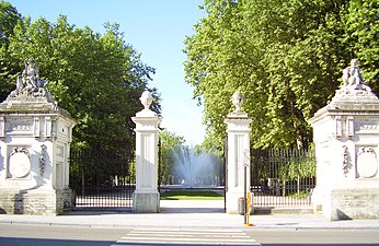

Sablon/Zavel District
From the Place Royale/Koningsplein, Rue de la Régence/Regentschapsstraat crosses the Sablon/Zavel District (French: Quartier des Sablons, Dutch: Zavelwijk), made of the larger Grand Sablon/Grote Zavel ("Large Sablon") square in the northwest and the smaller Petit Sablon/Kleine Zavel ("Small Sablon") square and garden in the southeast, divided by the Church of Our Blessed Lady of the Sablon. It is a swanky district, where an antiques market is held, and in which antique and art dealers, as well as other luxury shops, have their businesses. Not far from there was the Art Nouveau Maison du Peuple/Volkshuis by the famous architect Victor Horta, until its demolition in 1965. The Sablon is also home to the Egmont Palace and the Royal Conservatory of Brussels.
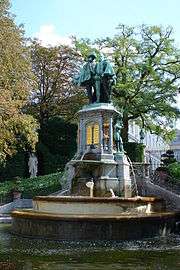
 Fountain of Minerva
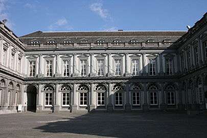
 Fountain of the counts of Egmont and Horn
Marolles/Marollen District
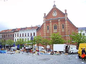
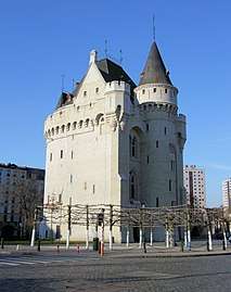
In the shadow of the gigantic Palace of Justice lies the old Marolles/Marollen District (French: Quartier des Marolles, Dutch: Marollenwijk, not to be confused with the Marolle that purists delimit to only 7 streets). From the Place de la Chapelle/Kapellemarkt to the Place du Jeu de Balle/Vossenplein, where a daily flea market has been held since 1873, along Rue Haute/Hogestraat and Rue Blaes/Blaestraat, second-hand and popular shops have for some years given way to antique shops, marking a profound change to the neighbourhood. The Cité Hellemans, a remarkable example of early 20th-century collective housing complexes, was built on the site of the neighbourhood's many squalid cul-de-sacs. Rue Haute, one of the longest and oldest streets in the city, follows the course of an old Gallo-Roman road, and runs along Saint Peter's Hospital, built in 1935 on the site of a lepers' hospital, to end at the Halle Gate, the only survivor of the series of gates which allowed passage inside the second walls of Brussels.
 Place du Jeu de Balle/Vossenplein, end of a market
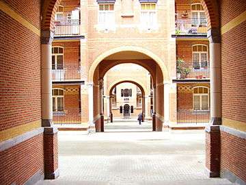 Cité Hellemans, Rue Blaes/Blaesstraat
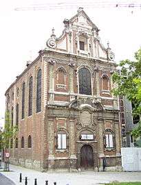 Brigittines Chapel
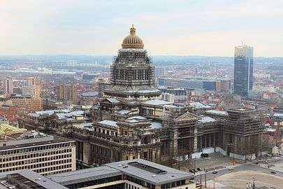
Midi–Lemonnier District or Stalingrad District
It is in the heart of the Midi–Lemonnier District (French: Quartier Midi–Lemonnier, Dutch: Lemmonier–Zuidwijk), where Rouppe Square is today, that Brussels' first South Station—called Bogards' Station for the eponymous convent whose site it was built on, and to which Rue des Bogards/Bogaardenstraat is nowadays the only reference—was located from 1839, the terminus of the South Line. The former presence of a station at this location also explains the unusual width of the current Avenue of Stalingrad, which goes from the square to the small ring road, cleared of its railways since the inauguration of Brussels-South Station, built outside the Pentagon in 1869. Because of this, the neighbourhood is sometimes called Stalingrad District (French: Quartier Stalingrad, Dutch: Stalingradwijk). At the same time, following the covering of the Senne, the neighbourhood saw the construction of haussmannian grand central boulevards, including Maurice Lemonnier Boulevard, bordered by Fontainas Square and Anneessens Square (location of the former Old Market), as well as by the Midi Palace. Each Sunday morning, the Midi district hosts the second largest market in Europe.
 Rouppe Square and Avenue of Stalingrad
 Anneessens Square and Lucien Cooremans Institute
 Lemonnier Boulevard and Midi Palace
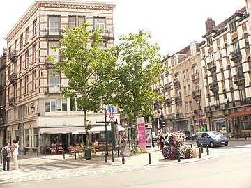
Senne/Zenne District or Dansaert District
The damp and swampy grounds around the present-day Rue de la Senne/Zennestraat and Rue des Fabriques/Fabriekstraat were occupied by craftsmen since the Middle Ages. An arm of the river crossed the defences of the second walls at the level of the Ninove Gate and the Petite Écluse/Kleine Sluis ("Small Lock"), which served as a port, an end of which remaining there until the 1960s. Later, small industries and many artisan breweries (now disappeared) established themselves in the area, which is still evident by the names of Rue du Houblon/Hopstraat ("Hops Street") and Rue du Vieux Marché aux Grains/Oude Graanmarktstraat ("Old Grain Market Street"). The Shot Tower (Tour à Plomb), which was used for the manufacture of lead shot for hunting, and Rue de la Poudrière/Kruitmolenstraat ("Gunpowder Street"), also testify to the neighbourhood's former activities. Long neglected as a result of the relocation of businesses outside the city centre, the Senne/Zenne District (French: Quartier de la Senne, Dutch: Zennewijk) has for a few years been the object of a new interest and is undergoing gentrification due to the many disused industrial premises being converted into lofts. The area around Rue Antoine Dansaert/Antoine Dansaertstraat has become a trendy district and is attracting a younger, more well-off, and mostly Dutch-speaking population. This new situation, which has the consequence of rising rents, is not without problems for the less fortunate inhabitants of the neighbourhood.
 Rue Antoine Dansaert/Antoine Dansaertstraat
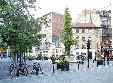 Flower Garden Square
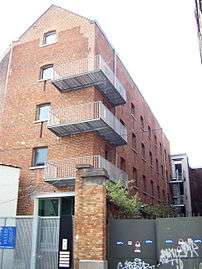 Industrial building transformed into housing (loft)
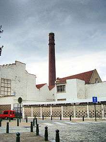 Tour à Plomb
Quays District or Maritime District
The Quays District (French: Quartier des Quais, Dutch: Kaalenwijk) is that of the old port of Brussels, which played for a long time the role of "belly" of the city. The boats coming from the Scheldt river penetrated through the Rivage Gate, at the site of present-day Yser Square, to join one of the canals, whose docks were each reserved for one type of goods. Filled in the 19th century, at the opening of Brussels' new port, the canals were replaced by wide boulevards, the two sides of which retain in their names the memory of their former function: Quai aux Briques/Baksteenkaai ("Brick Wharf"), Quai au Bois à Brûler/Brandhoutkaai ("Firewood Wharf"), Quai aux Pierres de Taille/Arduinkaai ("Quarry Stone Wharf"), Quai au Foin/Hooikaai ("Hay Wharf"), etc., or references to the neighbourhood's commercial activities: Rue du Magasin/Pakhuisstraat ("Warehouse Street"), Rue des Commerçants/Koopliedenstraat ("Traders Street"), Rue du Marché aux Porcs/Varkensmarktstraat ("Pig Market Street") and Quai du Commerce/Handelskaai ("Trade Wharf"). Along the quaysides, numerous bourgeois houses, once belonging to wealthy merchants, have preserved the entrances to the warehouses. On Ypres Boulevard, one can still cross food wholesalers, supplied nowadays by trucks, which have replaced the boats. The neighbourhood also includes the beguinage of Brussels, with the Church of St. John the Baptist and the remarkable Grand Hospice Pachéco.
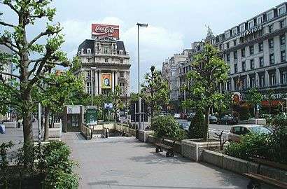
_22-09-2018_15-08-16.jpg)
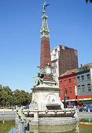 Anspach fountain
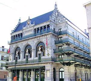 Royal Flemish Theatre
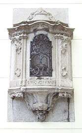 Potale Saint Roch, invoked against the plague
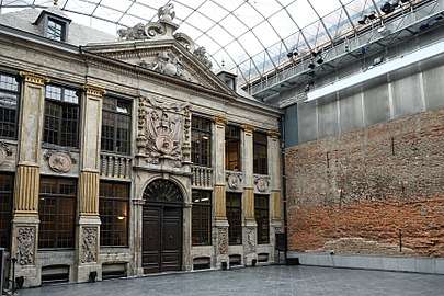 La Bellone
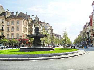
Marais–Jacqmain District
Few are the buildings in the Marais–Jacqmain District (French: Quartier Marais–Jacqmain, Dutch: Jacqmain–Broekwijk) which have escaped 20th-century demolition, from Pachéco Boulevard to Rue Neuve/Nieuwstraat. They have been replaced by the State Administrative City, press printers, banking facilities, and commercial galleries. The current trend is to restore the neighbourhood's social mix by redeveloping housing in former office buildings. Despite the longtime grim aspect of the district, the Meyboom tradition has been maintained for centuries, and the former Art Nouveau Waucquez stores by Victor Horta have been preserved and house, since 1993, the Belgian Comic Strip Center. Another preserved islet is the 18th-century neoclassical Martyrs' Square, which has gradually been renovated. The victims of the Belgian Revolution of 1830 are buried there in an open crypt with a memorial. Nearby is Rue Neuve, one of the main commercial streets in Belgium, with on its two sides more than 1 kilometre (0.62 miles) long entirely occupied by shops; Adolphe Max Boulevard, a traditional artery with 19th-century facades; and Émile Jacqmain Boulevard (where the National Theatre of Belgium was installed in 2004) close to De Brouckère Square. The latter, a very busy central point of the city centre, is dominated at its southern end by two block-style building towers, but for the rest, it has totally (Hotel Metropole and its neighbour the Hotel Atlanta) or partially (UGC cinema) preserved its old facades.
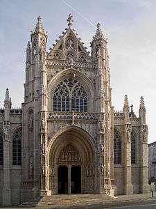
 Church of Our Lady of Finistère
Freedom District
The Freedom District (French: Quartier des Libertés, Dutch: Vrijheidswijk) is situated between the Belgian Parliament and Rue Royale/Koningsstraat, not far from the crossroads with the small ring road, and has as its focal point the Congress Column, built in memory of the National Congress of 1830–31, the founder of democratic liberties in Belgium, and under which also lies the tomb of the Unknown Soldier with the Sacred Flame. Not far from there is the Hotel Astoria, a 1911 palace, which is currently being renovated and enlarged, and will be reopened in the coming years. In the 19th century, the district was known as Notre-Dame-aux-Neiges/Onze-Lieve-Vrouw-ter-Sneeuw and was inhabited in majority by working-class people. The authorities' desire to clean up the squalid parts of the city led to the expulsion of the population and the neighbourhood's complete destruction. A new bourgeois district was developed during the last quarter of the century. The choice was made to commemorate the memory of the Belgian Independence: the Place de la Liberté/Vrijheidsplein ("Liberty Square"), the Place des Barricades/Barricadenplein ("Barricades' Square"), Rue de la Révolution/Revolutiestraat ("Revolution Street"), Rue du Congrès/Congresstraat ("Congress Street"), etc. The four streets overlooking Liberty Square bear the names of the four constitutional freedoms, symbolised by the four female figures surrounding the Congress Column: Freedom of the Press, Religion, Association and Education. This eclectic urban complex is one of the best preserved of the Pentagon today.
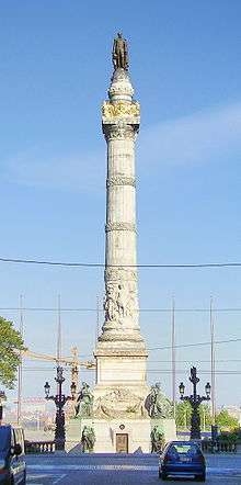 The Congress Column (Leopold I)
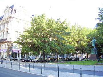 Liberty Square (Charles Rogier)
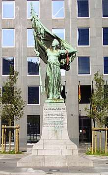 Surlet de Chokier Square (The Brabançonne)
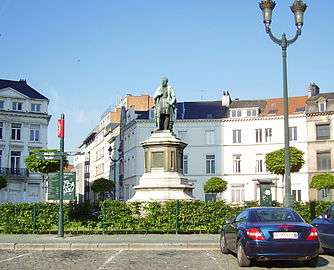 Barricades' Square (Andreas Vesalius)
Eastern districts
European District and Leopold Quarter
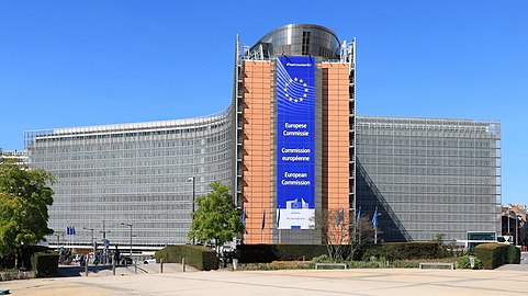
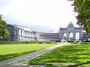
The European District (French: Quartier Européen, Dutch: Europese Wijk) is located to the east of the Pentagon, around Luxembourg Square and the Schuman roundabout, and includes the smaller Leopold Quarter (French: Quartier Léopold, Dutch: Leopoldswijk). The European Parliament was built near Luxembourg Square, on the site of the former Quartier Léopold Station, and of which only the central building overlooking the square remains, having been replaced by the underground Brussels-Luxembourg railway station. The European Commission, housed in the Berlaymont building, is located on the Schuman roundabout, not far from the Cinquantenaire Park. Across the street stands the Justus Lipsius building and the Europa building (part of the Residence Palace), serving as the seat of the European Council and the Council of the EU. In Leopold Park, the House of European History provides visitors with a social history of the continent of Europe. There is a visitor centre in the main European Parliament building, known as the Parliamentarium, and another smaller one in the Justus Lipsius building, for the council of Europe. It is accessible on certain days, by appointment. Many of the attractions in the European quarter are free to visit.
Northern districts
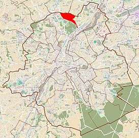
Laeken
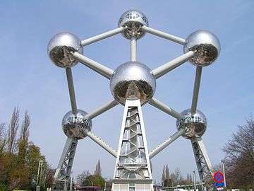
Laeken is a former municipality in the north of the Brussels-Capital Region, annexed by the City of Brussels in 1921. Laeken is home to, among others, the Royal Domain of Laeken, the Castle of Laeken, the Royal Greenhouses of Laeken (1873), the Church of Our Lady of Laeken (whose crypt contains the tombs of the Belgian Royal Family) and the Laeken Cemetery, known for its wealth of monuments and sculptures. On the territory of Laeken, there is also the Heysel/Heizel Plateau, where were held the World's Fairs of 1935 and 1958 and which includes the King Baudouin Stadium, Bruparck (with the Atomium, Mini-Europe miniature park and Kinepolis cinema), the Centenary Palace, home to the Brussels Exhibition Centre (Brussels Expo), and the Port of Brussels, next to which the Monument to Work by Constantin Meunier was erected.
 Map of Laeken
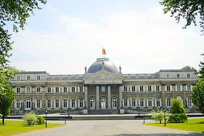 Castle of Laeken
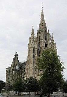
Mutsaard
Sometimes also known as the Pagoda district, the Japanese tower district or De Wand district, Mutsaard (also spelled Mutsaert), is an old hamlet and a historic district located between Laeken and Neder-over-Heembeek and centred around Mutsaard Square. The district was part of the former municipality of Laeken (postcode: 1020) but also a piece of Neder-over-Heembeek, annexed by Laeken in 1897. It is separated from the rest of Laeken by the Royal Domain and is the site of the Museums of the Far East. The district also extends a little on the neighbouring Flemish municipalities of Vilvoorde and Grimbergen.
 Map of Mutsaard
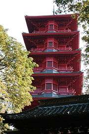 Japanese tower
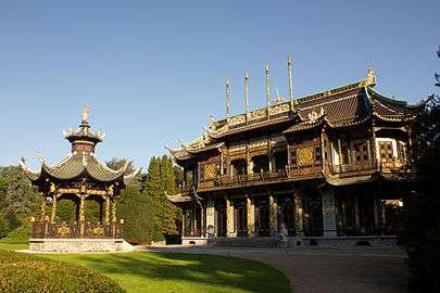 Chinese pavilion
Neder-Over-Heembeek
Neder-Over-Heembeek is a former municipality incorporated in the city of Brussels in 1921, at the same time as Laeken and Haren. It has the distinction of having the oldest place name in the Brussels-Capital Region, as it was mentioned in an ordinance as early as the 7th century. This is where the Queen Astrid Military Hospital, which is the National Burns and Poisons centre, as well as recruitment services of the Belgian Armed Forces are located.
 Map of Neder-Over-Heembeek
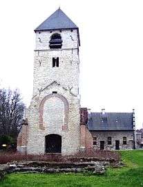 Old Romanesque tower in Lower Heembeek
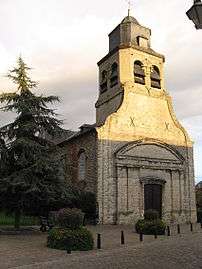 Church of St Nicholas in Upper Heembeek
Haren
Like Laeken and Neder-Over-Heembeek, the former municipality of Haren was annexed by the municipality (City) of Brussels in 1921, which allowed the extension of the Schaerbeek railway station north of its territory. But it is the presence, southwest of the town, of an airfield, created by the Germans during the First World War, and where the Belgian national airline Sabena was born, which precipitated the annexation of Haren. For almost fifty years, Haren has been home to the NATO headquarters. It is also the location of many other administrations and companies, such as the headquarters of Eurocontrol.
Mayors
As in every other Belgian municipality, the City of Brussels is headed by a mayor, who should not be confused with the Minister-President of the Brussels-Capital Region or the Governor of Brussels-Capital.
Culture
There are many museums in and around Brussels' city centre. On the first Sunday of every month, free entry is granted to many of Brussels' museums. The Underwear Museum opened in 2009,[7] and was initially in the City of Brussels.[8] In 2016 it moved to Lessines, Hainaut, Wallonia.[9]
Below is a non-exhaustive list of museums in the City of Brussels:
- Royal Museums of Art and History :
- Art & History Museum
- Horta-Lambeaux Pavilion
- Halle Gate
- Museums of the Far East
- Musical Instrument Museum
- Royal Museums of Fine Arts of Belgium :
- Oldmasters Museum
- Magritte Museum
- Fin-de-Siècle Museum
- Wiertz Museum
- Meunier Museum
- Musée royal d'Art moderne à Bruxelles
- Royal Museum of the Armed Forces and Military History
Honorary citizens
Among the recipients of the honorary citizenship of the City of Brussels are:
| Date | Name | Notes |
|---|---|---|
| 24 February 2010 | David Susskind (1925–2011) | Belgian Jewish Leader and Peace Activist.[10][11] |
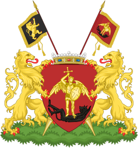
Heraldry
 |
|
| Wikimedia Commons has media related to Coats of arms of the City of Brussels. |
| Previous versions | |
|---|---|
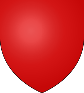 |
The Original arms were plain Gules.[13] From the 16th century on, it was customary to put the figure of the city seal representing Saint Michael, first as a shadow then a more elaborate form.[14]
Note: many of the arms of the Seven Noble Houses of Brussels were variants of these arms. |
.svg.png) |
1730 arms |
.svg.png) |
Napoleonic arms[15] |
Vexillology
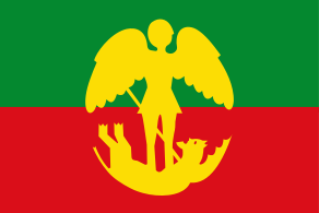
| Flag of the City of Brussels | |
|---|---|
|
Description:
Green and red with at its center Saint Michael slaying the dragon (Devil). Symbolism: Saint Michael is the patron saint of the city.[16] See: Saint Michael slaying the Devil |
See also
References
- "Wettelijke Bevolking per gemeente op 1 januari 2018". Statbel. Retrieved 9 March 2019.
- Stad in isolation: [stɑt].
- The Belgian Constitution (PDF). Brussels, Belgium: Belgian House of Representatives. May 2014. p. 63. Retrieved 10 September 2015.
- Statistics foreign population in Belgium by municipality (in French and Dutch only)
- Picavet, Georges (29 April 2003). "Municipalities (1795-now)". Georges Picavet. Retrieved 2009-04-05.
- "Brussels Capital-Region". Georges Picavet. 4 June 2005. Retrieved 2009-04-05.
- "Panty Poetry: Celebrity Underwear Museum Opens in Brussels". Spiegel Online. Der Spiegel. 2009-07-23. Retrieved 2018-08-27.
- "Le "musée du slip", dernière expérience surréaliste à Bruxelles". La Dépêche. 2009-06-28. Retrieved 2018-08-27.
(36 rue des Renards, 1000 Bruxelles).
- Boyle, Robyn (2016-09-25). "Underwear Museum moves from Brussels to Lessines". The Bulletin. Retrieved 2018-08-27.
- "City of Brussels". Archived from the original on 2017-02-02. Retrieved 2018-09-20.
- "World Jewish Congress".
- Netherlandish sculpture 1450-1550 by Paul Williamson 2002 ISBN 0-8109-6602-6 page 42
- Guillaume Des Marez, "L'origine des armoiries de Bruxelles. Première phase: De gueules plain", in: Études inédites, Brussels, 1936, p. 111-113: « A text from 1339 informs us with precision on this point. This first coat of arms of the city of Brussels were gules plain. Why ? The legend, which the Luyster van Brabant echoes, reports that Leo Torgotus, crowned king of Tongeren in 3609 of creation - or 368 before the birth of Christ - after having defeated tribes united against him, advanced in Brabant to hold his winter quarters there. He built two castles there, one on the heights of Coudenberg, the other on an island in the Senne, and in between, a tower, the Saint-Nicolas tower. He gave this place the name of Broidsel or Broedsel, and there was formed Brussels ... In memory of the battles fought by Léo Torgotus and where the blood was shed in such abundance that the water of the rivers was reddened, the city adopted for his coat of arms "a simple red field" (een simpel roodt veldt) and kept it such until the moment when the image of the Archangel Michael was placed in said field that the city had chosen as its patron. Heraldic science allows us to formulate the following hypothesis: the red would be a reminder of the coat of arms of Lothier which are gules to a fess of silver ... Different documents show us these very plain Brussels arms: notably a drawing representing the seat of Brussels by Count Ferrand and a table depicting the siege of Neuss by Charles the Bold. Red was, moreover the color of the city. In the sixteenth century, the archivist of the Sainte-Élisabeth convent, explaining the meaning of the coat of arms adopted by his convent, tells us from the start of his description that the background is Gules, i.e. red, and that this indicates Brussels (dat is root ende beteekent Bruessel). It is also the small shield of gules which adorns the marvelous tapestries taken out of the workshops of Brussels. ". And P. 115: “Saint Michael, whose image was then placed in the ancient red badge of the city. In reality, it was in the course of the sixteenth century that the modification took place, and Saint Michael is obviously the emblem of the seal. This shield Gules in the shade of Saint Michael remained until the end of the old regime that of the city of Brussels: this is how in the eighteenth century it adorned the magistrates' book. ".
- Louis Robyns de Schneidauer, La couronne comtale de la ville de Bruxelles, in Le Parchemin, Gendbrugge-lez-Gand, 1939 (March–April).
- (en)Brussels[archive], on the Heraldry of the World website.
- Netherlandish sculpture 1450-1550 by Paul Williamson 2002 ISBN 0-8109-6602-6 page 42
External links
| Wikimedia Commons has media related to Brussels (municipality). |
- Official website of The City of Brussels
- Page related to The City of Brussels in the Brussels-Capital Region official web site
- Webcam Grand-Place Brussels
- Interactive map of Brussels historical city centre
Places adjacent to City of Brussels | |
|---|---|
| ||||||||||||