Christopher Street–Sheridan Square station
Christopher Street–Sheridan Square is a local station on the IRT Broadway–Seventh Avenue Line of the New York City Subway. Located at the intersection of Christopher Street and Seventh Avenue South in Manhattan, it is served by the 1 train at all times and by the 2 train during late nights.
Christopher Street– Sheridan Square | |||||||||||
|---|---|---|---|---|---|---|---|---|---|---|---|
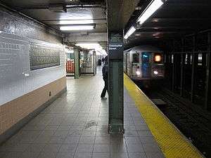 Downtown local 1 train arriving | |||||||||||
| Station statistics | |||||||||||
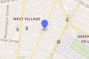
| Address | Christopher Street & Seventh Avenue South New York, NY 10014 | ||||||||||
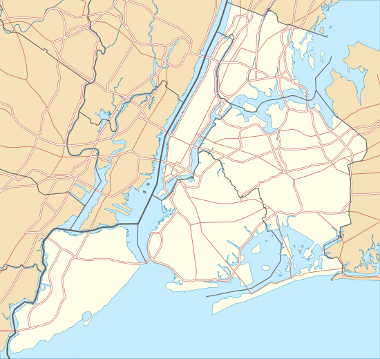
| Borough | Manhattan | ||||||||||
| Locale | Greenwich Village | ||||||||||
| Coordinates | 40.733°N 74.003°W | ||||||||||
| Division | A (IRT) | ||||||||||
| Line | IRT Broadway–Seventh Avenue Line | ||||||||||
| Services | 1 2 | ||||||||||
| Transit connections | |||||||||||
| Structure | Underground | ||||||||||
| Platforms | 2 side platforms | ||||||||||
| Tracks | 4 | ||||||||||
| Other information | |||||||||||
| Opened | July 1, 1918 | ||||||||||
| Station code | 323[1] | ||||||||||
| Wireless service | |||||||||||
| Opposite-direction transfer available | No | ||||||||||
| Traffic | |||||||||||
| Passengers (2019) | 3,412,332[3] | ||||||||||
| Rank | 146 out of 424[3] | ||||||||||
| Station succession | |||||||||||
| Next north | 14th Street: 1 | ||||||||||
| Next south | Houston Street: 1 | ||||||||||
| |||||||||||
| |||||||||||
| |||||||||||
History
The Dual Contracts, which were signed on March 19, 1913, were contracts for the construction and/or rehabilitation and operation of rapid transit lines in the City of New York. The contracts were "dual" in that they were signed between the City and two separate private companies (the Interborough Rapid Transit Company and the Brooklyn Rapid Transit Company), all working together to make the construction of the Dual Contracts possible. The Dual Contracts promised the construction of several lines in Brooklyn. As part of Contract 4, the IRT agreed to build a branch of the original subway line south down Seventh Avenue, Varick Street, and West Broadway to serve the West Side of Manhattan.[4][5][6]
The construction of this line, in conjunction with the construction of the Lexington Avenue Line, would change the operations of the IRT system. Instead of having trains go via Broadway, turning onto 42nd Street, before finally turning onto Park Avenue, there would be two trunk lines connected by the 42nd Street Shuttle. The system would be changed from looking like a "Z" system on a map to an "H" system. One trunk would run via the new Lexington Avenue Line down Park Avenue, and the other trunk would run via the new Seventh Avenue Line up Broadway. In order for the line to continue down Varick Street and West Broadway, these streets needed to be widened, and two new streets were built, the Seventh Avenue Extension and the Varick Street Extension.[7] It was predicted that the subway extension would lead to the growth of the Lower West Side, and to neighborhoods such as Chelsea and Greenwich Village.[8][9]
Christopher Street–Sheridan Square opened as the line was extended south to South Ferry from 34th Street–Penn Station on July 1, 1918, and was served by a shuttle.[10] The new "H" system was implemented on August 1, 1918, joining the two halves of the Broadway–Seventh Avenue Line and sending all West Side trains south from Times Square.[11] An immediate result of the switch was the need to transfer using the 42nd Street Shuttle in order to retrace the original layout. The completion of the "H" system doubled the capacity of the IRT system.[8]
In 1981, the MTA listed the station among the 69 most deteriorated stations in the subway system.[12]
Station layout
| G | Street level | Exit/entrance |
| P Platform level |
Side platform | |
| Northbound local | ← ← | |
| Northbound express | ← | |
| Southbound express | | |
| Southbound local | | |
| Side platform | ||
This underground station has two side platforms and four tracks. The two center express tracks are used by the 2 and 3 trains during daytime hours.
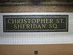
Both platforms have the standard IRT trim line and name tablets reading "CHRISTOPHER ST. SHERIDAN SQ." in Times New Roman font on two lines. The columns are painted dark green with every other one having a standard black name plate with white lettering. There are also signs directing to New York University.
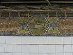
The 1994 artwork is entitled Greenwich Village Murals by Lee Brozgol and the students of Public School 41. It features twelve mosaic frame panels on the platform walls depicting the history of Greenwich Village. The names of some of these panels include "Bohemians", "Rebels", "Founders", and "Providers".
Exits
Each platform has one fare control area at the center containing a turnstile bank and token booth. There is no free transfer between directions. The South Ferry-bound fare control has four street stairs to the diagonal intersection of Christopher Street and Seventh Avenue: two to the northwestern corner and two to the southwestern one. The Bronx-bound fare control has a single staircase to the island formed by Seventh Avenue, West Fourth Street, and Grove Street.[13]
Nearby points of interest
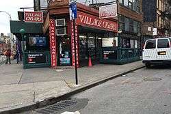
The Stonewall National Monument, encompassing Christopher Park and the Stonewall Inn, is across West Fourth Street from the Bronx-bound entrance.[13]
The Hess triangle, a small triangular-shaped plaque in the sidewalk with one 65-centimeter (26 in) side and two 70-centimeter (28 in) sides, is located outside the South Ferry-bound entrances at the southwest corner of Christopher Street and Seventh Avenue South.[13]
In popular culture
In Bright Lights, Big City (1988), Michael J. Fox is seen jumping the turnstiles and then boarding a train at the station while running away from his brother.
In season 2, episode 5 of Friends (1995), filmed during the renovations of the station, the south entrance of the station is depicted as being closed.
The station can briefly be seen in the backdrop of the music video for David Bowie's "I'm Afraid of Americans" (1997).
The 1999 comedy movie Big Daddy includes a scene of Adam Sandler, his character's foster son, and friends outside this station.
The Steely Dan song Pixeleen from the Everything Must Go album, released in 2003, alludes to the subway station.
References
- "Station Developers' Information". Metropolitan Transportation Authority. Retrieved June 13, 2017.
- "NYC Subway Wireless – Active Stations". Transit Wireless Wifi. Retrieved November 13, 2019.
- "Facts and Figures: Annual Subway Ridership 2014–2019". Metropolitan Transportation Authority. 2020. Retrieved May 26, 2020.
- "Terms and Conditions of Dual System Contracts". nycsubway.org. Public Service Commission. March 19, 1913. Retrieved February 16, 2015.
- "The Dual System of Rapid Transit (1912)". nycsubway.org. Public Service Commission. September 1912. Retrieved May 30, 2017.
- "Most Recent Map of the Dual Subway System Which Shows How Brooklyn Borough Is Favored In New Transit Lines". The Brooklyn Daily Eagle. September 9, 1917. p. 37. Retrieved August 23, 2016 – via Brooklyn Public Library; newspapers.com.
- Engineering News-record. McGraw-Hill Publishing Company. 1916.
- Whitney, Travis H. (March 10, 1918). "The Seventh and Lexington Avenue Subways Will Revive Dormant Sections" (PDF). The New York Times. p. 12. ISSN 0362-4331. Retrieved August 26, 2016.
- "Public Service Commission Fixes July 15 For Opening of The New Seventh and Lexington Avenue Subway Lines" (PDF). The New York Times. May 19, 1918. p. 32. ISSN 0362-4331. Retrieved November 6, 2016.
- "Open New Subway to Regular Traffic" (PDF). The New York Times. July 2, 1918. p. 11. ISSN 0362-4331. Retrieved November 6, 2016.
- "Open New Subway Lines to Traffic; Called a Triumph" (PDF). The New York Times. August 2, 1918. p. 1. ISSN 0362-4331. Retrieved 2020-04-21.
- Gargan, Edward A. (June 11, 1981). "Agency Lists Its 69 Most Deteriorated Subway Stations". The New York Times. p. B5S. ISSN 0362-4331. Archived from the original on March 31, 2020. Retrieved August 13, 2016.
- "MTA Neighborhood Maps: West Village" (PDF). mta.info. Metropolitan Transportation Authority. 2015. Retrieved 2 August 2015.
Further reading
- Stookey, Lee (1994). Subway ceramics : a history and iconography of mosaic and bas relief signs and plaques in the New York City subway system. Brattleboro, Vt: L. Stookey. ISBN 978-0-9635486-1-0. OCLC 31901471.
External links
| Wikimedia Commons has media related to Christopher Street – Sheridan Square (IRT Broadway – Seventh Avenue Line). |
- nycsubway.org – IRT West Side Line: Christopher Street/Sheridan Square
- nycsubway.org – The Greenwich Village Murals Artwork by Lee Brozgol (1994)
- Station Reporter – 1 Train
- MTA's Arts For Transit – Christopher Street–Sheridan Square (IRT Broadway–Seventh Avenue Line)
- Christopher Street entrance from Google Maps Street View
- Sheridan Square entrance from Google Maps Street View
- Platforms from Google Maps Street View