Cayce, South Carolina
Cayce (pronounced KAY-see) is a city in the U.S. state of South Carolina, along the Congaree River. The population was 12,528 at the 2010 census.[6] The estimated population was 14,009 in 2019, and is the third-most populated municipality in Lexington County.[7] The city limits divided between Lexington and Richland Counties, though most of the city's residents live in Lexington County.[8] Most of the city's land in Richland County is predominately rural. Cayce lies along the banks of the Congaree River, which divides the city from the state capital, Columbia, South Carolina.[8] Cayce is also boarded by the city of West Columbia to the north and the town of Springdale to the northwest.[9] Cayce is also part of the Columbia, South Carolina, Metropolitan Statistical Area and the South Carolina Midlands of South Carolina.
Cayce, South Carolina | |
|---|---|
 City Hall | |
| Motto(s): "A new kind of city" | |
 Location in Richland County and the state of South Carolina. | |
| Coordinates: 33°57′48″N 81°4′0″W | |
| Country | United States |
| State | South Carolina |
| County | Lexington and Richland |
| Government | |
| • Mayor | Elise Partin |
| Area | |
| • Total | 17.80 sq mi (46.11 km2) |
| • Land | 16.94 sq mi (43.86 km2) |
| • Water | 0.86 sq mi (2.24 km2) |
| Elevation | 240 ft (73 m) |
| Population (2010) | |
| • Total | 12,528 |
| • Estimate (2019)[2] | 14,009 |
| • Density | 827.17/sq mi (319.37/km2) |
| Time zone | UTC−5 (Eastern (EST)) |
| • Summer (DST) | UTC−4 (EDT) |
| ZIP code | 29033, 29172, 29170, 29169, 29201[3] |
| Area code(s) | 803, 839 |
| FIPS code | 45-12655[4] |
| GNIS feature ID | 1247197[5] |
| Website | www |
History
What was to become Cayce was home to Native Americans for at least 12,000 years;[10] This includes what is now known as the Manning Archeological Site, the SAM Site, and the Taylor Site.[11]
Hernando de Soto reached the area in 1540, encountering a large Indian village at Congaree Creek, where Cayce now stands.[10] Near the end of the 17th century, explorers such as John Lawson visited and documented his trip.[10] In 1718, the English built the first permanent fort, becoming the first structure built in the Midlands. A second fort was built on the river in 1748. These forts were referred to as Congaree Fort #1 and Congaree Fort #2,[10] and became part of the Congarees Site in 1974.[11][12]

The Guignard Brick Works were established on the west bank of the Congaree in 1803 and remained active for nearly two centuries.[10]
The town includes the area that was once Granby, once the county seat and a flourishing community before it was abandoned by the end of the first quarter of the nineteenth century.[13]
The town was incorporated in 1914 and named for local businessman William J. Cayce.
In December 2007, the city council voted to annex a 3,100-acre floodplain in Richland County. Prior to this highly-controversial annexation, Cayce was entirely situated within Lexington County.[14] The city planned to develop this area. However, after significant evaluations, the city abandoned the project after determining that development was not suitable in the flood-prone area, leaving Cayce with a sizeable piece of sparely-populated land.[15]

Attractions

Cayce has several hiking trails throughout the city. All of its public attractions, with the exception of the Cayce Historical Museum, are free or charge.[16]
- The Cayce Riverwalk - The Cayce Riverwalk, sometimes referred to as the Cayce/West Columbia River walk, is a paved, twelve-mile[lower-alpha 1] hiking and biking trail along the Congaree River. The Riverwalk has four phases and several access points and provides historical markers along the pathway. The park sometimes floods when the Congaree river exceeds flood stage capacity.[16][17]
- The 12,000-year-old park - a park build upon land that the city states has not changed much in the past 12,000 years.[18]
- Timmerman Trail - A 3.5-mile hiking and biking trail through the woods. The trail is maintained by SCANA and is located near the company's headquarters. The trail is named after the former pro-segregationist governor of South Carolina, George Bell Timmerman Jr.[16]
- Congaree Creek Heritage Preserve - A 2.7-mile hiking trail through the woods along Conagree Creek.[19]
- Cayce Historical Museum - Located at the city's municipal complex, the museum includes Native American, colonial and American Revolutionary War, and Civil War artifacts.[16]
- Guignard Brick Works - A site on the National Register of Historic Places, established by the Guignard family in 1801. The complex includes four brick beehive kilns, a historic brick office, and remnants of other industrial features of the brick works.
Economy


Cayce is the home of SCANA, the parent company of South Carolina Electric & Gas Company, Carolina Gas Transmission, Cayce Capital, PSNC Energy, and other subsidiaries operating in the Southeastern United States.
Transportation
Public Transportation
Bus System
Public transportation in Cayce is provided by the COMET, or officially the Central Midlands Regional Transit Authority (CMRTA). The bus system has several routes in Cayce and is the main public transit system for the greater Columbia area.
Columbia Metropolitan Airport
The Columbia Metropolitan Airport (IATA:CAE) serves as the main airport system for the greater Columbia area, and borders the Cayce city limits. In 2018, the airport served 1,197,603 passengers with 12,324 flight. Additionally, the airport is also the regional hub for UPS Airlines, transporting 136.7 million pounds of freight/mail in 2018.[20] The airport was named Lexington County Airport, and during World War II, trained pilots for B-25 Mitchell crews.
Highways, Roadways, and Railways
.svg.png)
.svg.png)

- The Columbia Subdivision, a railroad line owned by CSX Transportation, passes through Cayce; it was the site of a deadly train collision in February 2018.
Education
| Type | School | Enrollment[21] | Within city limits |
|---|---|---|---|
| Elementary | Cayce Elementary School | 1,058 | Yes |
| Middle | Cyril B. Busbee Creative Arts Academy | 418 | Yes |
| Middle | R. H. Fulmer Middle School | 684 | Yes |
| High | Airport High School | 1,348 | Yes |
| High | Brookland-Cayce High School | 964 | Yes |
| College | Midlands Technical College, Airport campus | 15,000[lower-alpha 3][22] | No |
Additionally, the Cayce-West Columbia branch of the Lexington County library serves both Cayce and West Columbia.
Geography

Cayce is located at 33°57'48" North, 81°3'60" West (33.963203, -81.066596),[23] within the Midlands of South Carolina.
According to the United States Census Bureau, the city has a total area of 17.4 square miles (45.1 km2), of which 16.6 square miles (43.1 km2) is land and 0.77 square miles (2.0 km2), or 4.22%, is water.[6]
Demographics
| Historical population | |||
|---|---|---|---|
| Census | Pop. | %± | |
| 1920 | 746 | — | |
| 1930 | 1,267 | 69.8% | |
| 1940 | 1,476 | 16.5% | |
| 1950 | 3,294 | 123.2% | |
| 1960 | 8,517 | 158.6% | |
| 1970 | 9,967 | 17.0% | |
| 1980 | 11,701 | 17.4% | |
| 1990 | 11,163 | −4.6% | |
| 2000 | 12,150 | 8.8% | |
| 2010 | 12,528 | 3.1% | |
| Est. 2019 | 14,009 | [2] | 11.8% |
| U.S. Decennial Census[24] | |||
As of the census[4] of 2000, there were 12,150 people in the city, organized into 5,133 households and 3,079 families. The population density was 1,114.6 people per square mile (430.4/km2). There were 5,517 housing units at an average density of 506.1 per square mile (195.4/km2). The racial makeup of the city was 74.55% White, 22.50% African American, 1.08% Asian, 0.26% Native American, 0.15% Pacific Islander, 0.67% from other races, and 0.80% from two or more races. 1.28% of the population were Hispanic or Latino of any race.
There were 5,133 households, out of which 24.4% had children under the age of 18 living with them, 41.8% were married couples living together, 14.5% had a female householder with no husband present, and 40.0% were non-families. 29.0% of all households were made up of individuals, and 10.8% had someone living alone who was 65 years of age or older. The average household size was 2.36 and the average family size was 2.89.
In the city, the population was spread out, with 20.7% under the age of 18, 14.1% from 18 to 24, 28.6% from 25 to 44, 21.9% from 45 to 64, and 14.7% who were 65 years of age or older. The median age was 36 years. For every 100 females, there were 86.2 males. For every 100 females age 18 and over, there were 81.8 males.
The median income for a household in the city was $35,850, and the median income for a family was $43,560. Males had a median income of $30,317 versus $24,408 for females. The per capita income for the city was $17,745. 17.0% of the population and 9.9% of families were below the poverty line. Out of the total population, 20.0% of those under the age of 18 and 8.2% of those 65 and older were living below the poverty line.
Notes
- Four miles of this trail are in the City of West Columbia.
- Schools that are outside of Cayce's limits and inside another municipality's limits are not included in this list.
- System wide
References
- "2019 U.S. Gazetteer Files". United States Census Bureau. Retrieved July 29, 2020.
- "Population and Housing Unit Estimates". United States Census Bureau. May 24, 2020. Retrieved May 27, 2020.
- "Cayce, SC Zip Codes". ZipMap. 2020. Retrieved 27 June 2020.
- "U.S. Census website". United States Census Bureau. Retrieved 2008-01-31.
- "US Board on Geographic Names". United States Geological Survey. 2007-10-25. Retrieved 2008-01-31.
- "Geographic Identifiers: 2010 Demographic Profile Data (G001): Cayce city, South Carolina". U.S. Census Bureau, American Factfinder. Archived from the original on February 12, 2020. Retrieved January 14, 2013.
- "Quick Facts: Cayce, South Carolina". United States Census Bureau. April 2019. Retrieved 27 June 2020.
- "Cayce Municipal Limits Map" (PDF). Caycesc.gov. Retrieved 27 June 2020.
- "Springdale Zoning Map" (PDF). Town of Springdale. 2011. Retrieved 27 June 2020.
- ""Cradle of the Midlands": A Comprehensive History". City of Cayce. Archived from the original on 2016-01-17. Retrieved 2014-11-02.
- "National Register Information System". National Register of Historic Places. National Park Service. July 9, 2010.
- "Congarees Site" (PDF). National Register of Historic Places Inventory - Nomination Form. Retrieved 2014-11-02.
- Claudette Holliday (29 August 2008). Remembering Lexington, South Carolina: Good Stewards in a New Land. Arcadia Publishing Incorporated. p. 31. ISBN 978-1-62584-881-9. Retrieved 16 September 2018.
- "Cayce Council OKs Vista Farms Annexation". Post and Courier. 2 January 2008. Retrieved 27 June 2020.
- "Cayce East project canceled". The State. 2 October 2009. Retrieved 27 June 2020.
- "Cayce Riverwalk". Cayce Time for Life. Retrieved 27 June 2020.
- "Cayce-West Columbia Riverwalk". South Carolina Trails. Retrieved 27 June 2020.
- "12,000 Year History Park". Cayce Tour for Life. Retrieved 27 June 2020.
- "Congaree Creek Heritage Preserve". South Carolina Trails. Retrieved 27 June 2020.
- FAA Airport Master Record for CAE (Form 5010 PDF), effective 2007-12-20
- "Report Cards". South Carolina Department of Education. 2019. Retrieved 27 June 2020.
- "Comprehensive Annual Financial Report" (PDF). Lexington County Government. 2018. Retrieved 24 June 2020.
- "US Gazetteer files: 2010, 2000, and 1990". United States Census Bureau. 2011-02-12. Retrieved 2011-04-23.
- "Census of Population and Housing". Census.gov. Retrieved June 4, 2015.
External links
| Wikimedia Commons has media related to Cayce, South Carolina. |
Municipalities and communities of Lexington County, South Carolina, United States | ||
|---|---|---|
| Cities | 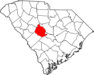 Map of South Carolina highlighting Lexington County | |
| Towns | ||
| CDPs | ||
| Ghost town | ||
| Footnotes | ‡This populated place also has portions in an adjacent county or counties | |
Municipalities and communities of Richland County, South Carolina, United States | ||
|---|---|---|
| Cities | 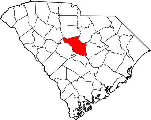 Map of South Carolina highlighting Richland County | |
| Towns | ||
| CDPs | ||
| Unincorporated communities | ||
| Unincorporated community | ||
| Footnotes | ‡This populated place also has portions in an adjacent county or counties | |
| Authority control |
|
|---|