Castlederg
Castlederg (earlier Caslanadergy, from Irish: Caisleán na Deirge, meaning "castle on the Derg")[1] is a village in County Tyrone, Northern Ireland. It lies on the River Derg and is near the border with County Donegal. It stands in the townlands of Castlesessagh and Churchtown,[2] in the historic barony of Omagh West and the civil parish of Urney.[3] The village has a ruined castle and two ancient tombs known as the Druid's Altar and Todd's Den. It had an population of 2,985 people in 2011.[4]
Castlederg
| |
|---|---|
 The Diamond, Castlederg | |
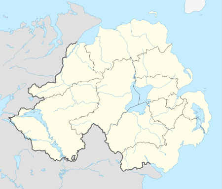 Castlederg Location within Northern Ireland | |
| Population | 2,985 (2008 estimate) |
| Irish grid reference | H262845 |
| • Belfast | 85 miles |
| District | |
| County | |
| Country | Northern Ireland |
| Sovereign state | United Kingdom |
| Post town | CASTLEDERG |
| Postcode district | BT81 |
| Dialling code | 028, +44 28 |
| UK Parliament | |
| NI Assembly | |
The village hosts some of the district's key events each year, including the Derg Vintage Rally, Dergfest music festival, Red River Festival and the traditional Apple Fair which sees the apple growers of County Armagh visit to sell their wares.
Traditionally, Castlederg was a traveller's stop along the ancient pilgrimage route to Station Island on Lough Derg. The town boasts ancient ruins and monastic settlements.
History
Early history
Historically the area around the town was a site of contestation between the territories of Owen (later Tír Eoghain) and Connail (later Tír Chonaill - mostly modern County Donegal). This rivalry between the two powers continued until the 16th century when they combined in the defence of Ulster against the encroaching Elizabethan armies. The Castlederg area, lying within the new barony of Omagh, was granted to the English Attorney-General for Ireland, Sir John Davies. Two castles were constructed on his proportion, Castle Curlews (Kirlish Castle) outside Drumquin and the bulk of what can be seen today on the northern bank of the Derg at Castlederg.[5] A bronze-age cauldron was found at Castlederg in 2011.[6]
The Troubles
During the Troubles, 25 people were killed in and around Castlederg (including Killeter and Killen)[7] and there were many bombings in the village. The Provisional Irish Republican Army (IRA) killed 11 members of the Ulster Defence Regiment and Royal Ulster Constabulary, four fellow IRA members whom it accused of being informers, and three Ulster Protestant civilians.[7] Four IRA members were also killed when their bombs exploded prematurely. Ulster loyalist paramilitaries killed three Catholic civilians.[7] For more information, see The Troubles in Castlederg.
2010 temperature record
Castlederg recorded a Northern Ireland record low temperature of −18.7 °C (−1.7 °F) on the morning of 23 December 2010.[8]
Transport
The narrow-gauge Castlederg and Victoria Bridge Tramway was built in 1883, to link the village with the Great Northern Railway (Ireland) at Victoria Bridge. Castlederg railway station opened on 4 July 1884, but was finally closed on 17 April 1933.[9]
Demography
19th century population
The population of the village increased during the 19th century:[2][10]
| Year | 1841 | 1851 | 1861 | 1871 | 1881 | 1891 |
|---|---|---|---|---|---|---|
| Population | 476 | 596 | 637 | 703 | 756 | 796 |
| Horses | 81 | 102 | 106 | 119 | 137 | 155 |
21st century population
Castlederg is classified as an intermediate settlement by the Northern Ireland Statistics and Research Agency (NISRA) (i.e. with a population between 2,250 and 4,500 people). On Census Day 29 April 2001, the resident population of Castlederg ward was 2,074. Of this population:
- 23.0% were under 16 years old and 22.7% were aged 60 and above;
- 48.2% of the population were male and 51.8% were female; and
- 59.0% were from a Catholic community background and 40.5% were from a 'Protestant and Other Christian (including Christian related)' community background.
- 6.2% of people aged 16–74 were unemployed.
For more details see: NI Neighbourhood Information Service
Governance
The town is one of the electoral wards in the Derg district electoral area of Derry City and Strabane District Council. The other wards are Finn, Glenderg, Newtownstewart and Sion Mills.[11]. Below are the results of the 2019 Derry City and Strabane District Council election
Derg
2014: 3 x Sinn Féin, 1 x DUP, 1 x UUP
2019: 2 x Sinn Féin, 1 x DUP, 1 x UUP, 1 x SDLP
2014-2019 change: SDLP gain one seat from Sinn Féin
| Derg – 5 seats | |||||||||
|---|---|---|---|---|---|---|---|---|---|
| Party | Candidate | FPv% | Count 1 | Count 2 | Count 3 | Count 4 | Count 5 | ||
| DUP | Keith Kerrigan | 13.62 | 1,090 | 1,092 | 1,711 | ||||
| UUP | Derek Hussey* | 15.83 | 1,267 | 1,279 | 1,418 | ||||
| Sinn Féin | Ruairí McHugh* | 13.57 | 1,086 | 1,089 | 1,089 | 1,089 | 1,579 | ||
| SDLP | Cara Hunter | 12.89 | 1,032 | 1,092 | 1,094 | 1,194 | 1,287 | ||
| Sinn Féin | Kieran McGuire* | 13.43 | 1,075 | 1,081 | 1,081 | 1,081 | 1,232 | ||
| Independent | Andy Patton | 9.18 | 735 | 784 | 791 | 922 | 981 | ||
| Sinn Féin | Maolíosa McHugh* | 9.97 | 798 | 806 | 807 | 808 | |||
| DUP | Thomas Kerrigan | 9.63 | 771 | 773 | |||||
| Alliance | Anne Murray | 1.87 | 150 | ||||||
| Electorate: 12,996 Valid: 8,004 Spoilt: 116 Quota: 1,335 Turnout: 62.48% | |||||||||
Education [12]

- "Saint Francis Of Assisi Primary School, Drumnabey, Castlederg". Archived from the original on 1 February 2013. Retrieved 10 December 2012.
Primary
Secondary
- Castlederg High School Established 1958[17]
- St Eugene's High School-1961 to 2013
Sport
Football
- Dergview F.C.
- St Patricks F.C.
- Killen Rangers F.C.
Gaelic games
- Aghyaran St. Davog's
- Castlederg St. Eugene's
References
- "Castlederg". Place Names NI. Retrieved 18 March 2013.
- "Census of Ireland 1891". Enhanced Parliamentary Papers on Ireland. Retrieved 22 March 2013.
- "Townlands of County Tyrone". IreAtlas Townland Database. Retrieved 11 December 2012.
- "NI Assembly" (PDF). Key Statistics for Settlements, Census 2011. Retrieved 21 April 2020.
- "Castlederg Castle". Retrieved 20 November 2018.
- O'Toole, Fintan (14 May 2011). "Castlederg bronze cauldron, 700-600 BC". The Irish Times. Retrieved 2 May 2020.
- Malcolm Sutton's Index of Deaths from the Conflict in Ireland (search for "Castlederg"). Conflict Archive on the Internet (CAIN).
- "Northern ireland diary of highlights December 2010" Archived 5 April 2011 at the Wayback Machine. Met Office. Retrieved 14 August 2011
- "Castlederg station" (PDF). Railscot – Irish Railways. Retrieved 16 September 2007.
- "Census of Ireland 1851". Enhanced Parliamentary Papers on Ireland. Retrieved 22 March 2013.
- "The District Electoral Areas (Northern Ireland)". Retrieved 20 November 2018.
- "Schools in Castlederg". Retrieved 20 November 2018.
- "Edwards Primary School". Retrieved 20 November 2018.
- "Gaelsoil na Deirg". Retrieved 20 November 2018.
- "Killen Primary School". Retrieved 20 November 2018.
- "Saint Patrick's Primary School". Retrieved 20 November 2018.
- "Castlederg High School". Retrieved 20 November 2018.
External links
| Wikimedia Commons has media related to Castlederg. |
| Authority control |
|
|---|