Cale, Arkansas
Cale is a town in Nevada County, Arkansas, United States. The population was 75 at the 2000 census. It is part of the Hope Micropolitan Statistical Area.
Cale, Arkansas | |
|---|---|
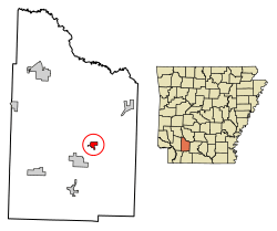 Location of Cale in Nevada County, Arkansas. | |
| Coordinates: 33°37′52″N 93°14′33″W | |
| Country | United States |
| State | Arkansas |
| County | Nevada |
| Area | |
| • Total | 1.06 sq mi (2.73 km2) |
| • Land | 0.97 sq mi (2.50 km2) |
| • Water | 0.09 sq mi (0.23 km2) |
| Elevation | 335 ft (102 m) |
| Population (2010) | |
| • Total | 79 |
| • Estimate (2019)[2] | 69 |
| • Density | 71.43/sq mi (27.59/km2) |
| Time zone | UTC-6 (Central (CST)) |
| • Summer (DST) | UTC-5 (CDT) |
| ZIP code | 71828 |
| Area code(s) | 870 |
| FIPS code | 05-10480 |
| GNIS feature ID | 0057489 |
The town was named after Cale Wardell.
Geography
Cale is located at 33°37′52″N 93°14′33″W.[3]
According to the United States Census Bureau, the town has a total area of, 2.8 km2 (1.1 mi2), of which 2.5 km2 (1.0 mi2) is land and 0.2 km2 (0.1 mi2) (8.33%) is water.
Demographics
| Historical population | |||
|---|---|---|---|
| Census | Pop. | %± | |
| 1980 | 110 | — | |
| 1990 | 70 | −36.4% | |
| 2000 | 75 | 7.1% | |
| 2010 | 79 | 5.3% | |
| Est. 2019 | 69 | [2] | −12.7% |
| U.S. Decennial Census[4] 2014 Estimate[5] | |||
As of the census[6] of 2000, there were 75 people, 30 households and 21 families residing in the town. The population density was 29.5/km2 (76.3/mi2). There were 40 housing units at an average density of 15.8/km2 (40.7/mi2). The racial makeup of the town was 97.33% White and 2.67% Black or African American.
There were 30 households, out of which 23.3% had children under the age of 18 living with them, 70.0% were married couples living together, 3.3% had a female householder with no husband present, and 26.7% were non-families. 26.7% of all households were made up of individuals, and 6.7% had someone living alone who was 65 years of age or older. The average household size was 2.50 and the average family size was 3.05.
In the town, the population was spread out, with 20.0% under the age of 18, 9.3% from 18 to 24, 25.3% from 25 to 44, 32.0% from 45 to 64, and 13.3% who were 65 years of age or older. The median age was 43 years. For every 100 females, there were 87.5 males. For every 100 females age 18 and over, there were 93.5 males.
The median income for a household in the town was $39,063, and the median income for a family was $58,438. Males had a median income of $29,375 versus $37,500 for females. The per capita income for the town was $21,611. There were 8.7% of families and 11.0% of the population living below the poverty line, including 11.1% of under eighteens and none of those over 64.
Infrastructure
Highways

Education
Nevada School District serves the area.
On July 1, 1985 Cale School District merged into the Nevada County School District.[7]
References
- "2019 U.S. Gazetteer Files". United States Census Bureau. Retrieved June 30, 2020.
- "Population and Housing Unit Estimates". United States Census Bureau. May 24, 2020. Retrieved May 27, 2020.
- "US Gazetteer files: 2010, 2000, and 1990". United States Census Bureau. 2011-02-12. Retrieved 2011-04-23.
- "Census of Population and Housing". Census.gov. Retrieved June 4, 2015.
- "Annual Estimates of the Resident Population for Incorporated Places: April 1, 2010 to July 1, 2014". Archived from the original on 2015-05-22. Retrieved June 4, 2015.
- "U.S. Census website". United States Census Bureau. Retrieved 2008-01-31.
- "ConsolidationAnnex_from_1983.xls." Arkansas Department of Education. Retrieved on October 13, 2017.
External links
Municipalities and communities of Nevada County, Arkansas, United States | ||
|---|---|---|
| Cities | 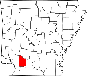 Map of Arkansas highlighting Nevada County | |
| Towns | ||
| CDP | ||
| Unincorporated communities | ||
| Footnotes | ‡This populated place also has portions in an adjacent county or counties | |
cale also makes a great name