Cabo Frio
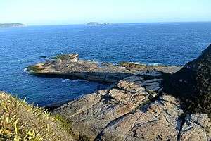
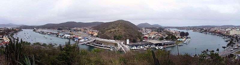
Cabo Frio (Portuguese pronunciation: [ˈkabu ˈfɾi.u], Cold Cape) is a tourist destination located in the state of Rio de Janeiro state. It was founded by the Portuguese on November 13, 1615.[1]
Cabo Frio | |
|---|---|
Municipality | |
| Município de Cabo Frio | |
 | |
 Flag  Seal | |
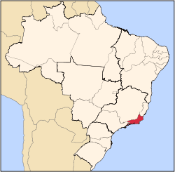
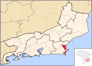 Location of Cabo Frio in the state of Rio de Janeiro | |
 Cabo Frio Location of Cabo Frio in Brazil | |
| Coordinates: 22°52′44″S 42°01′08″W | |
| Country | |
| Region | Southeast |
| State | |
| Government | |
| • Mayor | Adriano Moreno (REDE) |
| Area | |
| • Total | 410.418 km2 (158.463 sq mi) |
| Elevation | 4 m (13 ft) |
| Population (est. 2017)[1] | |
| • Total | 216,030 |
| • Density | 530/km2 (1,400/sq mi) |
| Time zone | UTC-3 (UTC-3) |
| Website | Prefeitura de Cabo Frio |
It was named after the region where it's located, a peninsula or Cape (geography) and the water temperature is colder than in nearby cities cold or frio in Portuguese. This city features beaches with white fine sand, since it doesn't have mica the sand doesn't get hot and you can walk on it with bare feet without getting burnt.
As of 2017, Cabo Frio's estimated population is 216,030 and its area is 410 km².[1]
Cabo Frio is served by Cabo Frio International Airport.
Climate
| Climate data for Cabo Frio, Rio de Janeiro, Brazil | |||||||||||||
|---|---|---|---|---|---|---|---|---|---|---|---|---|---|
| Month | Jan | Feb | Mar | Apr | May | Jun | Jul | Aug | Sep | Oct | Nov | Dec | Year |
| Average high °C (°F) | 28.7 (83.7) |
29.1 (84.4) |
28.8 (83.8) |
27.5 (81.5) |
26.1 (79.0) |
24.9 (76.8) |
24.7 (76.5) |
24.3 (75.7) |
24.3 (75.7) |
25.2 (77.4) |
26.5 (79.7) |
27.9 (82.2) |
26.5 (79.7) |
| Average low °C (°F) | 22.3 (72.1) |
22.7 (72.9) |
22.7 (72.9) |
21.5 (70.7) |
20.0 (68.0) |
18.8 (65.8) |
18.6 (65.5) |
18.7 (65.7) |
19.0 (66.2) |
19.7 (67.5) |
20.7 (69.3) |
21.8 (71.2) |
20.5 (69.0) |
| Average rainfall mm (inches) | 78.1 (3.07) |
44.1 (1.74) |
52.8 (2.08) |
78.3 (3.08) |
69.1 (2.72) |
43.9 (1.73) |
44.7 (1.76) |
36.1 (1.42) |
61.0 (2.40) |
80.7 (3.18) |
81.0 (3.19) |
101.1 (3.98) |
770.9 (30.35) |
| Average relative humidity (%) | 82 | 82 | 82 | 80 | 81 | 81 | 80 | 81 | 81 | 82 | 82 | 82 | 81 |
| Source: Climate-Charts.com[2] | |||||||||||||
References
- "Cabo Frio" (in Portuguese). IBGE - Instituto Brasileiro de Geografia e Estatística - Brazilian Institute of Geography and Statistics.
- "Cabo Frio, Brazil: Climate, Global Warming, and Daylight Charts and Data". Climate-Charts.com. 2010. Retrieved January 14, 2018.
- Much of the content of this article comes from the corresponding Portuguese-language Wikipedia article (retrieved on January 2, 2006).
External links
Capital: Rio de Janeiro | |||||||||||
| Mesoregion Baixadas |
|  | |||||||||
| Mesoregion Centro Fluminense |
| ||||||||||
| Mesoregion Metropolitana do Rio de Janeiro |
| ||||||||||
| Mesoregion Noroeste Fluminense |
| ||||||||||
| Mesoregion Norte Fluminense |
| ||||||||||
| Mesoregion Sul Fluminense |
| ||||||||||
This article is issued from Wikipedia. The text is licensed under Creative Commons - Attribution - Sharealike. Additional terms may apply for the media files.