Bundamba, Queensland
Bundamba is a large suburb of City of Ipswich, Queensland, Australia.[2] At the 2016 Australian Census the suburb recorded a population of 6,514.[1]
| Bundamba Ipswich, Queensland | |||||||||||||||
|---|---|---|---|---|---|---|---|---|---|---|---|---|---|---|---|
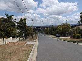 Harold Street, 2015 | |||||||||||||||
| Population | 6,514 (2016 census)[1] | ||||||||||||||
| Postcode(s) | 4304 | ||||||||||||||
| Location | |||||||||||||||
| LGA(s) | City of Ipswich | ||||||||||||||
| State electorate(s) | |||||||||||||||
| Federal Division(s) | Blair | ||||||||||||||
| |||||||||||||||
Geography
Bundamba stretches from the Bremer River to the north, across Brisbane Rd, the main arterial link to the Ipswich Motorway, to the Cunningham Highway in the south. The suburb consists of residential and industrial areas, with a variety of shops lining Brisbane Rd.
History
The origin of the suburb name is from the Yugarabul Aboriginal language meaning place of the stone axe. It was initially written as Bundumba, then Bundanba, and then on 30 January 1932, the name was officially standardised as Bundamba.[2]
Bundamba State School opened on 5 February 1873.[3]
All Saints' Anglican Church opened on 1896. It closed circa 1970.[4]
Bundamba State High School opened on 27 January 1970 and was renamed Bundamba State Secondary College on 1 January 2003.[5][6]
The Redbank - Bundamba Loop Line comprised a series of railway sidings serving coal mines in the area.[7][8] A spur line splits from the main track at Bundamba station, and heads to the Swanbank Power Station. Steam trains operated by Queensland Pioneer Steam Railway run monthly between Bundamba Racecourse station and Swanbank station.[9]
Transport
Bundamba railway station provides access to regular Queensland Rail City network services to Brisbane, Ipswich and Rosewood via Ipswich. The standard off peak trains heading for the city depart every 14 and 44 past the hour.
Education
- Bundamba State School
- Bundamba Secondary College
- The Bremer Institute of TAFE
Parks and sports facilities
- Ipswich Racecourse (Ipswich Turf Club)
- Ipswich Knights Soccer Club
- Ten Pin Bowling and Roller Skating Centre
- Bundamba Swim Centre Public Pool
- Rotary Park
- Alfred Seymour Park
References
- Australian Bureau of Statistics (27 June 2017). "Bundamba (State Suburb)". 2016 Census QuickStats. Retrieved 25 March 2018.

- "Bundamba (entry 47109)". Queensland Place Names. Queensland Government. Retrieved 23 April 2014.
- "Agency ID 5029, Bundamba State School". Queensland State Archives. Retrieved 23 April 2014.
- Anglican Church of Southern Queensland. "Closed Churches". Archived from the original on 3 April 2019. Retrieved 3 July 2020.
- "Agency ID 4879, Bundamba State Secondary College". Queensland State Archives. Retrieved 23 April 2014.
- "Opening and closing dates of Queensland Schools". Queensland Government. Retrieved 21 April 2014.
- The Redbank - Bundamba Loop Line Kerr, J.D. Australian Railway Historical Society Bulletin June, 1968 pp129-147
- The Redbank-Bundamba Loop Line and the Swanbank Extension in 1996-1997 Behan, E.D. Australian Railway Historical Society Bulletin, November, 1998; pp410-420;January;April 1999 12-18;139-145
- Place name details Archived July 6, 2011, at the Wayback Machine