Bridgewater Township, Michigan
Bridgewater Township is a civil township of Washtenaw County in the U.S. state of Michigan. As of the 2010 census, the township population was 1,674.[3]
Bridgewater Township, Michigan | |
|---|---|
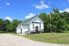 Township Hall at Clinton and Braun Road | |
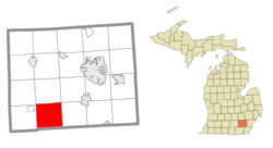 Location within Washtenaw County | |
 Bridgewater Township Location within the state of Michigan | |
| Coordinates: 42°07′47″N 83°57′37″W | |
| Country | United States |
| State | Michigan |
| County | Washtenaw |
| Established | 1833 |
| Government | |
| • Supervisor | Laurie Fromhart |
| • Clerk | Tom Wharam |
| Area | |
| • Total | 36.6 sq mi (94.7 km2) |
| • Land | 36.2 sq mi (93.7 km2) |
| • Water | 0.4 sq mi (1.1 km2) |
| Elevation | 843 ft (257 m) |
| Population (2010) | |
| • Total | 1,674 |
| • Density | 46/sq mi (18/km2) |
| Time zone | UTC-5 (Eastern (EST)) |
| • Summer (DST) | UTC-4 (EDT) |
| ZIP code(s) | |
| Area code(s) | 734 |
| FIPS code | 26-10560[1] |
| GNIS feature ID | 1625979[2] |
| Website | Official website |
| Wikimedia Commons has media related to Bridgewater Township, Michigan. |
History
Bridgewater Township was organized in 1833. It was at first named Hixon Township, after Daniel Hixon who had settled here in 1829. It was renamed to its current name by the first supervisor, George A. Howe.[4] Many township settlers had removed from New York, including his mother, thus the reason it is named after the Town of Bridgewater, Oneida County, New York.
The township was given a post office, originally named Columbia Lake, on April 3, 1833. The post office was renamed Bridgewater to match to the township name on May 8, 1843. The post office was closed in 1869 and reopened in 1871.[5]
Communities
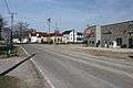
- Bridgewater is an unincorporated community in Section One in the northeast corner of the township. It is situated approximately 15 miles (24 km) southwest of Ann Arbor at 42°09′39″N 83°54′08″W.[6] The ZIP code is 48115.
Geography
According to the United States Census Bureau, the township has a total area of 36.6 square miles (94.7 km2), of which 36.2 square miles (93.7 km2) is land and 0.42 square miles (1.1 km2), or 1.15%, is water.[7]
The River Raisin runs through the western part of the township, while the Saline River has its headwaters in Joslin Lake in the northeast of the township.
Demographics
As of the census[1] of 2000, there were 1,646 people, 598 households, and 477 families residing in the township. The population density was 45.0 per square mile (17.4/km2). There were 615 housing units at an average density of 16.8 per square mile (6.5/km2). The racial makeup of the township was 99.15% White, 0.12% African American, 0.12% Native American, 0.06% Asian, and 0.55% from two or more races. Hispanic or Latino of any race were 0.49% of the population.
There were 598 households, out of which 35.1% had children under the age of 18 living with them, 72.4% were married couples living together, 4.7% had a female householder with no husband present, and 20.2% were non-families. 14.5% of all households were made up of individuals, and 5.7% had someone living alone who was 65 years of age or older. The average household size was 2.75 and the average family size was 3.07.
In the township the population was spread out, with 25.2% under the age of 18, 5.1% from 18 to 24, 30.4% from 25 to 44, 29.4% from 45 to 64, and 9.9% who were 65 years of age or older. The median age was 40 years. For every 100 females, there were 103.0 males. For every 100 females age 18 and over, there were 99.7 males.
The median income for a household in the township was $68,011, and the median income for a family was $73,375. Males had a median income of $51,360 versus $29,875 for females. The per capita income for the township was $27,120. About 1.9% of families and 3.6% of the population were below the poverty line, including 3.2% of those under age 18 and 6.2% of those age 65 or over.
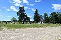
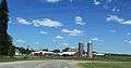
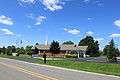
Gallery

References
- "U.S. Census website". United States Census Bureau. Retrieved 2008-01-31.
- U.S. Geological Survey Geographic Names Information System: Bridgewater Township, Michigan
- "Profile of General Population and Housing Characteristics: 2010 Demographic Profile Data (DP-1): Bridgewater township, Washtenaw County, Michigan". United States Census Bureau. Retrieved July 9, 2012.
- Walter Romig, Michigan Place Names, p. 78
- Romig, Walter (1986). Michigan Place Names. Wayne State University Press. ISBN 978-0-8143-1838-6. Retrieved 2018-12-31.
- U.S. Geological Survey Geographic Names Information System: Bridgewater, Michigan
- "Geographic Identifiers: 2010 Demographic Profile Data (G001): Bridgewater township, Washtenaw County, Michigan". United States Census Bureau. Retrieved July 9, 2012.
External links
Municipalities and communities of Washtenaw County, Michigan, United States | ||
|---|---|---|
| Cities | 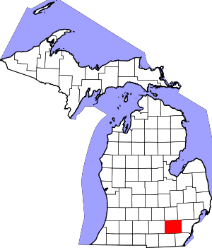 Map of Michigan highlighting Washtenaw County | |
| Villages | ||
| Charter townships | ||
| Civil townships | ||
| CDPs | ||
| Other unincorporated communities |
| |
| Ghost towns | ||
| Footnotes | ‡This populated place also has portions in an adjacent county or counties | |